 |
|
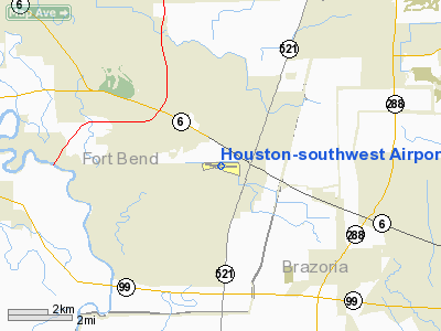
Houston-southwest Airport |
Coordinates: 29°30′22″N 095°28′37″W / 29.50611°N 95.47694°W / 29.50611; -95.47694
| Houston Southwest Airport |
| IATA: none – ICAO: KAXH – FAA LID: AXH |
| Summary |
| Airport type |
Public |
| Owner |
James Griffith, Jr. |
| Serves |
Houston, Texas |
| Location |
Arcola, Texas |
| Elevation AMSL |
68 ft / 21 m |
| Website |
www.HoustonAirport.com |
| Runways |
| Direction |
Length |
Surface |
| ft |
m |
| 9/27 |
5,003 |
1,525 |
Asphalt |
| Statistics (2006) |
| Aircraft operations |
46,381 |
| Based aircraft |
151 |
| Sources: airport web site and FAA |
Houston Southwest Airport or Houston-Southwest Airport (ICAO: KAXH, FAA LID: AXH) is a public-use airport located in Arcola, a city in Fort Bend County, Texas, United States, 15 miles (24 km) southwest of the central business district of Houston. It is privately owned by James Griffith, Jr.
Although most U.S. airports use the same three-letter location identifier for the FAA and IATA, Houston Southwest Airport is assigned AXH by the FAA but has no designation from the IATA.
Facilities and aircraft
Houston-Southwest Airport covers an area of 165 acres (67 ha) which contains one runway designated 9/27 with a 5,003 x 100 ft (1,525 x 30 m) asphalt surface. For the 12-month period ending January 27, 2006, the airport had 46,381 aircraft operations, an average of 127 per day: 98% general aviation, 2% military and <1% air taxi. At that time there were 151 aircraft based at this airport: 74% single-engine and 26% multi-engine.
The above content comes from Wikipedia and is published under free licenses – click here to read more.
Location & QuickFacts
| FAA Information Effective: | 2008-09-25 |
| Airport Identifier: | AXH |
| Airport Status: | Operational |
| Longitude/Latitude: | 095-28-36.9000W/29-30-22.1000N
-95.476917/29.506139 (Estimated) |
| Elevation: | 68 ft / 20.73 m (Surveyed) |
| Land: | 165 acres |
| From nearest city: | 15 nautical miles SW of Houston, TX |
| Location: | Fort Bend County, TX |
| Magnetic Variation: | 05E (2000) |
Owner & Manager
| Ownership: | Privately owned |
| Owner: | James Griffith Jr |
| Address: | 503 Mc Keever Rd
Arcola, TX 77583 |
| Phone number: | 281-431-2581 |
| Manager: | Len Franklin |
| Address: | 503 Mc Keever Rd
Arcola, TX 77583 |
| Phone number: | 281-431-2581 |
Airport Operations and Facilities
| Airport Use: | Open to public |
| Wind indicator: | Yes |
| Segmented Circle: | No |
| Control Tower: | No |
| Lighting Schedule: | DUSK-DAWN |
| Beacon Color: | Clear-Green (lighted land airport) |
| Landing fee charge: | No |
| Sectional chart: | Houston |
| Region: | ASW - Southwest |
| Boundary ARTCC: | ZHU - Houston |
| Tie-in FSS: | CXO - Montgomery County |
| FSS on Airport: | No |
| FSS Toll Free: | 1-800-WX-BRIEF
FOR FP FILING CALL CXO FSS 1-800-992-7433. |
| NOTAMs Facility: | CXO (NOTAM-d service avaliable) |
| Federal Agreements: | NG |
Airport Communications
| CTAF: | 123.000 |
| Unicom: | 123.000 |
Airport Services
| Fuel available: | 100LLA |
| Airframe Repair: | MAJOR |
| Power Plant Repair: | MAJOR |
| Bottled Oxygen: | HIGH |
Runway Information
Runway 09/27
| Dimension: | 5003 x 100 ft / 1524.9 x 30.5 m |
| Surface: | ASPH, Fair Condition |
| Weight Limit: | Single wheel: 13000 lbs. |
| Edge Lights: | Medium |
| |
Runway 09 |
Runway 27 |
| Longitude: | 095-29-05.1073W | 095-28-08.6490W |
| Latitude: | 29-30-23.9135N | 29-30-20.2555N |
| Elevation: | 68.00 ft | 66.00 ft |
| Alignment: | 94 | 127 |
| ILS Type: | LOC/DME
| |
| Traffic Pattern: | Left | Left |
| Markings: | Non-precision instrument, Fair Condition | Non-precision instrument, Fair Condition |
| Crossing Height: | 50.00 ft | 0.00 ft |
| VASI: | 2-light PAPI on left side | 2-light PAPI on left side |
| Visual Glide Angle: | 3.50° | 0.00° |
| Runway End Identifier: | Yes | Yes |
| Obstruction: | 50 ft trees, 1550.0 ft from runway, 27:1 slope to clear | 15 ft road, 330.0 ft from runway, 8:1 slope to clear |
|
Radio Navigation Aids
| ID |
Type |
Name |
Ch |
Freq |
Var |
Dist |
| SYG | NDB | Sandy Point | | 402.00 | 05E | 0.5 nm |
| SGR | NDB | Hull | | 388.00 | 05E | 12.1 nm |
| LYD | NDB | Lakeside | | 249.00 | 05E | 21.4 nm |
| JPA | NDB | Sanjac | | 347.00 | 05E | 23.4 nm |
| EYQ | NDB | Weiser | | 286.00 | 06E | 27.1 nm |
| BVP | NDB | Nixin | | 326.00 | 05E | 32.3 nm |
| DWH | NDB | David Hooks | | 521.00 | 05E | 37.5 nm |
| BYY | NDB | Bay City | | 344.00 | 06E | 37.8 nm |
| ARM | NDB | Wharton | | 245.00 | 06E | 38.5 nm |
| GLS | NDB | Galveston | | 206.00 | 08E | 39.1 nm |
| CBC | NDB | Anahuac | | 413.00 | 05E | 45.5 nm |
| EFD | TACAN | Ellington | 031X | | 05E | 17.6 nm |
| HUB | VOR/DME | Hobby | 118X | 117.10 | 05E | 13.8 nm |
| MHF | VOR/DME | Trinity | 083X | 113.60 | 07E | 38.2 nm |
| ELA | VOR/DME | Eagle Lake | 111X | 116.40 | 08E | 44.9 nm |
| IAH | VORTAC | Humble | 113X | 116.60 | 05E | 27.9 nm |
| VUH | VORTAC | Scholes | 077X | 113.00 | 06E | 34.9 nm |
| HOU | VOT | Houston Wm P Hobby | | 108.40 | | 13.3 nm |
Remarks
- NO TOUCH & GO LANDINGS FOR TRANSIENT OR NON BASED ACFT.
- HELICOPTER TFC INVOF ARPT.
- ULTRALIGHT & BALLOON OPNS PROHIBITED.
Images and information placed above are from
http://www.airport-data.com/airport/AXH/
We thank them for the data!
| General Info
|
| Country |
United States
|
| State |
TEXAS
|
| FAA ID |
AXH
|
| Latitude |
29-30-22.100N
|
| Longitude |
095-28-36.900W
|
| Elevation |
68 feet
|
| Near City |
HOUSTON
|
We don't guarantee the information is fresh and accurate. The data may
be wrong or outdated.
For more up-to-date information please refer to other sources.
|
|


