 |
|
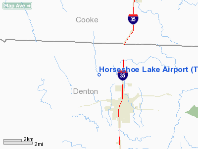
Location & QuickFacts
| FAA Information Effective: | 2008-09-25 |
| Airport Identifier: | TE24 |
| Airport Status: | Operational |
| Longitude/Latitude: | 097-12-19.0530W/33-23-35.4100N
-97.205292/33.393169 (Estimated) |
| Elevation: | 725 ft / 220.98 m (Estimated) |
| Land: | 41 acres |
| From nearest city: | 4 nautical miles NW of Sanger, TX |
| Location: | Denton County, TX |
| Magnetic Variation: | 07E (1985) |
Owner & Manager
| Ownership: | Privately owned |
| Owner: | James M. Sebastian |
| Address: | Po Box 271
Sanger, TX 76266 |
| Phone number: | 817-458-7478 |
| Address: |
|
Airport Operations and Facilities
| Airport Use: | Private |
| Wind indicator: | Yes |
| Segmented Circle: | No |
| Control Tower: | No |
| Sectional chart: | Dallas-ft Worth |
| Region: | ASW - Southwest |
| Boundary ARTCC: | ZFW - Fort Worth |
| Tie-in FSS: | FTW - Fort Worth |
| FSS Phone: | 817-541-3474 |
| FSS Toll Free: | 1-800-WX-BRIEF |
Runway Information
Runway 17/35
| Dimension: | 2675 x 60 ft / 815.3 x 18.3 m |
| Surface: | TURF, |
| |
Runway 17 |
Runway 35 |
| Traffic Pattern: | Left | Left |
| Obstruction: | 50 ft berm, 500.0 ft from runway | 50 ft pline, 0.0 ft from runway |
|
Radio Navigation Aids
| ID |
Type |
Name |
Ch |
Freq |
Var |
Dist |
| GLE | NDB | Gainesville | | 330.00 | 06E | 19.6 nm |
| GMZ | NDB | Grindstone Mountain | | 356.00 | 07E | 31.2 nm |
| DNI | NDB | Denison | | 341.00 | 06E | 37.3 nm |
| AUV | NDB | Arbuckle | | 284.00 | 07E | 45.7 nm |
| RBD | NDB | Redbird | | 287.00 | 06E | 46.2 nm |
| PQF | NDB | Mesquite | | 248.00 | 06E | 48.9 nm |
| XQH | NDB | Cedar Hill | | 353.00 | 08E | 49.6 nm |
| NFW | TACAN | Nas Jrb Fort Worth | 024X | | 07E | 39.2 nm |
| TTT | VOR/DME | Maverick | 078X | 113.10 | 06E | 32.6 nm |
| CVE | VOR/DME | Cowboy | 109X | 116.20 | 06E | 33.8 nm |
| FUZ | VORTAC | Ranger | 104X | 115.70 | 06E | 30.3 nm |
| UKW | VORTAC | Bowie | 071X | 112.40 | 06E | 32.1 nm |
| ADM | VORTAC | Ardmore | 114X | 116.70 | 06E | 49.2 nm |
| BYP | VORTAC | Bonham | 093X | 114.60 | 06E | 49.5 nm |
| FTW | VOT | Fort Worth Meacham | | 108.20 | | 35.4 nm |
| DAL | VOT | Dallas Love Field | | 113.30 | | 37.3 nm |
Remarks
Images and information placed above are from
http://www.airport-data.com/airport/TE24/
We thank them for the data!
| General Info
|
| Country |
United States
|
| State |
TEXAS
|
| FAA ID |
TE24
|
| Latitude |
33-23-35.410N
|
| Longitude |
097-12-19.053W
|
| Elevation |
725 feet
|
| Near City |
SANGER
|
We don't guarantee the information is fresh and accurate. The data may
be wrong or outdated.
For more up-to-date information please refer to other sources.
|
|


