 |
|
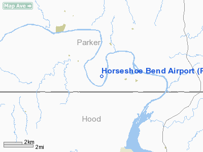
Location & QuickFacts
| FAA Information Effective: | 2008-09-25 |
| Airport Identifier: | F78 |
| Airport Status: | Operational |
| Longitude/Latitude: | 097-52-21.1220W/32-34-22.4840N
-97.872534/32.572912 (Estimated) |
| Elevation: | 715 ft / 217.93 m (Estimated) |
| Land: | 24 acres |
| From nearest city: | 12 nautical miles SW of Weatherford, TX |
| Location: | Parker County, TX |
| Magnetic Variation: | 07E (1985) |
Owner & Manager
| Ownership: | Privately owned |
| Owner: | Horseshoe Bend
LOT OWNERS CORPORATION. |
| Address: | 133 Lipan Trail
Weatherford, TX 76087 |
| Phone number: | 817-594-6454 |
| Manager: | Sandy Sanders |
| Address: | 133 Lipan Trail
Weatherford, TX 76087 |
| Phone number: | 817-594-6454
EMERGENCY PHONE: 817-598-0809. |
Airport Operations and Facilities
| Airport Use: | Open to public |
| Wind indicator: | Yes |
| Segmented Circle: | No |
| Control Tower: | No |
| Landing fee charge: | No |
| Sectional chart: | Dallas-ft Worth |
| Region: | ASW - Southwest |
| Boundary ARTCC: | ZFW - Fort Worth |
| Tie-in FSS: | FTW - Fort Worth |
| FSS on Airport: | No |
| FSS Phone: | 817-541-3474 |
| FSS Toll Free: | 1-800-WX-BRIEF |
| NOTAMs Facility: | FTW (NOTAM-d service avaliable) |
Airport Communications
Runway Information
Runway 17/35
| Dimension: | 3000 x 30 ft / 914.4 x 9.1 m |
| Surface: | GRVL, Good Condition |
| |
Runway 17 |
Runway 35 |
| Traffic Pattern: | Left | Left |
| Obstruction: | 8 ft fence, 90 ft right of centerline | 44 ft tree, 0.0 ft from runway, 100 ft right of centerline |
|
Radio Navigation Aids
| ID |
Type |
Name |
Ch |
Freq |
Var |
Dist |
| MWL | NDB | Mineral Wells | | 266.00 | 06E | 15.8 nm |
| GZV | NDB | Brazos River | | 280.00 | 07E | 35.6 nm |
| XQH | NDB | Cedar Hill | | 353.00 | 08E | 45.4 nm |
| GHX | NDB | Graham | | 371.00 | 07E | 47.6 nm |
| OIP | NDB | Old Rip | | 410.00 | 07E | 48.7 nm |
| NFW | TACAN | Nas Jrb Fort Worth | 024X | | 07E | 25.0 nm |
| TTT | VOR/DME | Maverick | 078X | 113.10 | 06E | 45.7 nm |
| MQP | VORTAC | Millsap | 124X | 117.70 | 09E | 11.2 nm |
| JEN | VORTAC | Glen Rose | 097X | 115.00 | 06E | 24.8 nm |
| FUZ | VORTAC | Ranger | 104X | 115.70 | 06E | 39.9 nm |
| FTW | VOT | Fort Worth Meacham | | 108.20 | | 29.9 nm |
Remarks
- RY 35 +70 FT TREES AT 635 FT 80 FT E OF CNTRLN & +20 FT POWERLINE AT 650 FT ON CNTRLN.
- WATCH FOR DEER AND MOTOR VEHICLES ON RY.
- USE EXTREME CARE ULTRALIGHT ACTIVITY ON & INVOF ARPT.
- THRESHOLDS DSPLCD TO A 20:1 SLOPE. TREES W OF RWY REMOVED.
Images and information placed above are from
http://www.airport-data.com/airport/F78/
We thank them for the data!
| General Info
|
| Country |
United States
|
| State |
TEXAS
|
| FAA ID |
F78
|
| Latitude |
32-34-22.484N
|
| Longitude |
097-52-21.122W
|
| Elevation |
715 feet
|
| Near City |
WEATHERFORD
|
We don't guarantee the information is fresh and accurate. The data may
be wrong or outdated.
For more up-to-date information please refer to other sources.
|
|


