 |
|
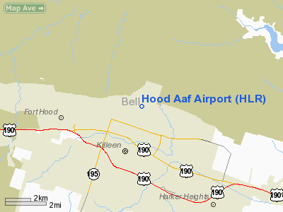
Location & QuickFacts
| FAA Information Effective: | 2008-09-25 |
| Airport Identifier: | HLR |
| Airport Status: | Operational |
| Longitude/Latitude: | 097-42-52.2000W/31-08-19.2000N
-97.714500/31.138667 (Estimated) |
| Elevation: | 924 ft / 281.64 m (Estimated) |
| Land: | 0 acres |
| From nearest city: | 1 nautical miles NE of Fort Hood(killeen), TX |
| Location: | Bell County, TX |
| Magnetic Variation: | 07E (1990) |
Owner & Manager
| Ownership: | Army owned |
| Owner: | U.s. Army Atca-aso |
| Address: | Cameron Station
Alexandria, VA 22314 |
| Address: |
|
| Phone number: | 817-685-7111 |
Airport Operations and Facilities
| Airport Use: | Private |
| Segmented Circle: | No |
| Control Tower: | Yes |
| Lighting Schedule: | DUSK-DAWN
ACTVT HIRL RY 16/34 - 119.65. |
| Beacon Color: | Split-Clear-Green (lighted military airport) |
| Sectional chart: | San Antonio |
| Region: | ASW - Southwest |
| Boundary ARTCC: | ZHU - Houston |
| Responsible ARTCC: | ZFW - Fort Worth |
| Tie-in FSS: | SJT - San Angelo |
| FSS on Airport: | No |
| FSS Toll Free: | 1-800-WX-BRIEF |
| NOTAMs Facility: | SJT (NOTAM-d service avaliable) |
Runway Information
Runway 16/34
| Dimension: | 3803 x 144 ft / 1159.2 x 43.9 m |
| Surface: | ASPH, |
| Pavement Class: | 8 /F/C/W/T |
| Edge Lights: | High |
| |
Runway 16 |
Runway 34 |
| Traffic Pattern: | Left | Left |
| Displaced threshold: | 560.00 ft | 0.00 ft |
| RVR Equipment: | | touchdown |
| Runway End Identifier: | No | No |
|
Radio Navigation Aids
| ID |
Type |
Name |
Ch |
Freq |
Var |
Dist |
| HLR | NDB | Hood | | 347.00 | 07E | 0.6 nm |
| IL | NDB | Iresh | | 278.00 | 07E | 6.9 nm |
| GR | NDB | Starn | | 323.00 | 07E | 8.6 nm |
| GUO | NDB | Georgetown | | 332.00 | 06E | 27.4 nm |
| BMQ | NDB | Burnet | | 341.00 | 07E | 36.0 nm |
| MNZ | NDB | Hamilton | | 251.00 | 07E | 36.5 nm |
| ROB | NDB | Robinson | | 400.00 | 07E | 39.7 nm |
| MFS | NDB | Horseshoe Bay Resort | | 403.00 | 07E | 49.7 nm |
| GRK | VOR/DME | Gray | 055X | 111.80 | 07E | 8.2 nm |
| TPL | VOR/DME | Temple | 041X | 110.40 | 09E | 15.5 nm |
| LZZ | VORTAC | Lampasas | 072X | 112.50 | 08E | 22.2 nm |
| ACT | VORTAC | Waco | 100X | 115.30 | 09E | 38.9 nm |
| CWK | VORTAC | Centex | 075X | 112.80 | 06E | 46.7 nm |
Remarks
- CAUTION: R6302 LCTD 1.1 NM N OF AFLD.
- TRAN ALERT: LTD TRAN PRK.
- RSTD: F/W ACFT - PPR ALL TRAN ACFT, C254-288-9200, DSN 738-9200.
- MISC: NO TRML FCST ISSUED FOR HOOD AAF. FOR REMOTE BRIEFING SVC CTC ROBERT GRAY AAF C254-288-9620, DSN 738-9620 OR 26 OWS, BARKSDALE AFB, C318-456-4775, DSN 781-4775.
- SEE FLIP AP/1 SUPPLEMENTARY ARPT RMK.
- MISC: WINDS ARE ACCURATE TO WITHIN ONLY +/-4 KTS.
- FUEL: JP8 (NO TRANS ACFT FUEL).
- CAUTION: SOME ACFT OPR IN AREA WO CONSPICUOUS MRK AND BLEND WITH TERRAIN.
- MISC: WX OBS FULLY AUTOMATED VIA ASOS.
- CAUTION: INST FINAL APCH CRS CROSS 1 NM SW KILLEEN MUNI.
- CAUTION: INTS COPTER OPR VCNTY FT HOOD.
- RSTD: NO BASE OPS SVC AVBL AT HOOD AAF, CTC ROBERT GRAY BASE OPS C254-288-9200, DSN 738-9200.
- OIL: SOAP.
Images and information placed above are from
http://www.airport-data.com/airport/HLR/
We thank them for the data!
| General Info
|
| Country |
United States
|
| State |
TEXAS
|
| FAA ID |
HLR
|
| Latitude |
31-08-15.628N
|
| Longitude |
097-42-51.064W
|
| Elevation |
924 feet
|
| Near City |
FORT HOOD(KILLEEN)
|
We don't guarantee the information is fresh and accurate. The data may
be wrong or outdated.
For more up-to-date information please refer to other sources.
|
|


