|
|
| Hondo Municipal Airport |
 |
| IATA: HDO – ICAO: KHDO – FAA LID: HDO |
| Summary |
| Airport type |
Public |
| Owner |
City of Hondo |
| Serves |
Hondo, Texas |
| Elevation AMSL |
930 ft / 283 m |
| Coordinates |
29°21′35″N 099°10′36″W / 29.35972°N 99.17667°W / 29.35972; -99.17667 |
| Runways |
| Direction |
Length |
Surface |
| ft |
m |
| 4/22 |
5,400 |
1,646 |
Concrete |
| 8/26 |
6,059 |
1,847 |
Concrete |
| 13/31 |
6,045 |
1,843 |
Concrete |
| 17L/35R |
5,624 |
1,714 |
Concrete |
| 17R/35L |
3,224 |
983 |
Asphalt |
| Statistics (2008) |
| Aircraft operations |
27,120 |
| Based aircraft |
22 |
| Source: Federal Aviation Administration |
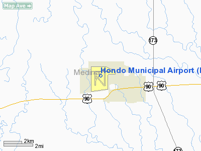
Hondo Municipal Airport (IATA: HDO, ICAO: KHDO, FAA LID: HDO) is a public-use airport located two nautical miles (3.7 km) northwest of the central business district of Hondo, in Medina County, Texas, United States. It is owned and operated by the city of Hondo. History
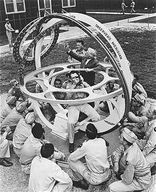 | |
Shown in this picture is the Hagner Planetarium, a brightly-colored vehicle used by navigation cadets at Hondo Army Air Field, Texas to ride herd on the stars. This intricate gadget helps the navigator get the "feel" of the 52 celestial bodies which show him the way as he directs his bomber through uncharted skies. The navigator can determine his position in the sky by sketching astronomical triangles involving his ship, the stars and certain points on the Earth's surface. Hondo-trained navigators learn that these celestial signposts can give them an unerring signal to turn to the bombardier and say, "That's Tokyo, pal, bombs away!" |
In early 1942 Hondo applied for a United States Army Air Force pilot-training facility. Citizens acquired guarantees of 400 housing units in less than two days. Authorization for construction of the navigation school arrived from Washington in March 1942. The Henry B. Zachry Company of San Antonio used 3,000 employees to construct more than 600 buildings, numerous streets, a utility network, and an airdrome with runways, taxiways, and aprons, in eighty-nine days and at a cost of nearly $7.25 million. A 330-unit housing project known as Navigation Village sprang up on fifty-two acres at the southeastern corner of the 3,675-acre (14.87 km) base.
The airport was opened in July 1942 as Hondo Army Airfield and was used by the United States Army Air Forces as a training base. The airfield, commanded by Col G. B. Dany, began operations on July 4, 1942, began student training on August 10, 1942, and graduated its first class of navigators on November 26 of that year. By that time more than 5,300 military personnel were stationed at the base. The aircraft included B-34s, B-18s, AT-7s, and AT-11s. The school was the largest United States Air Force navigation School in the world at the time.
The Women's Air Force Service Pilot squadrons were assigned there in November 1943. Two notable woman pilots, Betty Henrich and Hollywood stunt actress Mary Wiggins, were among the first WASPs to report for duty. Between July 1942 and August 1945 some 14,158 navigators were trained at Hondo. The base was closed on December 29, 1945, and the buildings and fixtures were sold as surplus.
Between 1945 and 1951 civilian operators such as the Hollaway flying school trained student pilots at the former base under the GI Bill
As a result of the Korean War, the United States Air Force reactivated the base as a contract pilot training center with Texas Aviation Industries, directed by H. B. Zachry, training pilots at Hondo Air Base in J-3's, and T-6s in a joint effort with the United States Air Force. In 1955, they were replaced with T-28s, and T-34s. This arrangement ended when the base was closed again on June 30, 1958.
During the 1960s the city of Hondo leased facilities at the base to the Hondo Livestock Auction and to Gary Aerospace, Universal Rundle, and Doss Aviation. The aviation companies worked with the United States Air Force to screen pilots, and Universal Rundle manufactured toilets.
In 1957 a golf course was constructed on the base through the efforts of base commander Lt Col Earl V. Riley. A golf tournament bearing his name remained a yearly event in the 1980s. In the spring of 1973 the Air Force began a flight-screening program at Hondo using the T-41 Mescalero, a militarized version of the civilian Cessna 172. The training program, still in operation in the 1980s, was attended by United States and foreign students.
After the mid-1970s the base housed a number of businesses, including a fiberglass-products plant, a greenhouse, a national guard armory, and the Medina Electric Cooperative.
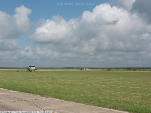
Facilities and aircraft
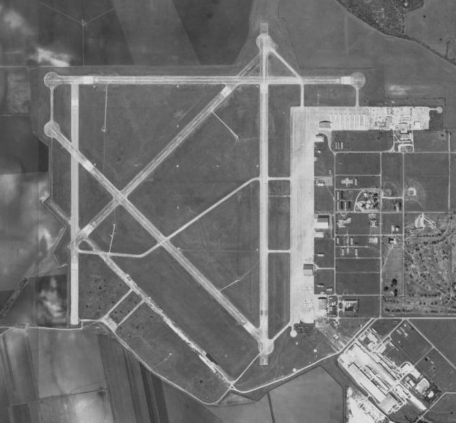
Hondo Municipal Airport covers an area of 3,500 acres (1,416 ha) at an elevation of 930 feet (283 m) above mean sea level. It has five runways:
- 4/22 is 5,400 by 150 feet (1,646 x 46 m) with a concrete surface;
- 8/26 is 6,059 by 150 feet (1,847 x 46 m) with a concrete surface;
- 13/31 is 6,045 by 150 feet (1,843 x 46 m) with a concrete surface;
- 17L/35R is 5,624 by 150 feet (1,714 x 46 m) with a concrete surface;
- 17R/35L is 3,224 by 140 feet (983 x 43 m) with an asphalt surface.
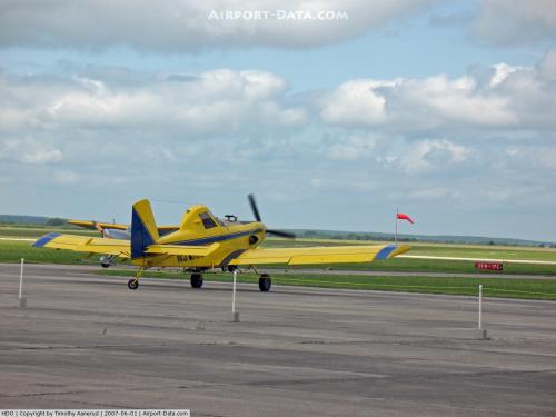
For the 12-month period ending April 14, 2008, the airport had 27,120 aircraft operations, an average of 74 per day: 69% military and 31% general aviation. At that time there were 22 aircraft based at this airport: 82% single-engine, 14% multi-engine and 4% helicopter.
The above content comes from Wikipedia and is published under free licenses – click here to read more.
 |
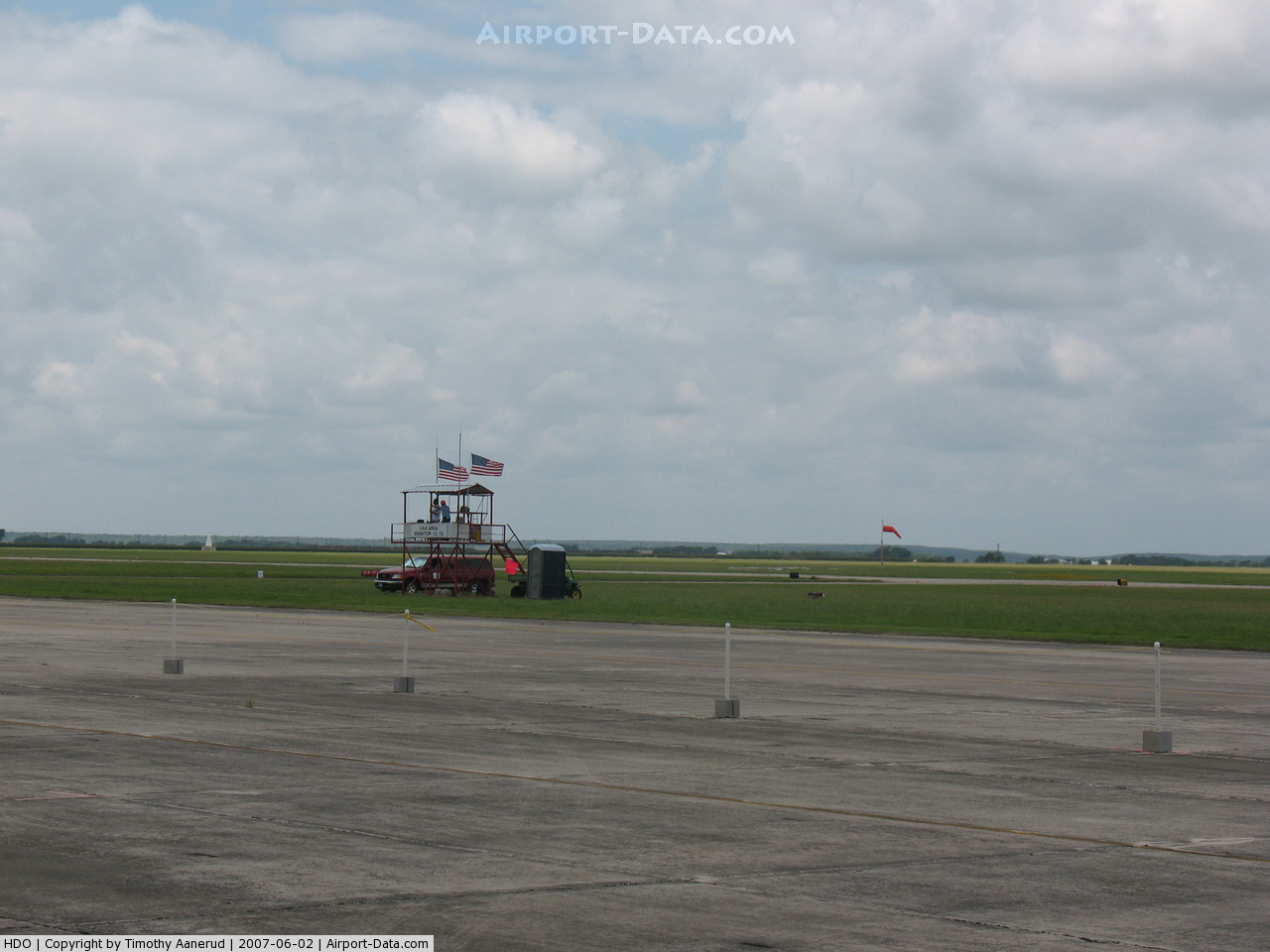
(Click on the photo to enlarge) |
 |
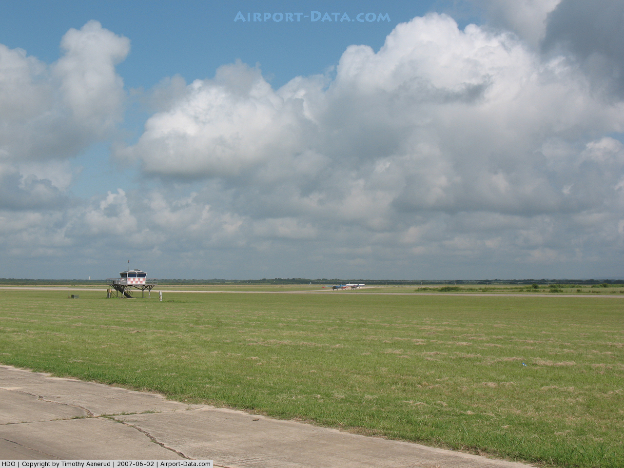
(Click on the photo to enlarge) |
 |
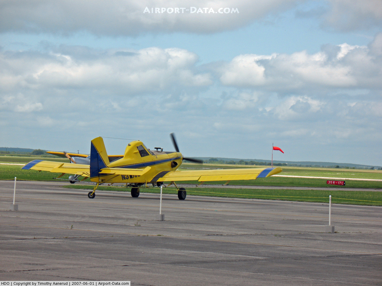
(Click on the photo to enlarge) |
Location & QuickFacts
| FAA Information Effective: | 2008-09-25 |
| Airport Identifier: | HDO |
| Airport Status: | Operational |
| Longitude/Latitude: | 099-10-36.0000W/29-21-34.3000N
-99.176667/29.359528 (Estimated) |
| Elevation: | 930 ft / 283.46 m (Surveyed) |
| Land: | 3500 acres |
| From nearest city: | 2 nautical miles NW of Hondo, TX |
| Location: | Medina County, TX |
| Magnetic Variation: | 08E (1980) |
Owner & Manager
| Ownership: | Publicly owned |
| Owner: | City Of Hondo |
| Address: | 1600 Avenue M
Hondo, TX 78861 |
| Phone number: | 830-426-3378 |
| Manager: | Tim Fousse |
| Address: | 1600 Avenue M
Hondo, TX 78861 |
| Phone number: | 210-275-2664 |
Airport Operations and Facilities
| Airport Use: | Open to public |
| Wind indicator: | Yes |
| Segmented Circle: | Yes |
| Control Tower: | No |
| Lighting Schedule: | DUSK-DAWN |
| Beacon Color: | Clear-Green (lighted land airport) |
| Landing fee charge: | No |
| Sectional chart: | San Antonio |
| Region: | ASW - Southwest |
| Traffic Pattern Alt: | 870 ft |
| Boundary ARTCC: | ZHU - Houston |
| Tie-in FSS: | SJT - San Angelo |
| FSS on Airport: | No |
| FSS Toll Free: | 1-800-WX-BRIEF |
| NOTAMs Facility: | HDO (NOTAM-d service avaliable) |
| Federal Agreements: | NP |
Airport Communications
| CTAF: | 122.725 |
| Unicom: | 122.725 |
Airport Services
| Fuel available: | 100LLA
SELF SERVICE FUEL AVBL 24 HRS. FULL SERVICE JET A AVBL UPON REQUEST; CALL 210-639-7150 OR 210-275-2664. 2 HRS NOTICE REQUIRED AFT HRS. |
| Airframe Repair: | MINOR |
| Power Plant Repair: | MINOR |
| Bottled Oxygen: | NONE |
| Bulk Oxygen: | NONE |
Runway Information
Runway 04/22
| Dimension: | 5400 x 150 ft / 1645.9 x 45.7 m |
| Surface: | CONC, Good Condition |
| Weight Limit: | Single wheel: 30000 lbs.
Dual wheel: 45000 lbs.
Dual tandem wheel: 90000 lbs. |
| |
Runway 04 |
Runway 22 |
| Longitude: | 099-11-00.0750W | 099-10-16.9550W |
| Latitude: | 29-21-19.7200N | 29-21-57.5430N |
| Elevation: | 919.00 ft | 926.00 ft |
| Alignment: | 45 | 127 |
| Traffic Pattern: | Left | Left |
| Markings: | Basic, Poor Condition
RY NUMBER IS FADED. | Basic, Poor Condition
RY NUMBERS ARE FADED. |
| Displaced threshold: | 294.00 ft | 532.00 ft |
|
Runway 08/26
| Dimension: | 6059 x 150 ft / 1846.8 x 45.7 m |
| Surface: | CONC, Good Condition |
| Weight Limit: | Single wheel: 30000 lbs.
Dual wheel: 45000 lbs.
Dual tandem wheel: 90000 lbs. |
| |
Runway 08 |
Runway 26 |
| Longitude: | 099-11-06.2580W | 099-09-57.7890W |
| Latitude: | 29-21-50.5320N | 29-21-50.5830N |
| Elevation: | 930.00 ft | 922.00 ft |
| Alignment: | 90 | 127 |
| Traffic Pattern: | Left | Left |
| Markings: | Basic, Poor Condition
RY NUMBER IS FADED. | Basic, Poor Condition
RY NUMBERS ARE FADED. |
| Displaced threshold: | 0.00 ft | 79.00 ft |
| Obstruction: | , 50:1 slope to clear | 6 ft trees, 200.0 ft from runway, 235 ft right of centerline
APCH RATIO 0:1 BASED ON DSPLCD THLD; 6 FT TREES AT THLD 230 FT RIGHT.
+6 FT TREES AT THLD 230 FT RIGHT. |
|
Runway 13/31
| Dimension: | 6045 x 150 ft / 1842.5 x 45.7 m |
| Surface: | CONC, Good Condition |
| Weight Limit: | Single wheel: 30000 lbs.
Dual wheel: 45000 lbs.
Dual tandem wheel: 90000 lbs. |
| |
Runway 13 |
Runway 31 |
| Longitude: | 099-11-05.8330W | 099-10-17.5040W |
| Latitude: | 29-21-42.1770N | 29-20-59.8910N |
| Elevation: | 927.00 ft | 909.00 ft |
| Alignment: | 127 | 127 |
| Traffic Pattern: | Left | Left |
| Markings: | Basic, Poor Condition
RY NUMBERS ARE FADED. | Basic, Good Condition
RY NUMBERS ARE FADED. |
| Displaced threshold: | 98.00 ft | 471.00 ft |
|
Runway 17L/35R
| Dimension: | 6024 x 150 ft / 1836.1 x 45.7 m |
| Surface: | CONC, Good Condition |
| Weight Limit: | Single wheel: 30000 lbs.
Dual wheel: 45000 lbs.
Dual tandem wheel: 90000 lbs. |
| Edge Lights: | Medium
THLD LGTS OTS INDEFLY. |
| |
Runway 17L |
Runway 35R |
| Longitude: | 099-10-19.2710W | 099-10-19.2330W |
| Latitude: | 29-21-59.0590N | 29-20-59.4250N |
| Elevation: | 927.00 ft | 910.00 ft |
| Alignment: | 127 | 127 |
| Traffic Pattern: | Left | Right |
| Markings: | Basic, Poor Condition
RY NUMBERS ARE FADED. | Non-precision instrument, Good Condition
RY NUMBERS ARE FADED. |
| Obstruction: | 26 ft trees, 870.0 ft from runway, 270 ft left of centerline, 25:1 slope to clear | , 50:1 slope to clear |
|
Runway 17R/35L
| Dimension: | 3224 x 140 ft / 982.7 x 42.7 m |
| Surface: | ASPH, Good Condition |
| Weight Limit: | Single wheel: 30000 lbs.
Dual wheel: 45000 lbs.
Dual tandem wheel: 90000 lbs. |
| |
Runway 17R |
Runway 35L |
| Longitude: | 099-10-59.8800W | 099-10-59.8680W |
| Latitude: | 29-21-46.8370N | 29-21-14.9220N |
| Elevation: | 928.00 ft | 917.00 ft |
| Alignment: | 127 | 127 |
| Traffic Pattern: | Right | Left |
| Markings: | Basic, Fair Condition | Basic, Fair Condition |
| Displaced threshold: | 454.00 ft | 0.00 ft |
|
Radio Navigation Aids
| ID |
Type |
Name |
Ch |
Freq |
Var |
Dist |
| HMA | NDB | Hondo | | 329.00 | 08E | 0.9 nm |
| CVB | NDB | Castroville | | 338.00 | 08E | 17.2 nm |
| HHH | NDB | Devine | | 359.00 | 07E | 18.2 nm |
| UVA | NDB | Uvalde | | 281.00 | 07E | 30.8 nm |
| ER | NDB | Shein | | 263.00 | 08E | 34.5 nm |
| PEZ | NDB | Pleasanton | | 275.00 | 07E | 42.2 nm |
| LKX | NDB | La Pryor | | 223.00 | 09E | 44.0 nm |
| KSY | TACAN | Kelly | 057X | | 07E | 31.3 nm |
| DHK | TACAN | Randolph | 036X | | 09E | 48.8 nm |
| SSF | VOR | Stinson | | 108.40 | 09E | 38.9 nm |
| HDO | VOR/DME | Hondo | 31X | 109.40 | 08E | 0.6 nm |
| CSI | VORTAC | Center Point | 122X | 117.50 | 08E | 33.9 nm |
| SAT | VORTAC | San Antonio | 115X | 116.80 | 08E | 41.1 nm |
| RND | VORTAC | Randolph | 70X | 112.30 | 09E | 47.6 nm |
| SAT | VOT | San Antonio Intl | | 110.40 | | 38.4 nm |
Remarks
- MARKINGS ALL RYS ARE NSTD; NRS 30 FT TALL; NPI BARS 100 FT LONG; RY 17R/35L NO CNTRLN.
- ALL TWYS HOLDING LINE MARKINGS NSTD.
- PILOT TRNG IN T6-A ACFT BEING CONDUCTED UNDER THE RANDOLPH 2A MOA & WITHIN 15 NM OF HONDO MUNI MON-FRI SR-SS FM SFC TO 7500 FT MSL. WKEND FLYING CONDUCTED AS NEEDED.
- U.S. AIR FORCE T-6 ACFT FLY A NONSTANDARD RIGHT TFC PAT TO RY 17L & A NONSTANDARD LEFT TFC PAT TO RY 35R.
- MILITARY USE: MISC - TOUCH AND GO TRNG PROVIDED ONLY O/R CTC TINCAN 122.725 FOR ADVSY WHEN 20 NM OUT.
Images and information placed above are from
http://www.airport-data.com/airport/HDO/
We thank them for the data!
| General Info
|
| Country |
United States
|
| State |
TEXAS
|
| FAA ID |
HDO
|
| Latitude |
29-21-34.300N
|
| Longitude |
099-10-36.000W
|
| Elevation |
930 feet
|
| Near City |
HONDO
|
We don't guarantee the information is fresh and accurate. The data may
be wrong or outdated.
For more up-to-date information please refer to other sources.
|
|