 |
|
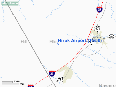
Location & QuickFacts
| FAA Information Effective: | 2008-09-25 |
| Airport Identifier: | TE50 |
| Airport Status: | Operational |
| Longitude/Latitude: | 096-57-57.9990W/32-10-23.5380N
-96.966111/32.173205 (Estimated) |
| Elevation: | 700 ft / 213.36 m (Estimated) |
| Land: | 2 acres |
| From nearest city: | 3 nautical miles N of Milford, TX |
| Location: | Ellis County, TX |
| Magnetic Variation: | 07E (1985) |
Owner & Manager
| Ownership: | Privately owned |
| Owner: | Rick Bradley |
| Address: | Rt 1 Box 71
Milford, TX 76670 |
| Phone number: | 214-493-5422 |
| Manager: | Rick Bradley |
| Address: | Rt 1 Box 71
Milford, TX 76670 |
| Phone number: | 214-493-5422 |
Airport Operations and Facilities
| Airport Use: | Private |
| Wind indicator: | Yes |
| Segmented Circle: | Yes |
| Control Tower: | No |
| Sectional chart: | Dallas-ft Worth |
| Region: | ASW - Southwest |
| Boundary ARTCC: | ZFW - Fort Worth |
| Tie-in FSS: | FTW - Fort Worth |
| FSS Phone: | 817-541-3474 |
| FSS Toll Free: | 1-800-WX-BRIEF |
Runway Information
Runway 15/33
| Dimension: | 1500 x 50 ft / 457.2 x 15.2 m |
| Surface: | TURF, |
| |
Runway 15 |
Runway 33 |
| Traffic Pattern: | Right | Left |
|
Radio Navigation Aids
| ID |
Type |
Name |
Ch |
Freq |
Var |
Dist |
| XQH | NDB | Cedar Hill | | 353.00 | 08E | 25.1 nm |
| LNC | NDB | Lancaster | | 239.00 | 06E | 27.3 nm |
| CGQ | NDB | Powell | | 344.00 | 06E | 28.2 nm |
| CRS | NDB | Corsicana | | 396.00 | 06E | 30.4 nm |
| RBD | NDB | Redbird | | 287.00 | 06E | 30.7 nm |
| JUG | NDB | Jecca | | 388.00 | 06E | 37.0 nm |
| LXY | NDB | Mexia | | 329.00 | 07E | 39.6 nm |
| ROB | NDB | Robinson | | 400.00 | 07E | 40.6 nm |
| PYF | NDB | Pyramid | | 418.00 | 06E | 43.4 nm |
| PQF | NDB | Mesquite | | 248.00 | 06E | 44.2 nm |
| NFW | TACAN | Nas Jrb Fort Worth | 024X | | 07E | 43.2 nm |
| GNL | VOR/DME | Groesbeck | 025X | 108.80 | 05E | 41.5 nm |
| TTT | VOR/DME | Maverick | 078X | 113.10 | 06E | 42.0 nm |
| CVE | VOR/DME | Cowboy | 109X | 116.20 | 06E | 43.2 nm |
| ACT | VORTAC | Waco | 100X | 115.30 | 09E | 34.4 nm |
| CQY | VORTAC | Cedar Creek | 095X | 114.80 | 06E | 38.1 nm |
| FUZ | VORTAC | Ranger | 104X | 115.70 | 06E | 44.4 nm |
| JEN | VORTAC | Glen Rose | 097X | 115.00 | 06E | 46.4 nm |
| DAL | VOT | Dallas Love Field | | 113.30 | | 40.9 nm |
| FTW | VOT | Fort Worth Meacham | | 108.20 | | 43.5 nm |
Remarks
- PRVDD AN OPERATIONAL LETTER OF AGREEMENT IS ESTABLISHED WITH OWNER OF DALE ACRES ARPT THAT PROVIDES COMPATIBLE TRAFFIC PATTERNS AT BOTH ARPTS.
Images and information placed above are from
http://www.airport-data.com/airport/TE50/
We thank them for the data!
| General Info
|
| Country |
United States
|
| State |
TEXAS
|
| FAA ID |
TE50
|
| Latitude |
32-10-23.538N
|
| Longitude |
096-57-57.999W
|
| Elevation |
700 feet
|
| Near City |
MILFORD
|
We don't guarantee the information is fresh and accurate. The data may
be wrong or outdated.
For more up-to-date information please refer to other sources.
|
|


