 |
|
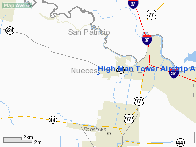
High Man Tower Airstrip Airport |
Location & QuickFacts
| FAA Information Effective: | 2008-09-25 |
| Airport Identifier: | TE62 |
| Airport Status: | Operational |
| Longitude/Latitude: | 097-40-56.1890W/27-51-15.3570N
-97.682275/27.854266 (Estimated) |
| Elevation: | 90 ft / 27.43 m (Estimated) |
| Land: | 10 acres |
| From nearest city: | 4 nautical miles N of Robstown, TX |
| Location: | Nueces County, TX |
| Magnetic Variation: | 06E (1995) |
Owner & Manager
| Ownership: | Privately owned |
| Owner: | Kevin Robertson |
| Address: | 5155 South County Road 73
Robstown, TX 78380 |
| Phone number: | 512-835-4793 |
| Manager: | Charlotte Robertson |
| Address: | 5155 South County Road 73
Robstown, TX 78380 |
| Phone number: | 512-767-6425 |
Airport Operations and Facilities
| Airport Use: | Private |
| Wind indicator: | Yes |
| Segmented Circle: | No |
| Control Tower: | No |
| Lighting Schedule: | DUSK-DAWN
ACTVT HIRL RY 09/27 - 122.85. |
| Beacon Color: | Clear-Green (lighted land airport) |
| Sectional chart: | Brownsville |
| Region: | ASW - Southwest |
| Boundary ARTCC: | ZHU - Houston |
| Tie-in FSS: | SJT - San Angelo |
| FSS Toll Free: | 1-800-WX-BRIEF |
Airport Services
Runway Information
Runway 09/27
| Dimension: | 3300 x 60 ft / 1005.8 x 18.3 m |
| Surface: | ASPH, |
| Edge Lights: | High |
| |
Runway 09 |
Runway 27 |
| Traffic Pattern: | Right | Left |
| Displaced threshold: | 345.00 ft
RYS 09 & 27 DSPLCD THLDS MKD WITH PAINT. | 472.00 ft |
|
Radio Navigation Aids
| ID |
Type |
Name |
Ch |
Freq |
Var |
Dist |
| TKB | NDB | Kleberg County | | 347.00 | 06E | 26.1 nm |
| BEA | NDB | Beeville | | 284.00 | 07E | 31.5 nm |
| MNO | NDB | Mellon Ranch | | 375.00 | 06E | 36.0 nm |
| RKP | NDB | Rockport | | 391.00 | 06E | 36.6 nm |
| BKS | NDB | Brooks County | | 353.00 | 06E | 45.4 nm |
| NOG | TACAN | Orange Grove | 063X | | 09E | 19.3 nm |
| NQI | TACAN | Kingsville | 125X | | 09E | 22.3 nm |
| ALI | VOR | Alice | | 114.50 | 06E | 19.3 nm |
| CRP | VORTAC | Corpus Christi | 102X | 115.50 | 09E | 13.0 nm |
| NGP | VORTAC | Truax | 087X | 114.00 | 06E | 23.0 nm |
| THX | VORTAC | Three Rivers | 051X | 111.40 | 08E | 46.3 nm |
Images and information placed above are from
http://www.airport-data.com/airport/TE62/
We thank them for the data!
| General Info
|
| Country |
United States
|
| State |
TEXAS
|
| FAA ID |
TE62
|
| Latitude |
27-51-15.357N
|
| Longitude |
097-40-56.189W
|
| Elevation |
90 feet
|
| Near City |
ROBSTOWN
|
We don't guarantee the information is fresh and accurate. The data may
be wrong or outdated.
For more up-to-date information please refer to other sources.
|
|


