 |
|
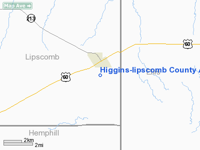
Higgins-lipscomb County Airport |
Location & QuickFacts
| FAA Information Effective: | 2008-09-25 |
| Airport Identifier: | 1X1 |
| Airport Status: | Operational |
| Longitude/Latitude: | 100-01-32.5440W/36-06-21.2500N
-100.025707/36.105903 (Estimated) |
| Elevation: | 2566 ft / 782.12 m (Surveyed) |
| Land: | 100 acres |
| From nearest city: | 1 nautical miles S of Higgins, TX |
| Location: | Lipscomb County, TX |
| Magnetic Variation: | 08E (1995) |
Owner & Manager
| Ownership: | Publicly owned |
| Owner: | Lipscomb Co. |
| Address: | County Courthouse
Lipscomb, TX 79056 |
| Phone number: | 806-862-4131 |
| Manager: | John Fritzleen
CO. COMMISSIONER. |
| Address: | Box 130
Higgins, TX 79046 |
| Phone number: | 806-852-4231 |
Airport Operations and Facilities
| Airport Use: | Open to public |
| Wind indicator: | Yes |
| Segmented Circle: | No |
| Control Tower: | No |
| Lighting Schedule: | DUSK-DAWN
ACTVT LIRL RY 18/36 - CTAF. |
| Beacon Color: | Clear-Green (lighted land airport) |
| Landing fee charge: | No |
| Sectional chart: | Wichita |
| Region: | ASW - Southwest |
| Traffic Pattern Alt: | 1000 ft |
| Boundary ARTCC: | ZKC - Kansas City |
| Tie-in FSS: | FTW - Fort Worth |
| FSS on Airport: | No |
| FSS Phone: | 817-541-3474 |
| FSS Toll Free: | 1-800-WX-BRIEF |
| NOTAMs Facility: | FTW (NOTAM-d service avaliable) |
Airport Communications
Airport Services
| Airframe Repair: | NONE |
| Power Plant Repair: | NONE |
| Bottled Oxygen: | NONE |
| Bulk Oxygen: | NONE |
Runway Information
Runway 18/36
| Dimension: | 3969 x 60 ft / 1209.8 x 18.3 m |
| Surface: | ASPH, Good Condition |
| Weight Limit: | Single wheel: 12500 lbs. |
| Edge Lights: | Low
LIRL OTS INDEFLY. |
| |
Runway 18 |
Runway 36 |
| Longitude: | 100-01-27.7590W | 100-01-37.2590W |
| Latitude: | 36-06-40.5220N | 36-06-02.0390N |
| Elevation: | 2566.00 ft | 2537.00 ft |
| Alignment: | 127 | 11 |
| Traffic Pattern: | Left | Left |
| Markings: | Basic, Good Condition | Basic, Good Condition |
| Displaced threshold: | 196.00 ft | 0.00 ft |
| Obstruction: | 7 ft fence, 200.0 ft from runway, 200 ft right of centerline
APCH SLOPE 0:1 FM DSPLCD THR TO +4 FT FENCE 200 FT RIGHT.
+4 FT FENCE ALONG NW SIDE OF RY AT 200 FT. | , 50:1 slope to clear |
|
Radio Navigation Aids
| ID |
Type |
Name |
Ch |
Freq |
Var |
Dist |
| HHF | NDB | Hemphill County | | 400.00 | 08E | 22.5 nm |
| OWU | NDB | West Woodward | | 329.00 | 08E | 31.3 nm |
| PYX | NDB | Perryton | | 266.00 | 09E | 39.6 nm |
| MDF | NDB | Mooreland/dcmsnd | | 284.00 | 08E | 46.4 nm |
| BFK | NDB | Buffalo | | 215.00 | 08E | 49.6 nm |
| GAG | VORTAC | Gage | 103X | 115.60 | 10E | 15.9 nm |
| SYO | VORTAC | Sayre | 099X | 115.20 | 10E | 49.5 nm |
Remarks
- NO LINE OF SIGHT BTN RY ENDS.
Images and information placed above are from
http://www.airport-data.com/airport/1X1/
We thank them for the data!
| General Info
|
| Country |
United States
|
| State |
TEXAS
|
| FAA ID |
1X1
|
| Latitude |
36-06-21.250N
|
| Longitude |
100-01-32.544W
|
| Elevation |
2566 feet
|
| Near City |
HIGGINS
|
We don't guarantee the information is fresh and accurate. The data may
be wrong or outdated.
For more up-to-date information please refer to other sources.
|
|


