 |
|
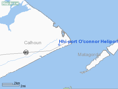
Hhi-port O'connor Heliport |
Location & QuickFacts
| FAA Information Effective: | 2008-09-25 |
| Airport Identifier: | 91XS |
| Airport Status: | Operational |
| Longitude/Latitude: | 096-25-30.9070W/28-26-33.0070N
-96.425252/28.442502 (Estimated) |
| Elevation: | 7 ft / 2.13 m (Estimated) |
| Land: | 10 acres |
| From nearest city: | 1 nautical miles SW of Port O'connor, TX |
| Location: | Calhoun County, TX |
| Magnetic Variation: | 06E (1985) |
Owner & Manager
| Ownership: | Privately owned |
| Owner: | Houston Helicopters Inc |
| Address: | Po Box 830
Pearland, TX 77581 |
| Phone number: | 713-485-1777 |
| Manager: | F.m. Baker |
| Address: | 211 Buyers Rd
Port O'connor, TX 77952 |
| Phone number: | 512-983-2738 |
Airport Operations and Facilities
| Airport Use: | Private |
| Wind indicator: | Yes |
| Segmented Circle: | No |
| Control Tower: | No |
| Lighting Schedule: | PHONE REQ
FOR ROTG BCN & PERIMETER LGTS H1 CALL 512-983-2738. |
| Beacon Color: | Clear (unlighted land airport) |
| Landing fee charge: | No |
| Sectional chart: | Houston |
| Region: | ASW - Southwest |
| Boundary ARTCC: | ZHU - Houston |
| Tie-in FSS: | CXO - Montgomery County |
| FSS on Airport: | No |
| FSS Toll Free: | 1-800-WX-BRIEF
FOR FP FILING CALL CXO FSS 1-800-833-5602. |
Runway Information
Helipad H1
| Dimension: | 1000 x 1000 ft / 304.8 x 304.8 m |
| Surface: | TURF, |
| |
Runway H1 |
Runway |
| Traffic Pattern: | Left | Left |
|
Helipad H2
| Dimension: | 40 x 20 ft / 12.2 x 6.1 m |
| Surface: | CONC, |
| |
Runway H2 |
Runway |
| Traffic Pattern: | Left | Left |
|
Helipad H3
| Dimension: | 40 x 20 ft / 12.2 x 6.1 m |
| Surface: | CONC, |
| |
Runway H3 |
Runway |
| Traffic Pattern: | Left | Left |
|
Helipad H4
| Dimension: | 40 x 20 ft / 12.2 x 6.1 m |
| Surface: | CONC, |
| |
Runway H4 |
Runway |
| Traffic Pattern: | Left | Left |
|
Helipad H5
| Dimension: | 40 x 20 ft / 12.2 x 6.1 m |
| Surface: | CONC, |
| |
Runway H5 |
Runway |
| Traffic Pattern: | Left | Left |
|
Helipad H6
| Dimension: | 40 x 20 ft / 12.2 x 6.1 m |
| Surface: | CONC, |
| |
Runway H6 |
Runway |
| Traffic Pattern: | Left | Left |
|
Helipad H7
| Dimension: | 40 x 20 ft / 12.2 x 6.1 m |
| Surface: | CONC, |
| |
Runway H7 |
Runway |
| Traffic Pattern: | Left | Left |
|
Radio Navigation Aids
| ID |
Type |
Name |
Ch |
Freq |
Var |
Dist |
| PKV | NDB | Port Lavaca | | 515.00 | 05E | 18.4 nm |
| RKP | NDB | Rockport | | 391.00 | 06E | 39.1 nm |
| MNO | NDB | Mellon Ranch | | 375.00 | 06E | 42.4 nm |
| BYY | NDB | Bay City | | 344.00 | 06E | 43.7 nm |
| VCT | VOR/DME | Victoria | 027X | 109.00 | 06E | 40.1 nm |
| PSX | VORTAC | Palacios | 120X | 117.30 | 08E | 20.3 nm |
Images and information placed above are from
http://www.airport-data.com/airport/91XS/
We thank them for the data!
| General Info
|
| Country |
United States
|
| State |
TEXAS
|
| FAA ID |
91XS
|
| Latitude |
28-26-33.007N
|
| Longitude |
096-25-30.907W
|
| Elevation |
7 feet
|
| Near City |
PORT O'CONNOR
|
We don't guarantee the information is fresh and accurate. The data may
be wrong or outdated.
For more up-to-date information please refer to other sources.
|
|


