 |
|
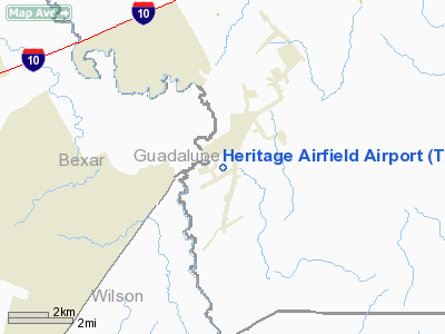
Heritage Airfield Airport |
Location & QuickFacts
| FAA Information Effective: | 2008-09-25 |
| Airport Identifier: | TE86 |
| Airport Status: | Operational |
| Longitude/Latitude: | 098-06-46.0000W/29-26-40.0000N
-98.112778/29.444444 (Estimated) |
| Elevation: | 555 ft / 169.16 m (Estimated) |
| Land: | 0 acres |
| From nearest city: | 3 nautical miles SW of New Berlin, TX |
| Location: | Guadalupe County, TX |
| Magnetic Variation: | 07E (1995) |
Owner & Manager
| Ownership: | Privately owned |
| Owner: | Texas Heritage Enterprises, Llc |
| Address: | 9343 Blazing Star Trail
Garden Ridge, TX 98266 |
| Phone number: | 210-651-4439 |
| Manager: | Brian Cook |
| Address: | 439 Tx Heritage Dr
New Berlin, TX 78121 |
| Phone number: | 830-420-2573 |
Airport Operations and Facilities
| Airport Use: | Private |
| Wind indicator: | Yes |
| Segmented Circle: | Yes |
| Control Tower: | No |
| Sectional chart: | San Antonio |
| Region: | ASW - Southwest |
| Boundary ARTCC: | ZHU - Houston |
| Tie-in FSS: | SJT - San Angelo |
| FSS Toll Free: | 1-800-WX-BRIEF |
Runway Information
Runway 17/35
| Dimension: | 3100 x 70 ft / 944.9 x 21.3 m |
| Surface: | TURF, |
| |
Runway 17 |
Runway 35 |
| Traffic Pattern: | Left | Left |
| Obstruction: | | 15 ft fence, 200.0 ft from runway |
|
Radio Navigation Aids
| ID |
Type |
Name |
Ch |
Freq |
Var |
Dist |
| PEZ | NDB | Pleasanton | | 275.00 | 07E | 36.3 nm |
| CVB | NDB | Castroville | | 338.00 | 08E | 39.0 nm |
| HHH | NDB | Devine | | 359.00 | 07E | 47.1 nm |
| DHK | TACAN | Randolph | 036X | | 09E | 9.8 nm |
| KSY | TACAN | Kelly | 057X | | 07E | 24.7 nm |
| SSF | VOR | Stinson | | 108.40 | 09E | 20.6 nm |
| RND | VORTAC | Randolph | 70X | 112.30 | 09E | 10.1 nm |
| SAT | VORTAC | San Antonio | 115X | 116.80 | 08E | 21.8 nm |
| SAT | VOT | San Antonio Intl | | 110.40 | | 19.4 nm |
Remarks
- PRVDD PLINES APCH RY 35 BURIED AND CAUTION SIGNS ARE INSTALLED AT ZUEHL CROSSING ROAD ADVISING OF LOW FLYING ACFT.
Images and information placed above are from
http://www.airport-data.com/airport/TE86/
We thank them for the data!
| General Info
|
| Country |
United States
|
| State |
TEXAS
|
| FAA ID |
TE86
|
| Latitude |
29-26-40.000N
|
| Longitude |
098-06-46.000W
|
| Elevation |
555 feet
|
| Near City |
NEW BERLIN
|
We don't guarantee the information is fresh and accurate. The data may
be wrong or outdated.
For more up-to-date information please refer to other sources.
|
|


