 |
|
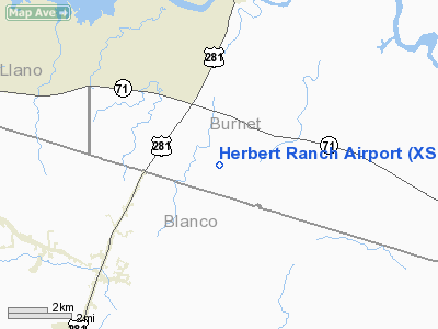
Location & QuickFacts
| FAA Information Effective: | 2008-09-25 |
| Airport Identifier: | XS03 |
| Airport Status: | Operational |
| Longitude/Latitude: | 098-16-52.0740W/30-28-52.6940N
-98.281132/30.481304 (Estimated) |
| Elevation: | 1140 ft / 347.47 m (Estimated) |
| Land: | 0 acres |
| From nearest city: | 4 nautical miles S of Marble Falls, TX |
| Location: | Burnet County, TX |
| Magnetic Variation: | 07E (1985) |
Owner & Manager
| Ownership: | Privately owned |
| Owner: | Wallace Herbert |
| Address: | Hc O2 Box 34
Marble Falls, TX 78654 |
| Phone number: | 210-693-4498 |
| Manager: | Wallace Herbert |
| Address: | Hco 2, Box 34
Marble Falls, TX 78654 |
| Phone number: | 210-693-4498 |
Airport Operations and Facilities
| Airport Use: | Private |
| Wind indicator: | Yes |
| Segmented Circle: | No |
| Control Tower: | No |
| Landing fee charge: | No |
| Sectional chart: | San Antonio |
| Region: | ASW - Southwest |
| Boundary ARTCC: | ZHU - Houston |
| Tie-in FSS: | SJT - San Angelo |
| FSS on Airport: | No |
| FSS Toll Free: | 1-800-WX-BRIEF |
Runway Information
Runway 08/26
| Dimension: | 2000 x 75 ft / 609.6 x 22.9 m |
| Surface: | TURF, |
| |
Runway 08 |
Runway 26 |
| Traffic Pattern: | Left | Left |
| Obstruction: | 4 ft fence | |
|
Runway 18/36
| Dimension: | 2500 x 60 ft / 762.0 x 18.3 m |
| Surface: | TURF, |
| |
Runway 18 |
Runway 36 |
| Traffic Pattern: | Left | Left |
| Obstruction: | | 4 ft fence |
|
Radio Navigation Aids
| ID |
Type |
Name |
Ch |
Freq |
Var |
Dist |
| MFS | NDB | Horseshoe Bay Resort | | 403.00 | 07E | 4.7 nm |
| BMQ | NDB | Burnet | | 341.00 | 07E | 15.7 nm |
| GUO | NDB | Georgetown | | 332.00 | 06E | 33.4 nm |
| IL | NDB | Iresh | | 278.00 | 07E | 44.1 nm |
| GR | NDB | Starn | | 323.00 | 07E | 46.2 nm |
| HLR | NDB | Hood | | 347.00 | 07E | 48.8 nm |
| GRK | VOR/DME | Gray | 055X | 111.80 | 07E | 41.0 nm |
| STV | VORTAC | Stonewall | 085X | 113.80 | 08E | 27.5 nm |
| LLO | VORTAC | Llano | 019X | 108.20 | 08E | 32.3 nm |
| CWK | VORTAC | Centex | 075X | 112.80 | 06E | 39.4 nm |
| LZZ | VORTAC | Lampasas | 072X | 112.50 | 08E | 42.9 nm |
Remarks
- VFR WX CONDS; PRVDD 2 50' TREES E OF RWY 26 ARE RMVD;RWY 26 DSPLCD FOR 20:1 APCH SFC;4' FENCE W OF RWY 8 BE RMVD OR MOVED FOR 20:1 APCH SFC.
Images and information placed above are from
http://www.airport-data.com/airport/XS03/
We thank them for the data!
| General Info
|
| Country |
United States
|
| State |
TEXAS
|
| FAA ID |
XS03
|
| Latitude |
30-28-52.694N
|
| Longitude |
098-16-52.074W
|
| Elevation |
1140 feet
|
| Near City |
MARBLE FALLS
|
We don't guarantee the information is fresh and accurate. The data may
be wrong or outdated.
For more up-to-date information please refer to other sources.
|
|


