 |
|
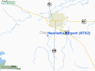
Location & QuickFacts
| FAA Information Effective: | 2008-09-25 |
| Airport Identifier: | 8TS2 |
| Airport Status: | Operational |
| Longitude/Latitude: | 098-13-01.1620W/33-47-00.3630N
-98.216989/33.783434 (Estimated) |
| Elevation: | 932 ft / 284.07 m (Estimated) |
| Land: | 15 acres |
| From nearest city: | 2 nautical miles SW of Henrietta, TX |
| Location: | Clay County, TX |
| Magnetic Variation: | 07E (1985) |
Owner & Manager
| Ownership: | Privately owned |
| Owner: | Jeff Pierce |
| Address: | Rt 1, Box 3a
Henrietta, TX 76365 |
| Phone number: | 817-538-5643 |
| Manager: | Jeff Pierce |
| Address: | Rt 1, Box 3a
Henrietta, TX 76365 |
| Phone number: | 817-538-5643 |
Airport Operations and Facilities
| Airport Use: | Private |
| Wind indicator: | Yes |
| Segmented Circle: | No |
| Control Tower: | No |
| Landing fee charge: | No |
| Sectional chart: | Dallas-ft Worth |
| Region: | ASW - Southwest |
| Boundary ARTCC: | ZFW - Fort Worth |
| Tie-in FSS: | FTW - Fort Worth |
| FSS on Airport: | No |
| FSS Phone: | 817-541-3474 |
| FSS Toll Free: | 1-800-WX-BRIEF |
Airport Services
| Airframe Repair: | MAJOR |
| Power Plant Repair: | MAJOR |
| Bottled Oxygen: | NONE |
| Bulk Oxygen: | NONE |
Runway Information
Runway 17/35
| Dimension: | 3180 x 30 ft / 969.3 x 9.1 m |
| Surface: | GRVL-TRTD, |
| Weight Limit: | Single wheel: 4000 lbs. |
| |
Runway 17 |
Runway 35 |
| Traffic Pattern: | Left | Left |
| Markings: | None, | None, |
| Runway End Identifier: | No | No |
| Centerline Lights: | No | No |
| Touchdown Lights: | No | No |
| Obstruction: | 4 ft fence
4' FENCE AT 64'; +2' ELEC FENCE 1' FROM RWY END. | 15 ft road, 100.0 ft from runway |
|
Radio Navigation Aids
| ID |
Type |
Name |
Ch |
Freq |
Var |
Dist |
| SKB | NDB | Scotland | | 344.00 | 08E | 13.5 nm |
| GMZ | NDB | Grindstone Mountain | | 356.00 | 07E | 24.6 nm |
| GHX | NDB | Graham | | 371.00 | 07E | 39.7 nm |
| ONY | NDB | Olney | | 272.00 | 07E | 39.7 nm |
| SHP | TACAN | Sheppard | 045X | | 10E | 18.1 nm |
| DUC | VOR/DME | Duncan | 047X | 111.00 | 09E | 39.1 nm |
| LAW | VOR/DME | Lawton | 031X | 109.40 | 09E | 43.9 nm |
| SPS | VORTAC | Wichita Falls | 074X | 112.70 | 10E | 22.4 nm |
| UKW | VORTAC | Bowie | 071X | 112.40 | 06E | 24.8 nm |
Remarks
- FLD COND-FAIR. SOME LOOSE AGGR. SHOULDERS SOFT WHEN WET, SOME GRASS IN EDGES.
- PRVDD ARPT REMAINS PERSONAL USE W/RWY ALIGNMENTS OF 04/22 AND 08/26.
Images and information placed above are from
http://www.airport-data.com/airport/8TS2/
We thank them for the data!
| General Info
|
| Country |
United States
|
| State |
TEXAS
|
| FAA ID |
8TS2
|
| Latitude |
33-47-00.363N
|
| Longitude |
098-13-01.162W
|
| Elevation |
932 feet
|
| Near City |
HENRIETTA
|
We don't guarantee the information is fresh and accurate. The data may
be wrong or outdated.
For more up-to-date information please refer to other sources.
|
|


