 |
|
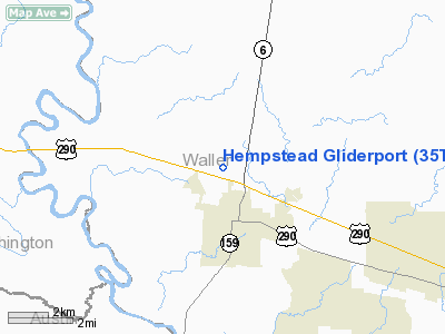
Hempstead Gliderport Airport |
Location & QuickFacts
| FAA Information Effective: | 2008-09-25 |
| Airport Identifier: | 35TS |
| Airport Status: | Operational |
| Longitude/Latitude: | 096-05-11.8500W/30-07-17.7820N
-96.086625/30.121606 (Estimated) |
| Elevation: | 260 ft / 79.25 m (Estimated) |
| Land: | 25 acres |
| From nearest city: | 2 nautical miles N of Hempstead, TX |
| Location: | Waller County, TX |
| Magnetic Variation: | 06E (1985) |
Owner & Manager
| Ownership: | Privately owned |
| Owner: | Hempstead Airport Inc |
| Address: | Box 1006
Hempstead, TX 77445 |
| Phone number: | 713-826-3355 |
| Manager: | J M Josey |
| Address: | Box 1006
Hempstead, TX 77445 |
| Phone number: | 713-826-3355 |
Airport Operations and Facilities
| Airport Use: | Private |
| Wind indicator: | Yes |
| Segmented Circle: | No |
| Control Tower: | No |
| Landing fee charge: | No |
| Sectional chart: | Houston |
| Region: | ASW - Southwest |
| Boundary ARTCC: | ZHU - Houston |
| Tie-in FSS: | CXO - Montgomery County |
| FSS on Airport: | No |
| FSS Toll Free: | 1-800-WX-BRIEF
FOR FP FILING CALL CXO FSS 1-800-833-5602. |
Airport Services
| Airframe Repair: | NONE |
| Power Plant Repair: | NONE |
Runway Information
Runway 17/35
| Dimension: | 3055 x 50 ft / 931.2 x 15.2 m |
| Surface: | TURF, Fair Condition |
| Weight Limit: | Single wheel: 4000 lbs. |
| |
Runway 17 |
Runway 35 |
| Traffic Pattern: | Right | Left |
| Obstruction: | 4 ft fence | 4 ft fence, 0.0 ft from runway |
|
Radio Navigation Aids
| ID |
Type |
Name |
Ch |
Freq |
Var |
Dist |
| BNH | NDB | Brenham | | 362.00 | 06E | 16.1 nm |
| EYQ | NDB | Weiser | | 286.00 | 06E | 25.8 nm |
| DWH | NDB | David Hooks | | 521.00 | 05E | 27.1 nm |
| LYD | NDB | Lakeside | | 249.00 | 05E | 28.1 nm |
| SGR | NDB | Hull | | 388.00 | 05E | 37.0 nm |
| UTS | NDB | Huntsville | | 308.00 | 06E | 45.2 nm |
| BVP | NDB | Nixin | | 326.00 | 05E | 46.0 nm |
| GYB | NDB | Lee County | | 385.00 | 07E | 46.5 nm |
| SYG | NDB | Sandy Point | | 402.00 | 05E | 49.2 nm |
| ELA | VOR/DME | Eagle Lake | 111X | 116.40 | 08E | 30.1 nm |
| TNV | VORTAC | Navasota | 106X | 115.90 | 08E | 10.1 nm |
| IDU | VORTAC | Industry | 039X | 110.20 | 08E | 26.7 nm |
| CLL | VORTAC | College Station | 080X | 113.30 | 08E | 33.8 nm |
| IAH | VORTAC | Humble | 113X | 116.60 | 05E | 39.8 nm |
Remarks
- +4' FENCE 100' WEST OF RWY 35 CNTRLN FROM THR; 1650' NORTH VIOLATES PRIMARY SFC.
Images and information placed above are from
http://www.airport-data.com/airport/35TS/
We thank them for the data!
| General Info
|
| Country |
United States
|
| State |
TEXAS
|
| FAA ID |
35TS
|
| Latitude |
30-07-17.782N
|
| Longitude |
096-05-11.850W
|
| Elevation |
260 feet
|
| Near City |
HEMPSTEAD
|
We don't guarantee the information is fresh and accurate. The data may
be wrong or outdated.
For more up-to-date information please refer to other sources.
|
|


