 |
|
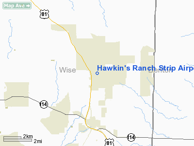
Hawkin's Ranch Strip Airport |
Location & QuickFacts
| FAA Information Effective: | 2008-09-25 |
| Airport Identifier: | TA02 |
| Airport Status: | Operational |
| Longitude/Latitude: | 097-27-51.0800W/33-06-10.4370N
-97.464189/33.102899 (Estimated) |
| Elevation: | 960 ft / 292.61 m (Estimated) |
| Land: | 16 acres |
| From nearest city: | 3 nautical miles N of Rhome, TX |
| Location: | Wise County, TX |
| Magnetic Variation: | 07E (1985) |
Owner & Manager
| Ownership: | Privately owned |
| Owner: | Phillip A Hawkins |
| Address: | 1101 W Fm 407; Po Box 1
Rhome, TX 76078-0001 |
| Phone number: | 817-636-2700
FAX NUMBER IS 817-636-2701 |
| Manager: | Phillip A Hawkins |
| Address: | 1101 W Fm 407/po Box 1
Rhome, TX 76078-0001 |
| Phone number: | 817-636-2700 |
Airport Operations and Facilities
| Airport Use: | Private |
| Wind indicator: | Yes |
| Segmented Circle: | No |
| Control Tower: | No |
| Landing fee charge: | No |
| Sectional chart: | Dallas-ft Worth |
| Region: | ASW - Southwest |
| Boundary ARTCC: | ZFW - Fort Worth |
| Tie-in FSS: | FTW - Fort Worth |
| FSS on Airport: | No |
| FSS Phone: | 817-541-3474 |
| FSS Toll Free: | 1-800-WX-BRIEF |
Runway Information
Runway 01/19
| Dimension: | 2450 x 150 ft / 746.8 x 45.7 m |
| Surface: | TURF, |
| |
Runway 01 |
Runway 19 |
| Traffic Pattern: | Left | Left |
| Obstruction: | | 161 ft twr, 260.0 ft from runway |
|
Radio Navigation Aids
| ID |
Type |
Name |
Ch |
Freq |
Var |
Dist |
| GMZ | NDB | Grindstone Mountain | | 356.00 | 07E | 34.0 nm |
| MWL | NDB | Mineral Wells | | 266.00 | 06E | 35.5 nm |
| GLE | NDB | Gainesville | | 330.00 | 06E | 39.3 nm |
| RBD | NDB | Redbird | | 287.00 | 06E | 39.4 nm |
| XQH | NDB | Cedar Hill | | 353.00 | 08E | 39.4 nm |
| GZV | NDB | Brazos River | | 280.00 | 07E | 48.7 nm |
| LNC | NDB | Lancaster | | 239.00 | 06E | 49.0 nm |
| NFW | TACAN | Nas Jrb Fort Worth | 024X | | 07E | 20.0 nm |
| TTT | VOR/DME | Maverick | 078X | 113.10 | 06E | 25.6 nm |
| CVE | VOR/DME | Cowboy | 109X | 116.20 | 06E | 31.0 nm |
| FUZ | VORTAC | Ranger | 104X | 115.70 | 06E | 19.3 nm |
| UKW | VORTAC | Bowie | 071X | 112.40 | 06E | 31.6 nm |
| MQP | VORTAC | Millsap | 124X | 117.70 | 09E | 35.2 nm |
| FTW | VOT | Fort Worth Meacham | | 108.20 | | 18.0 nm |
| DAL | VOT | Dallas Love Field | | 113.30 | | 34.5 nm |
Remarks
- VFR ONLY; PRVDD RWY TH DSPLCD TO PRVD 20:1 APCH SLOPE OVER PLINES LCTD NEAR RWY END.
Images and information placed above are from
http://www.airport-data.com/airport/TA02/
We thank them for the data!
| General Info
|
| Country |
United States
|
| State |
TEXAS
|
| FAA ID |
TA02
|
| Latitude |
33-06-10.437N
|
| Longitude |
097-27-51.080W
|
| Elevation |
960 feet
|
| Near City |
RHOME
|
We don't guarantee the information is fresh and accurate. The data may
be wrong or outdated.
For more up-to-date information please refer to other sources.
|
|


