 |
|
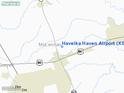
Location & QuickFacts
| FAA Information Effective: | 2008-09-25 |
| Airport Identifier: | XS57 |
| Airport Status: | Operational |
| Longitude/Latitude: | 097-24-17.2500W/31-27-55.2800N
-97.404792/31.465356 (Estimated) |
| Elevation: | 711 ft / 216.71 m (Estimated) |
| Land: | 8 acres |
| From nearest city: | 1 nautical miles N of Mc Gregor, TX |
| Location: | Mc Lennan County, TX |
| Magnetic Variation: | 06E (2000) |
Owner & Manager
| Ownership: | Privately owned |
| Owner: | Lambert & Sue Havelka |
| Address: | 8817 New Windsor Pky
Mc Gregor, TX 76657-3739 |
| Phone number: | 254-840-3464 |
| Manager: | Lambert & Sue Havelka |
| Address: | 8817 New Windsor Pky
Mc Gregor, TX 76657-3739 |
| Phone number: | 254-840-3464 |
Airport Operations and Facilities
| Airport Use: | Private |
| Wind indicator: | Yes |
| Segmented Circle: | No |
| Control Tower: | No |
| Sectional chart: | San Antonio |
| Region: | ASW - Southwest |
| Boundary ARTCC: | ZFW - Fort Worth |
| Tie-in FSS: | FTW - Fort Worth |
| FSS Phone: | 817-541-3474 |
| FSS Toll Free: | 1-800-WX-BRIEF |
Runway Information
Runway 14/32
| Dimension: | 2250 x 45 ft / 685.8 x 13.7 m |
| Surface: | TURF, |
| |
Runway 14 |
Runway 32 |
| Traffic Pattern: | Left | Left |
| Displaced threshold: | 0.00 ft | 500.00 ft |
| Obstruction: | | 30 ft pline, 500.0 ft from runway |
|
Radio Navigation Aids
| ID |
Type |
Name |
Ch |
Freq |
Var |
Dist |
| ROB | NDB | Robinson | | 400.00 | 07E | 17.3 nm |
| HLR | NDB | Hood | | 347.00 | 07E | 25.6 nm |
| GR | NDB | Starn | | 323.00 | 07E | 30.2 nm |
| IL | NDB | Iresh | | 278.00 | 07E | 30.8 nm |
| MNZ | NDB | Hamilton | | 251.00 | 07E | 39.2 nm |
| LXY | NDB | Mexia | | 329.00 | 07E | 46.9 nm |
| GUO | NDB | Georgetown | | 332.00 | 06E | 49.0 nm |
| TPL | VOR/DME | Temple | 041X | 110.40 | 09E | 15.4 nm |
| GRK | VOR/DME | Gray | 055X | 111.80 | 07E | 33.4 nm |
| GNL | VOR/DME | Groesbeck | 025X | 108.80 | 05E | 44.4 nm |
| ACT | VORTAC | Waco | 100X | 115.30 | 09E | 13.7 nm |
| LZZ | VORTAC | Lampasas | 072X | 112.50 | 08E | 41.4 nm |
| JEN | VORTAC | Glen Rose | 097X | 115.00 | 06E | 48.2 nm |
Remarks
- PRVDD A CLEAR 20:1 APCH SLOPE TO EACH RY.
Images and information placed above are from
http://www.airport-data.com/airport/XS57/
We thank them for the data!
| General Info
|
| Country |
United States
|
| State |
TEXAS
|
| FAA ID |
XS57
|
| Latitude |
31-27-55.280N
|
| Longitude |
097-24-17.250W
|
| Elevation |
711 feet
|
| Near City |
MC GREGOR
|
We don't guarantee the information is fresh and accurate. The data may
be wrong or outdated.
For more up-to-date information please refer to other sources.
|
|


