 |
|
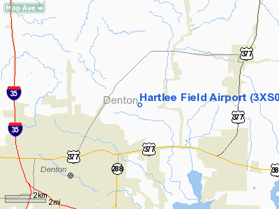
Location & QuickFacts
| FAA Information Effective: | 2008-09-25 |
| Airport Identifier: | 3XS0 |
| Airport Status: | Operational |
| Longitude/Latitude: | 097-04-16.0370W/33-16-06.4240N
-97.071121/33.268451 (Estimated) |
| Elevation: | 588 ft / 179.22 m (Surveyed) |
| Land: | 160 acres |
| From nearest city: | 4 nautical miles NE of Denton, TX |
| Location: | Denton County, TX |
| Magnetic Variation: | 07E (1985) |
Owner & Manager
| Ownership: | Privately owned |
| Owner: | Robert Payne |
| Address: | 5646 Milton Suite 340
Dallas, TX 75206 |
| Phone number: | 214-369-5942 |
| Manager: | Mike Clark |
| Address: | P.o. Box 802402
Dallas, TX 75380 |
| Phone number: | 817-565-8421 |
Airport Operations and Facilities
| Airport Use: | Private
AIR MUSEUM |
| Wind indicator: | Yes |
| Segmented Circle: | Yes |
| Control Tower: | No |
| Lighting Schedule: | PHONE REQ
FOR LIRL RWY 17/35 CALL 817-565-8421. |
| Landing fee charge: | No |
| Sectional chart: | Dallas-ft Worth |
| Region: | ASW - Southwest |
| Boundary ARTCC: | ZFW - Fort Worth |
| Tie-in FSS: | FTW - Fort Worth |
| FSS on Airport: | No |
| FSS Phone: | 817-541-3474 |
| FSS Toll Free: | 1-800-WX-BRIEF |
Airport Services
| Airframe Repair: | NONE
ULTRALIGHT ONLY. |
| Power Plant Repair: | NONE
ULTRALIGHT ONLY. |
| Bottled Oxygen: | NONE |
| Bulk Oxygen: | NONE |
Runway Information
Runway 17/35
| Dimension: | 2200 x 215 ft / 670.6 x 65.5 m |
| Surface: | TURF, Good Condition |
| Edge Lights: | Low |
| |
Runway 17 |
Runway 35 |
| Traffic Pattern: | Left | Right |
| Markings: | None, | None, |
| Displaced threshold: | 222.00 ft
APCH RATIO 15:1 FROM NGT DSPLCD THR TO 20' TREES. | 222.00 ft
APCH RATIO 9:1 FM NGT DSPLCD THR TO 30' TREES. |
| Runway End Identifier: | No | No |
| Centerline Lights: | No | No |
| Touchdown Lights: | No | No |
| Obstruction: | 20 ft trees, 85.0 ft from runway, 19 ft right of centerline, 4:1 slope to clear | 30 ft trees, 50.0 ft from runway, 50 ft right of centerline, 1:1 slope to clear |
|
Radio Navigation Aids
| ID |
Type |
Name |
Ch |
Freq |
Var |
Dist |
| GLE | NDB | Gainesville | | 330.00 | 06E | 27.8 nm |
| RBD | NDB | Redbird | | 287.00 | 06E | 37.0 nm |
| PQF | NDB | Mesquite | | 248.00 | 06E | 38.8 nm |
| DNI | NDB | Denison | | 341.00 | 06E | 39.0 nm |
| GMZ | NDB | Grindstone Mountain | | 356.00 | 07E | 40.6 nm |
| XQH | NDB | Cedar Hill | | 353.00 | 08E | 41.0 nm |
| MII | NDB | Caddo Mills | | 316.00 | 06E | 43.6 nm |
| LNC | NDB | Lancaster | | 239.00 | 06E | 45.1 nm |
| JUG | NDB | Jecca | | 388.00 | 06E | 45.2 nm |
| HJM | NDB | Rayburn | | 415.00 | 06E | 49.5 nm |
| NFW | TACAN | Nas Jrb Fort Worth | 024X | | 07E | 35.2 nm |
| TTT | VOR/DME | Maverick | 078X | 113.10 | 06E | 24.1 nm |
| CVE | VOR/DME | Cowboy | 109X | 116.20 | 06E | 24.2 nm |
| FUZ | VORTAC | Ranger | 104X | 115.70 | 06E | 23.4 nm |
| UKW | VORTAC | Bowie | 071X | 112.40 | 06E | 40.9 nm |
| BYP | VORTAC | Bonham | 093X | 114.60 | 06E | 45.0 nm |
| DAL | VOT | Dallas Love Field | | 113.30 | | 27.6 nm |
| FTW | VOT | Fort Worth Meacham | | 108.20 | | 30.7 nm |
Remarks
Images and information placed above are from
http://www.airport-data.com/airport/3XS0/
We thank them for the data!
| General Info
|
| Country |
United States
|
| State |
TEXAS
|
| FAA ID |
3XS0
|
| Latitude |
33-16-06.424N
|
| Longitude |
097-04-16.037W
|
| Elevation |
588 feet
|
| Near City |
DENTON
|
We don't guarantee the information is fresh and accurate. The data may
be wrong or outdated.
For more up-to-date information please refer to other sources.
|
|


