 |
|
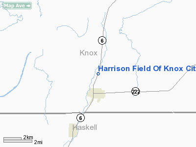
Harrison Field Of Knox City Airport |
Location & QuickFacts
| FAA Information Effective: | 2008-09-25 |
| Airport Identifier: | F75 |
| Airport Status: | Operational |
| Longitude/Latitude: | 099-48-46.3280W/33-26-17.3420N
-99.812869/33.438151 (Estimated) |
| Elevation: | 1500 ft / 457.20 m (Estimated) |
| Land: | 47 acres |
| From nearest city: | 1 nautical miles N of Knox City, TX |
| Location: | Knox County, TX |
| Magnetic Variation: | 08E (1985) |
Owner & Manager
| Ownership: | Publicly owned |
| Owner: | City Of Knox City |
| Address: | Po Box 128
Knox City, TX 79529 |
| Phone number: | 940-658-3313 |
| Manager: | Barbra Rector
CITY ADMINISTRATOR. |
| Address: | P O Box 128
Knox City, TX 79529 |
| Phone number: | 940-658-3313 |
Airport Operations and Facilities
| Airport Use: | Open to public |
| Wind indicator: | Yes
WINDSOCK LIGHTS OTS INDEFLY. |
| Segmented Circle: | Yes |
| Control Tower: | No |
| Lighting Schedule: | DUSK-DAWN
MIRL RY 01/19 PRESET LOW INTST DUSK-2300; TO INCR INTST ACTVT - CTAF. AFT 2300 ACTVT - CTAF. |
| Beacon Color: | Clear-Green (lighted land airport)
ROTG BCN OTS INDEFLY. |
| Landing fee charge: | No |
| Sectional chart: | Dallas-ft Worth |
| Region: | ASW - Southwest |
| Boundary ARTCC: | ZFW - Fort Worth |
| Tie-in FSS: | FTW - Fort Worth |
| FSS on Airport: | No |
| FSS Phone: | 817-541-3474 |
| FSS Toll Free: | 1-800-WX-BRIEF |
| NOTAMs Facility: | FTW (NOTAM-d service avaliable) |
Airport Communications
Airport Services
| Airframe Repair: | NONE |
| Power Plant Repair: | NONE |
| Bottled Oxygen: | NONE |
| Bulk Oxygen: | NONE |
Runway Information
Runway 01/19
| Dimension: | 3200 x 50 ft / 975.4 x 15.2 m |
| Surface: | ASPH, Good Condition |
| Weight Limit: | Single wheel: 10000 lbs. |
| Edge Lights: | Medium |
| |
Runway 01 |
Runway 19 |
| Traffic Pattern: | Left | Left |
| Markings: | Basic, Good Condition | Basic, Good Condition |
| Crossing Height: | 0.00 ft | 27.00 ft |
| VASI: | | 2-light PAPI on left side
PAPI OTS INDEFLY. |
| Visual Glide Angle: | 0.00° | 3.75° |
| Obstruction: | 4 ft fence, 200.0 ft from runway | 18 ft tree, 215.0 ft from runway, 90 ft right of centerline
+4 FT FENCE 100 FT RIGHT OF CNTRLN AT THLD. |
|
Radio Navigation Aids
| ID |
Type |
Name |
Ch |
Freq |
Var |
Dist |
| AKL | NDB | Haskell | | 407.00 | 08E | 15.6 nm |
| TMV | NDB | Stamford | | 290.00 | 08E | 34.5 nm |
| GTH | VORTAC | Guthrie | 092X | 114.50 | 10E | 33.2 nm |
Remarks
- RWY 19 +20' PUMPJACK 125' RIGHT OF CNTRLN 40' SOUTH RWY 19 THR.
- RY 19 +20 FT TREES 105 FT RIGHT 0-200 FT SOUTH OF RY THLD.
Images and information placed above are from
http://www.airport-data.com/airport/F75/
We thank them for the data!
| General Info
|
| Country |
United States
|
| State |
TEXAS
|
| FAA ID |
F75
|
| Latitude |
33-26-17.342N
|
| Longitude |
099-48-46.328W
|
| Elevation |
1500 feet
|
| Near City |
KNOX CITY
|
We don't guarantee the information is fresh and accurate. The data may
be wrong or outdated.
For more up-to-date information please refer to other sources.
|
|


