|
|
| Cynthiana-Harrison County Airport |
| IATA: none – ICAO: none – FAA LID: 0I8 |
| Summary |
| Airport type |
Public |
| Owner |
Cynthiana-Harrison County Airport Board |
| Serves |
Harrison County |
| Location |
Cynthiana, Kentucky |
| Elevation AMSL |
721 ft / 220 m |
| Coordinates |
38°21′58″N 084°17′00″W / 38.36611°N 84.2833333°W / 38.36611; -84.2833333 |
| Website |
www.ky0i8.com |
| Runways |
| Direction |
Length |
Surface |
| ft |
m |
| 11/29 |
3,852 |
1,174 |
Asphalt |
| Statistics (2008) |
| Aircraft operations |
8,530 |
| Based aircraft |
30 |
| Source: Federal Aviation Administration |
Cynthiana-Harrison County Airport (FAA LID: 0I8) is a public use airport located two nautical miles (3.7 km) south of the central business district of Cynthiana, in Harrison County, Kentucky, United States. It is owned by the Cynthiana-Harrison County Airport Board.
Facilities and aircraft
Cynthiana-Harrison County Airport covers an area of 86 acres (35 ha) at an elevation of 721 feet (220 m) above mean sea level. It has one asphalt paved runway designated 11/29 which measures 3,852 by 75 feet (1,174 x 23 m).
For the 12-month period ending November 28, 2008, the airport had 8,530 aircraft operations, an average of 23 per day: 94% general aviation, 4% air taxi and 2% military. At that time there were 30 aircraft based at this airport: 77% single-engine, 10% multi-engine and 13% ultralight.
The above content comes from Wikipedia and is published under free licenses – click here to read more.
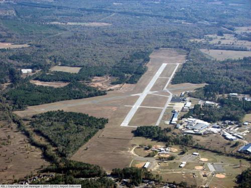 |
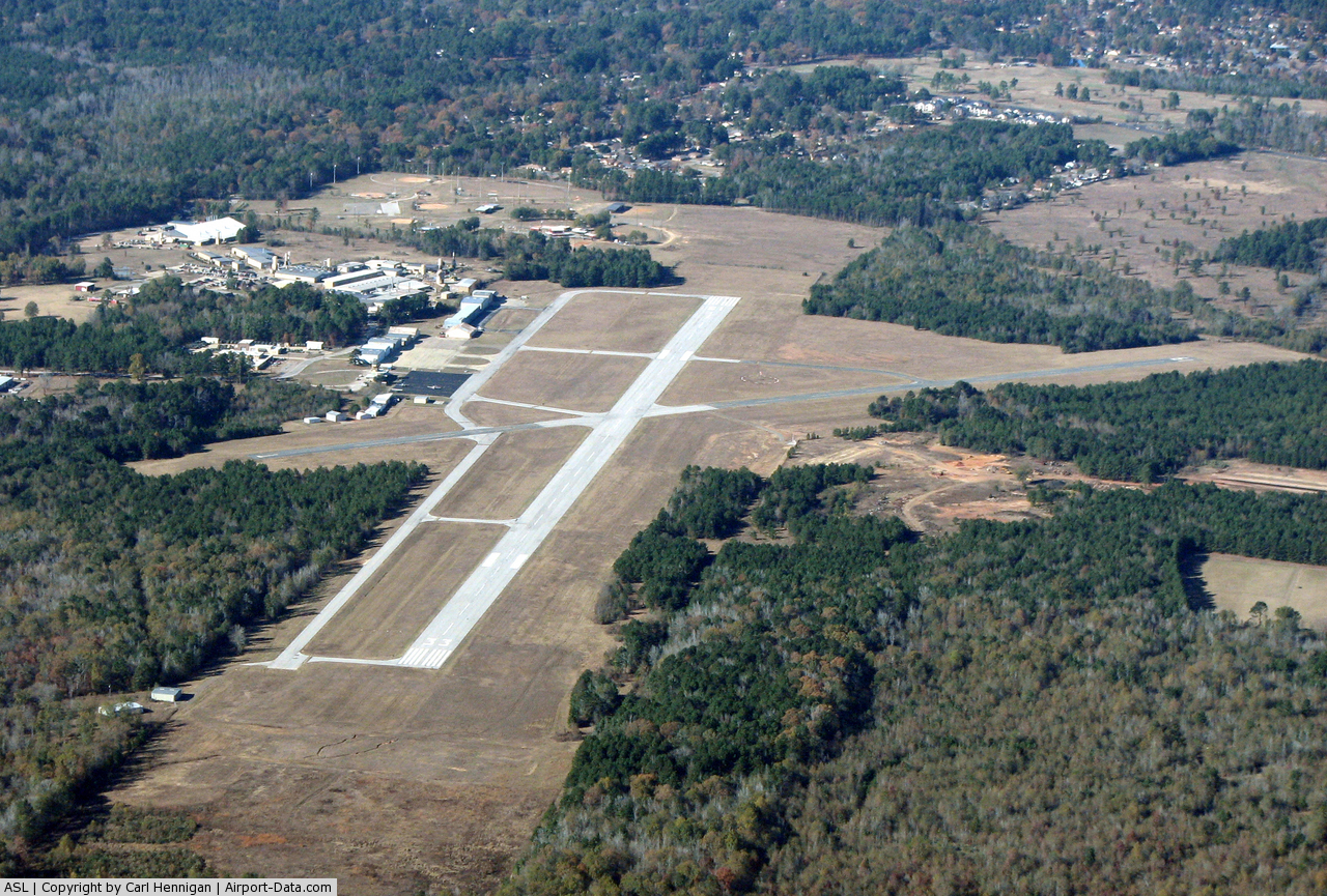
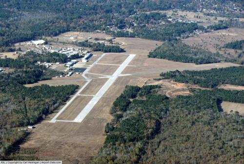
(Click on the photo to enlarge) |
 |
(Click on the photo to enlarge) |
Location & QuickFacts
| FAA Information Effective: | 2008-09-25 |
| Airport Identifier: | ASL |
| Airport Status: | Operational |
| Longitude/Latitude: | 094-18-28.0000W/32-31-13.8000N
-94.307778/32.520500 (Estimated) |
| Elevation: | 357 ft / 108.81 m (Surveyed) |
| Land: | 480 acres |
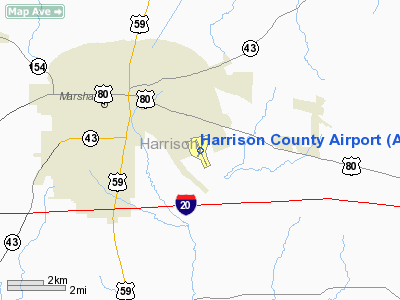
| From nearest city: | 3 nautical miles SE of Marshall, TX |
| Location: | Harrison County, TX |
| Magnetic Variation: | 07E (1975) |
Owner & Manager
| Ownership: | Publicly owned |
| Owner: | Harrison County |
| Address: | County Courthouse
Marshall, TX 75670 |
| Phone number: | 903-935-8401 |
| Manager: | Robert R. Aiello |
| Address: | 2100 Warren Dr.
Marshall, TX 75672 |
| Phone number: | 903-938-1394
OR 903-938-3908. |
Airport Operations and Facilities
| Airport Use: | Open to public |
| Wind indicator: | Yes |
| Segmented Circle: | Yes |
| Control Tower: | No |
| Lighting Schedule: | DUSK-DAWN
ACTVT REIL RYS 15 & 33 - CTAF. |
| Beacon Color: | Clear-Green (lighted land airport) |
| Landing fee charge: | No |
| Sectional chart: | Memphis |
| Region: | ASW - Southwest |
| Boundary ARTCC: | ZFW - Fort Worth |
| Tie-in FSS: | FTW - Fort Worth |
| FSS on Airport: | No |
| FSS Phone: | 817-541-3474 |
| FSS Toll Free: | 1-800-WX-BRIEF |
| NOTAMs Facility: | FTW (NOTAM-d service avaliable) |
| Federal Agreements: | NGY |
Airport Communications
| CTAF: | 122.800 |
| Unicom: | 122.800 |
Airport Services
| Fuel available: | 100LLA |
| Airframe Repair: | MAJOR |
| Power Plant Repair: | MAJOR |
| Bottled Oxygen: | NONE |
| Bulk Oxygen: | NONE |
Runway Information
Runway 01/19
| Dimension: | 3299 x 60 ft / 1005.5 x 18.3 m |
| Surface: | ASPH, Good Condition |
| Weight Limit: | Single wheel: 20000 lbs. |
| |
Runway 01 |
Runway 19 |
| Longitude: | 094-18-35.2249W | 094-18-20.9703W |
| Latitude: | 32-31-03.5530N | 32-31-33.8766N |
| Elevation: | 338.00 ft | 341.00 ft |
| Alignment: | 22 | 127 |
| Traffic Pattern: | Left | Left |
| Markings: | Basic, Good Condition | Basic, Good Condition |
| Obstruction: | 37 ft trees, 430.0 ft from runway, 6:1 slope to clear | 22 ft trees, 425.0 ft from runway, 10 ft right of centerline, 10:1 slope to clear |
|
Runway 15/33
| Dimension: | 5002 x 100 ft / 1524.6 x 30.5 m |
| Surface: | ASPH, Good Condition |
| Weight Limit: | Single wheel: 20000 lbs. |
| Edge Lights: | Medium |
| |
Runway 15 |
Runway 33 |
| Longitude: | 094-18-39.4590W | 094-18-16.3591W |
| Latitude: | 32-31-33.2474N | 32-30-47.7891N |
| Elevation: | 356.00 ft | 320.00 ft |
| Alignment: | 127 | 127 |
| Traffic Pattern: | Left | Left |
| Markings: | Non-precision instrument, Good Condition | Non-precision instrument, Good Condition |
| VASI: | 4-light PAPI on left side | 4-light PAPI on left side |
| Visual Glide Angle: | 3.00° | 3.00° |
| Runway End Identifier: | Yes | Yes |
| Obstruction: | 40 ft trees, 200.0 ft from runway, 255 ft right of centerline
+30 FT TREES 0-200 FT FROM THLD 240 FT RIGHT. | 35 ft trees, 1000.0 ft from runway, 22:1 slope to clear |
|
Radio Navigation Aids
| ID |
Type |
Name |
Ch |
Freq |
Var |
Dist |
| RPF | NDB | Carthage | | 332.00 | 04E | 20.5 nm |
| VIV | NDB | Vivian | | 284.00 | 06E | 25.3 nm |
| LST | NDB | Lone Star | | 305.00 | 05E | 32.9 nm |
| HNO | NDB | Henderson | | 371.00 | 06E | 34.5 nm |
| ATA | NDB | Atlanta | | 347.00 | 04E | 35.6 nm |
| MSD | NDB | Mansfield | | 414.00 | 04E | 38.9 nm |
| ABG | NDB | Ambassador | | 404.00 | 07E | 41.0 nm |
| CZJ | NDB | Amason | | 341.00 | 04E | 42.1 nm |
| BAD | TACAN | Barksdale | 105X | | 05E | 32.5 nm |
| DTN | VOR | Downtown | | 108.60 | 07E | 28.7 nm |
| GGG | VORTAC | Gregg County | 070X | 112.30 | 07E | 23.4 nm |
| EIC | VORTAC | Belcher | 121X | 117.40 | 07E | 29.4 nm |
| EMG | VORTAC | Elm Grove | 049X | 111.20 | 07E | 36.9 nm |
| SHV | VOT | Shreveport Regional | | 108.20 | | 24.5 nm |
Images and information placed above are from
http://www.airport-data.com/airport/ASL/
We thank them for the data!
| General Info
|
| Country |
United States
|
| State |
TEXAS
|
| FAA ID |
ASL
|
| Latitude |
32-31-13.800N
|
| Longitude |
094-18-28.000W
|
| Elevation |
357 feet
|
| Near City |
MARSHALL
|
We don't guarantee the information is fresh and accurate. The data may
be wrong or outdated.
For more up-to-date information please refer to other sources.
|
|