 |
|
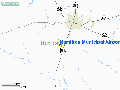
| Hamilton Municipal Airport |
| IATA: none – ICAO: KMNZ – FAA LID: MNZ |
| Summary |
| Airport type |
Public |
| Owner |
City of Hamilton |
| Serves |
Hamilton, Texas |
| Location |
Hamilton County, near Hamilton, Texas |
| Elevation AMSL |
1,299 ft / 396 m |
| Coordinates |
31°39′57″N 098°08′55″W / 31.66583°N 98.14861°W / 31.66583; -98.14861 |
| Website |
HamiltonTexas.com/... |
| Runways |
| Direction |
Length |
Surface |
| ft |
m |
| 18/36 |
5,000 |
1,524 |
Asphalt |
| Statistics (2005) |
| Aircraft operations |
5,048 |
| Based aircraft |
20 |
| Source: Federal Aviation Administration |
Hamilton Municipal Airport (ICAO: KMNZ, FAA LID: MNZ) is a city-owned public-use airport located two miles (3 km) south of the central business district of Hamilton, a city in Hamilton County, Texas, United States.
Although most U.S. airports use the same three-letter location identifier for the FAA and IATA, Hamilton Municipal Airport is assigned MNZ by the FAA but has no designation from the IATA. Facilities and aircraft
Hamilton Municipal Airport covers an area of 250 acres (101 ha) which contains one runway designated 18/36 with a 5,000 x 75 ft (1,524 x 23 m) asphalt pavement. For the 12-month period ending September 15, 2005, the airport had 5,048 aircraft operations, an average of 13 per day: 99% general aviation, 0.5% air taxi and 0.5% military. At that time there were 20 aircraft based at this airport: 95% single-engine and 5% multi-engine.
History
Provided contract glider training to the United States Army Air Forces, 1942-1944. Training provided by Hunter Flying Service. Used primarily C-47 Skytrains and Waco CG-4 unpowered Gliders. The mission of the school was to train glider pilot students in proficiency in operation of gliders in various types of towed and soaring flight, both day and night, and in servicing of gliders in the field.
The above content comes from Wikipedia and is published under free licenses – click here to read more.
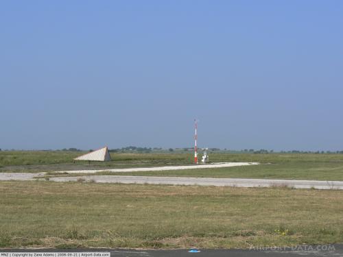 |
(Click on the photo to enlarge) |
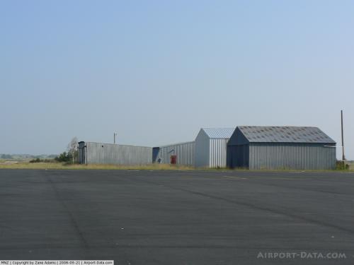 |
(Click on the photo to enlarge) |
Location & QuickFacts
| FAA Information Effective: | 2008-09-25 |
| Airport Identifier: | MNZ |
| Airport Status: | Operational |
| Longitude/Latitude: | 098-08-55.0950W/31-39-57.3350N
-98.148637/31.665926 (Estimated) |
| Elevation: | 1299 ft / 395.94 m (Surveyed) |
| Land: | 250 acres |
| From nearest city: | 2 nautical miles S of Hamilton, TX |
| Location: | Hamilton County, TX |
| Magnetic Variation: | 07E (1995) |
Owner & Manager
| Ownership: | Publicly owned |
| Owner: | City Of Hamilton |
| Address: | 200 E. Main
Hamilton, TX 76531 |
| Phone number: | 254-386-8116 |
| Manager: | Harry Hansen |
| Address: | 415 Cr 503
Hamilton, TX 76531 |
| Phone number: | 254-386-3939 |
Airport Operations and Facilities
| Airport Use: | Open to public |
| Wind indicator: | Yes |
| Segmented Circle: | No |
| Control Tower: | No |
| Lighting Schedule: | DUSK-DAWN |
| Beacon Color: | Clear-Green (lighted land airport) |
| Landing fee charge: | No |
| Sectional chart: | San Antonio |
| Region: | ASW - Southwest |
| Boundary ARTCC: | ZFW - Fort Worth |
| Tie-in FSS: | FTW - Fort Worth |
| FSS on Airport: | No |
| FSS Phone: | 817-541-3474 |
| FSS Toll Free: | 1-800-WX-BRIEF |
| NOTAMs Facility: | FTW (NOTAM-d service avaliable) |
| Federal Agreements: | N |
Airport Communications
| CTAF: | 122.700 |
| Unicom: | 122.700 |
Airport Services
| Fuel available: | 100LLA
FOR FUEL AFT HRS CALL 254-386-3939/3484. |
| Airframe Repair: | MAJOR |
| Power Plant Repair: | MAJOR |
| Bottled Oxygen: | NONE |
| Bulk Oxygen: | NONE |
Runway Information
Runway 18/36
| Dimension: | 5000 x 75 ft / 1524.0 x 22.9 m |
| Surface: | ASPH, Good Condition |
| Weight Limit: | Single wheel: 30000 lbs. |
| Edge Lights: | Medium |
| |
Runway 18 |
Runway 36 |
| Longitude: | 098-08-50.5700W | 098-08-59.6200W |
| Latitude: | 31-40-21.7700N | 31-39-32.9000N |
| Elevation: | 1299.00 ft | 1299.00 ft |
| Alignment: | 127 | 9 |
| Traffic Pattern: | Left | Left |
| Markings: | Non-precision instrument, Good Condition | Non-precision instrument, Good Condition |
| Crossing Height: | 24.00 ft | 24.00 ft |
| VASI: | pulsating/steady burning on left side | pulsating/steady burning on left side |
| Visual Glide Angle: | 3.00° | 3.00° |
| Obstruction: | 18 ft tree, 625.0 ft from runway, 265 ft right of centerline, 23:1 slope to clear | 15 ft pole, 775.0 ft from runway, 210 ft right of centerline, 38:1 slope to clear |
|
Radio Navigation Aids
| ID |
Type |
Name |
Ch |
Freq |
Var |
Dist |
| MNZ | NDB | Hamilton | | 251.00 | 07E | 2.8 nm |
| GR | NDB | Starn | | 323.00 | 07E | 33.0 nm |
| HLR | NDB | Hood | | 347.00 | 07E | 39.3 nm |
| IL | NDB | Iresh | | 278.00 | 07E | 44.7 nm |
| GRK | VOR/DME | Gray | 055X | 111.80 | 07E | 41.8 nm |
| BWD | VOR/DME | Brownwood | 023X | 108.60 | 08E | 43.5 nm |
| TPL | VOR/DME | Temple | 041X | 110.40 | 09E | 46.2 nm |
| LZZ | VORTAC | Lampasas | 072X | 112.50 | 08E | 28.9 nm |
| JEN | VORTAC | Glen Rose | 097X | 115.00 | 06E | 32.7 nm |
| ACT | VORTAC | Waco | 100X | 115.30 | 09E | 45.0 nm |
Images and information placed above are from
http://www.airport-data.com/airport/MNZ/
We thank them for the data!
| General Info
|
| Country |
United States
|
| State |
TEXAS
|
| FAA ID |
MNZ
|
| Latitude |
31-39-57.335N
|
| Longitude |
098-08-55.095W
|
| Elevation |
1299 feet
|
| Near City |
HAMILTON
|
We don't guarantee the information is fresh and accurate. The data may
be wrong or outdated.
For more up-to-date information please refer to other sources.
|
|


