 |
|
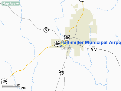
Location & QuickFacts
| FAA Information Effective: | 2008-09-25 |
| Airport Identifier: | ATA |
| Airport Status: | Operational |
| Longitude/Latitude: | 094-11-43.1770W/33-06-06.4980N
-94.195327/33.101805 (Estimated) |
| Elevation: | 280 ft / 85.34 m (Surveyed) |
| Land: | 162 acres |
| From nearest city: | 2 nautical miles SW of Atlanta, TX |
| Location: | Cass County, TX |
| Magnetic Variation: | 04E (2000) |
Owner & Manager
| Ownership: | Publicly owned |
| Owner: | City Of Atlanta |
| Address: | Po Box 669
Atlanta, TX 75551 |
| Phone number: | 903-796-7153 |
| Manager: | Mike Ahrens
CITY MANAGER. |
| Address: | Po Box 669
Atlanta, TX 75551 |
| Phone number: | 903-796-2192 |
Airport Operations and Facilities
| Airport Use: | Open to public |
| Wind indicator: | Yes |
| Segmented Circle: | Yes |
| Control Tower: | No |
| Lighting Schedule: | DUSK-DAWN |
| Beacon Color: | Clear-Green (lighted land airport) |
| Landing fee charge: | No |
| Sectional chart: | Memphis |
| Region: | ASW - Southwest |
| Boundary ARTCC: | ZFW - Fort Worth |
| Tie-in FSS: | FTW - Fort Worth |
| FSS on Airport: | No |
| FSS Phone: | 817-541-3474 |
| FSS Toll Free: | 1-800-WX-BRIEF |
| NOTAMs Facility: | FTW (NOTAM-d service avaliable) |
| Federal Agreements: | NGY |
Airport Communications
Airport Services
| Airframe Repair: | MAJOR |
| Power Plant Repair: | MAJOR |
| Bottled Oxygen: | NONE |
| Bulk Oxygen: | NONE |
Runway Information
Runway 05/23
| Dimension: | 3800 x 60 ft / 1158.2 x 18.3 m |
| Surface: | ASPH, Good Condition |
| Weight Limit: | Single wheel: 23000 lbs. |
| Edge Lights: | Medium |
| |
Runway 05 |
Runway 23 |
| Longitude: | 094-11-58.8111W | 094-11-23.5516W |
| Latitude: | 33-05-58.4499N | 33-06-21.5355N |
| Elevation: | 280.00 ft | 268.00 ft |
| Alignment: | 52 | 127 |
| Traffic Pattern: | Left | Left |
| Markings: | Non-precision instrument, Good Condition | Non-precision instrument, Good Condition |
| Crossing Height: | 0.00 ft | 29.00 ft |
| VASI: | 2-light PAPI on left side | 2-light PAPI on left side |
| Visual Glide Angle: | 0.00° | 4.00° |
| Runway End Identifier: | Yes | Yes |
| Obstruction: | 40 ft trees, 494.0 ft from runway, 250 ft right of centerline, 7:1 slope to clear
+25 FT TREE FM THLD 75 FT 175 FT R. | 25 ft trees, 200.0 ft from runway, 200 ft left of centerline
10-15 FT TREES FM THLD 200 FT 127 FT L. |
|
Runway 15/33
| Dimension: | 2463 x 150 ft / 750.7 x 45.7 m |
| Surface: | TURF, Good Condition |
| |
Runway 15 |
Runway 33 |
| Longitude: | 094-11-49.0560W | 094-11-37.2980W |
| Latitude: | 33-06-17.6320N | 33-05-55.3640N |
| Elevation: | 270.00 ft | 262.00 ft |
| Alignment: | 127 | 127 |
| Traffic Pattern: | Left | Left |
| Obstruction: | 55 ft trees, 150.0 ft from runway, 2:1 slope to clear | 55 ft trees, 40.0 ft from runway |
|
Radio Navigation Aids
| ID |
Type |
Name |
Ch |
Freq |
Var |
Dist |
| ATA | NDB | Atlanta | | 347.00 | 04E | 0.3 nm |
| VIV | NDB | Vivian | | 284.00 | 06E | 17.3 nm |
| LST | NDB | Lone Star | | 305.00 | 05E | 29.5 nm |
| SPH | NDB | Springhill | | 375.00 | 05E | 41.1 nm |
| HPC | NDB | Hope | | 362.00 | 03E | 46.1 nm |
| AGO | NDB | Magnolia | | 266.00 | 04E | 49.9 nm |
| BAD | TACAN | Barksdale | 105X | | 05E | 44.8 nm |
| DTN | VOR | Downtown | | 108.60 | 07E | 40.8 nm |
| TXK | VORTAC | Texarkana | 110X | 116.30 | 07E | 25.5 nm |
| EIC | VORTAC | Belcher | 121X | 117.40 | 07E | 27.8 nm |
| GGG | VORTAC | Gregg County | 070X | 112.30 | 07E | 49.9 nm |
| SHV | VOT | Shreveport Regional | | 108.20 | | 34.4 nm |
Remarks
- DEER ON ARPT.
- 24 FT MARKED POWERLINE 500 FT FROM END OF RY 23.
Images and information placed above are from
http://www.airport-data.com/airport/ATA/
We thank them for the data!
| General Info
|
| Country |
United States
|
| State |
TEXAS
|
| FAA ID |
ATA
|
| Latitude |
33-06-06.498N
|
| Longitude |
094-11-43.177W
|
| Elevation |
280 feet
|
| Near City |
ATLANTA
|
We don't guarantee the information is fresh and accurate. The data may
be wrong or outdated.
For more up-to-date information please refer to other sources.
|
|


