|
|
 |
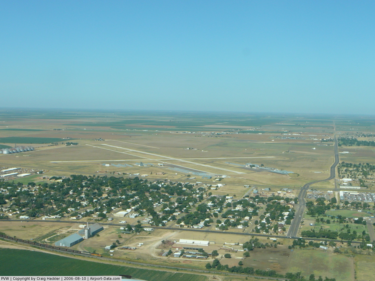
(Click on the photo to enlarge) |
 |
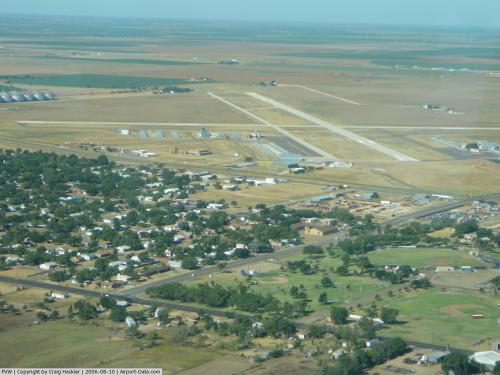
(Click on the photo to enlarge) |
Location & QuickFacts
| FAA Information Effective: | 2008-09-25 |
| Airport Identifier: | PVW |
| Airport Status: | Operational |
| Longitude/Latitude: | 101-43-02.4100W/34-10-05.3300N
-101.717336/34.168147 (Estimated) |
| Elevation: | 3374 ft / 1028.40 m (Surveyed) |
| Land: | 600 acres |
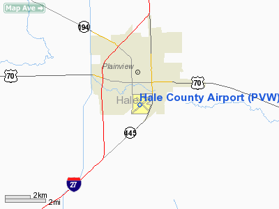
| From nearest city: | 1 nautical miles S of Plainview, TX |
| Location: | Hale County, TX |
| Magnetic Variation: | 09E (2000) |
Owner & Manager
| Ownership: | Publicly owned |
| Owner: | City Of Plainview & Hale Co. |
| Address: | 500 Broadway 100
Plainview, TX 79072 |
| Phone number: | 806-219-5214 |
| Manager: | Mike Hutcherson
TIM HARDAGE MNGR, HALE COUNTY AIRPORT, PHONE 806-293-4121; CO-MGR. |
| Address: | 1000 S. Columbia
Plainview, TX 79072 |
| Phone number: | 806-293-4121 |
Airport Operations and Facilities
| Airport Use: | Open to public |
| Wind indicator: | Yes |
| Segmented Circle: | Yes |
| Control Tower: | No |
| Lighting Schedule: | DUSK-DAWN
LIRL RY 04/22 PRESET LOW INTST. ACTVT LIRL RY 13/31 AND VASI RYS 04 & 22 - CTAF. |
| Beacon Color: | Clear-Green (lighted land airport) |
| Landing fee charge: | No |
| Sectional chart: | Dallas-ft Worth |
| Region: | ASW - Southwest |
| Boundary ARTCC: | ZFW - Fort Worth |
| Tie-in FSS: | FTW - Fort Worth |
| FSS on Airport: | No |
| FSS Phone: | 817-541-3474 |
| FSS Toll Free: | 1-800-WX-BRIEF |
| NOTAMs Facility: | PVW (NOTAM-d service avaliable) |
| Federal Agreements: | NGY |
Airport Communications
| CTAF: | 123.000 |
| Unicom: | 123.000 |
Airport Services
| Fuel available: | 100LLA1+ |
| Airframe Repair: | MAJOR |
| Power Plant Repair: | MAJOR |
| Bottled Oxygen: | LOW |
Runway Information
Runway 04/22
| Dimension: | 5997 x 100 ft / 1827.9 x 30.5 m |
| Surface: | ASPH, Good Condition |
| Weight Limit: | Single wheel: 27000 lbs. |
| Edge Lights: | Low |
| |
Runway 04 |
Runway 22 |
| Longitude: | 101-43-33.3210W | 101-42-38.0810W |
| Latitude: | 34-09-44.6400N | 34-10-22.1890N |
| Elevation: | 3373.00 ft | 3366.00 ft |
| Alignment: | 51 | 127 |
| Traffic Pattern: | Left | Left |
| Markings: | Non-precision instrument, Fair Condition | Non-precision instrument, Good Condition |
| Crossing Height: | 62.00 ft | 52.00 ft |
| VASI: | 4-box on left side | 4-box on left side |
| Visual Glide Angle: | 3.50° | 3.50° |
| Runway End Identifier: | Yes | Yes |
| Obstruction: | 40 ft pole, 1750.0 ft from runway, 38:1 slope to clear | 190 ft bldg, 6200.0 ft from runway, 800 ft right of centerline, 31:1 slope to clear |
|
Runway 13/31
| Dimension: | 4000 x 100 ft / 1219.2 x 30.5 m |
| Surface: | ASPH, Good Condition |
| Weight Limit: | Single wheel: 27000 lbs. |
| Edge Lights: | Low |
| |
Runway 13 |
Runway 31 |
| Longitude: | 101-43-13.3660W | 101-42-41.5360W |
| Latitude: | 34-10-22.9210N | 34-09-53.5040N |
| Elevation: | 3372.00 ft | 3372.00 ft |
| Alignment: | 127 | 127 |
| Traffic Pattern: | Left | Left |
| Markings: | Non-precision instrument, Good Condition | Non-precision instrument, Good Condition |
| Obstruction: | 30 ft pline, 1100.0 ft from runway, 215 ft left of centerline, 30:1 slope to clear | 15 ft road, 585.0 ft from runway, 172 ft right of centerline, 25:1 slope to clear |
|
Radio Navigation Aids
| ID |
Type |
Name |
Ch |
Freq |
Var |
Dist |
| LIU | NDB | Littlefield | | 212.00 | 10E | 36.5 nm |
| CZX | NDB | Crosbyton | | 332.00 | 09E | 40.5 nm |
| LLN | NDB | Levelland | | 266.00 | 09E | 49.3 nm |
| PVW | VOR/DME | Plainview | 076X | 112.90 | 11E | 6.1 nm |
| LBB | VORTAC | Lubbock | 029X | 109.20 | 11E | 29.5 nm |
Remarks
- NO LINE OF SIGHT TO RY 13/31 FM RY END 22.
Images and information placed above are from
http://www.airport-data.com/airport/PVW/
We thank them for the data!
| General Info
|
| Country |
United States
|
| State |
TEXAS
|
| FAA ID |
PVW
|
| Latitude |
34-10-05.330N
|
| Longitude |
101-43-02.410W
|
| Elevation |
3374 feet
|
| Near City |
PLAINVIEW
|
We don't guarantee the information is fresh and accurate. The data may
be wrong or outdated.
For more up-to-date information please refer to other sources.
|
|