 |
|
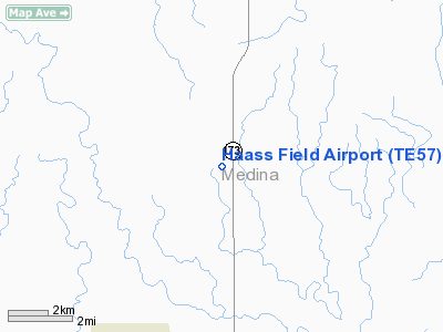
Location & QuickFacts
| FAA Information Effective: | 2008-09-25 |
| Airport Identifier: | TE57 |
| Airport Status: | Operational |
| Longitude/Latitude: | 099-07-22.0700W/29-26-41.2900N
-99.122797/29.444803 (Estimated) |
| Elevation: | 945 ft / 288.04 m (Estimated) |
| Land: | 20 acres |
| From nearest city: | 6 nautical miles N of Hondo, TX |
| Location: | Medina County, TX |
| Magnetic Variation: | 07E (1995) |
Owner & Manager
| Ownership: | Privately owned |
| Owner: | Gary W. Haass |
| Address: | 17046 Fm 3133
Van Alstyne, TX 75495 |
| Phone number: | 972-924-2096 |
| Manager: | Gary W. Haass |
| Address: | 17046 Fm 3133
Van Alstyne, TX 75495 |
| Phone number: | 972-924-2096 |
Airport Operations and Facilities
| Airport Use: | Private |
| Segmented Circle: | No |
| Control Tower: | No |
| Sectional chart: | San Antonio |
| Region: | ASW - Southwest |
| Boundary ARTCC: | ZHU - Houston |
| Tie-in FSS: | SJT - San Angelo |
| FSS Toll Free: | 1-800-WX-BRIEF |
Runway Information
Runway 17/35
| Dimension: | 1700 x 20 ft / 518.2 x 6.1 m |
| Surface: | TURF-DIRT, |
| |
Runway 17 |
Runway 35 |
| Traffic Pattern: | Left | Left |
| Obstruction: | 30 ft pline, 400.0 ft from runway | 4 ft fence, 10.0 ft from runway |
|
Radio Navigation Aids
| ID |
Type |
Name |
Ch |
Freq |
Var |
Dist |
| HMA | NDB | Hondo | | 329.00 | 08E | 5.0 nm |
| CVB | NDB | Castroville | | 338.00 | 08E | 15.5 nm |
| HHH | NDB | Devine | | 359.00 | 07E | 20.8 nm |
| ER | NDB | Shein | | 263.00 | 08E | 28.9 nm |
| UVA | NDB | Uvalde | | 281.00 | 07E | 35.4 nm |
| PEZ | NDB | Pleasanton | | 275.00 | 07E | 43.3 nm |
| LKX | NDB | La Pryor | | 223.00 | 09E | 49.3 nm |
| KSY | TACAN | Kelly | 057X | | 07E | 28.5 nm |
| DHK | TACAN | Randolph | 036X | | 09E | 45.1 nm |
| SSF | VOR | Stinson | | 108.40 | 09E | 37.3 nm |
| HDO | VOR/DME | Hondo | 31X | 109.40 | 08E | 6.4 nm |
| CSI | VORTAC | Center Point | 122X | 117.50 | 08E | 29.1 nm |
| SAT | VORTAC | San Antonio | 115X | 116.80 | 08E | 36.6 nm |
| RND | VORTAC | Randolph | 70X | 112.30 | 09E | 44.1 nm |
| SAT | VOT | San Antonio Intl | | 110.40 | | 34.6 nm |
Images and information placed above are from
http://www.airport-data.com/airport/TE57/
We thank them for the data!
| General Info
|
| Country |
United States
|
| State |
TEXAS
|
| FAA ID |
TE57
|
| Latitude |
29-26-41.290N
|
| Longitude |
099-07-22.070W
|
| Elevation |
945 feet
|
| Near City |
HONDO
|
We don't guarantee the information is fresh and accurate. The data may
be wrong or outdated.
For more up-to-date information please refer to other sources.
|
|


