 |
|
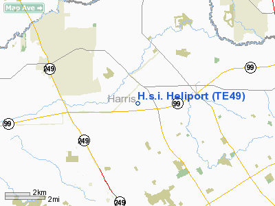
Location & QuickFacts
| FAA Information Effective: | 2008-09-25 |
| Airport Identifier: | TE49 |
| Airport Status: | Operational |
| Longitude/Latitude: | 095-33-28.0000W/30-03-39.6000N
-95.557778/30.061000 (Estimated) |
| Elevation: | 150 ft / 45.72 m (Estimated) |
| Land: | 2 acres |
| From nearest city: | 5 nautical miles W of Tomball, TX |
| Location: | Harris County, TX |
| Magnetic Variation: | 05E (2000) |
Owner & Manager
| Ownership: | Privately owned |
| Owner: | Helicopter Services, Inc |
| Address: | 19931 Stuebner Airline Road
Spring, TX 77379 |
| Phone number: | 281-370-4354 |
| Manager: | Mr. Robin Simpson |
| Address: | 19931 Stuebner Airline Road
Spring, TX 77379 |
| Phone number: | 281-370-4354 |
Airport Operations and Facilities
| Airport Use: | Private |
| Wind indicator: | Yes |
| Segmented Circle: | No |
| Control Tower: | No |
| Sectional chart: | Houston |
| Region: | ASW - Southwest |
| Boundary ARTCC: | ZHU - Houston |
| Tie-in FSS: | CXO - Montgomery County |
| FSS Toll Free: | 1-800-WX-BRIEF |
Airport Communications
Airport Services
Runway Information
Helipad H1
| Dimension: | 50 x 50 ft / 15.2 x 15.2 m |
| Surface: | TURF, |
| |
Runway H1 |
Runway |
| Traffic Pattern: | Left | Left |
|
Radio Navigation Aids
| ID |
Type |
Name |
Ch |
Freq |
Var |
Dist |
| DWH | NDB | David Hooks | | 521.00 | 05E | 3.9 nm |
| EYQ | NDB | Weiser | | 286.00 | 06E | 8.8 nm |
| LYD | NDB | Lakeside | | 249.00 | 05E | 16.0 nm |
| BVP | NDB | Nixin | | 326.00 | 05E | 18.3 nm |
| SGR | NDB | Hull | | 388.00 | 05E | 26.3 nm |
| SYG | NDB | Sandy Point | | 402.00 | 05E | 33.9 nm |
| JPA | NDB | Sanjac | | 347.00 | 05E | 34.7 nm |
| UTS | NDB | Huntsville | | 308.00 | 06E | 40.9 nm |
| BNH | NDB | Brenham | | 362.00 | 06E | 43.5 nm |
| CBC | NDB | Anahuac | | 413.00 | 05E | 49.7 nm |
| EFD | TACAN | Ellington | 031X | | 05E | 34.3 nm |
| HUB | VOR/DME | Hobby | 118X | 117.10 | 05E | 28.4 nm |
| ELA | VOR/DME | Eagle Lake | 111X | 116.40 | 08E | 46.3 nm |
| IAH | VORTAC | Humble | 113X | 116.60 | 05E | 12.7 nm |
| TNV | VORTAC | Navasota | 106X | 115.90 | 08E | 29.4 nm |
| DAS | VORTAC | Daisetta | 116X | 116.90 | 05E | 48.1 nm |
| HOU | VOT | Houston Wm P Hobby | | 108.40 | | 28.9 nm |
Images and information placed above are from
http://www.airport-data.com/airport/TE49/
We thank them for the data!
| General Info
|
| Country |
United States
|
| State |
TEXAS
|
| FAA ID |
TE49
|
| Latitude |
30-03-39.600N
|
| Longitude |
095-33-28.000W
|
| Elevation |
150 feet
|
| Near City |
TOMBALL
|
We don't guarantee the information is fresh and accurate. The data may
be wrong or outdated.
For more up-to-date information please refer to other sources.
|
|


