 |
|
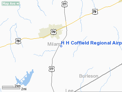
H H Coffield Rgnl Airport |
Location & QuickFacts
| FAA Information Effective: | 2008-09-25 |
| Airport Identifier: | RCK |
| Airport Status: | Operational |
| Longitude/Latitude: | 096-59-22.9450W/30-37-53.7170N
-96.989707/30.631588 (Estimated) |
| Elevation: | 474 ft / 144.48 m (Estimated) |
| Land: | 41 acres |
| From nearest city: | 2 nautical miles SE of Rockdale, TX |
| Location: | Milam County, TX |
| Magnetic Variation: | 06E (1985) |
Owner & Manager
| Ownership: | Publicly owned |
| Owner: | City Of Rockdale |
| Address: | Po Box 586
Rockdale, TX 76567 |
| Phone number: | 512-446-2511 |
| Manager: | Eddie Zapata
DIRECTOR OF PUBLIC WORKS |
| Address: | Po Box 586
Rockdale, TX 76567 |
| Phone number: | 512-446-5620 |
Airport Operations and Facilities
| Airport Use: | Open to public |
| Wind indicator: | Yes |
| Segmented Circle: | Yes |
| Control Tower: | No |
| Lighting Schedule: | DUSK-DAWN |
| Beacon Color: | Clear-Green (lighted land airport) |
| Sectional chart: | Houston |
| Region: | ASW - Southwest |
| Boundary ARTCC: | ZHU - Houston |
| Tie-in FSS: | CXO - Montgomery County |
| FSS on Airport: | No |
| FSS Toll Free: | 1-800-WX-BRIEF
FOR FP FILING CALL CXO FSS 1-800-992-7433. |
| NOTAMs Facility: | CXO (NOTAM-d service avaliable) |
Airport Communications
Airport Services
| Fuel available: | 100LL
FOR FUEL CALL 512-446-2511; AFT 1700 & WKENDS CALL 512-446-3436. |
| Airframe Repair: | NONE |
| Power Plant Repair: | NONE |
Runway Information
Runway 17/35
| Dimension: | 3084 x 50 ft / 940.0 x 15.2 m |
| Surface: | ASPH, Fair Condition |
| Edge Lights: | Non-standard lighting system
NSTD LIRL DUE TO SPACING. |
| |
Runway 17 |
Runway 35 |
| Traffic Pattern: | Left | Left |
| Markings: | Nonstandard, Poor Condition
MARKINGS ARE EXTREMELY FADED. | Nonstandard, Poor Condition
RY 35 NRS & CNTRLN STRIPES NSTD 30 TALL; MARKINGS FADED. |
| Obstruction: | 14 ft road, 200.0 ft from runway, 51 ft left of centerline
+4 FT FENCE 110 FT L OF CNTRLN AT THLD. | 20 ft trees, 200.0 ft from runway
4 FT FENCE 125 FT FM THLD ACROSS APCH; 23 FT TREE AT THLD 100 FT LEFT, 18 FT TREE 185 FT FM THLD ACROSS APCH; 15 FT TREE 125 FT FM THLD ON CNTRLN. |
|
Radio Navigation Aids
| ID |
Type |
Name |
Ch |
Freq |
Var |
Dist |
| GYB | NDB | Lee County | | 385.00 | 07E | 27.8 nm |
| GUO | NDB | Georgetown | | 332.00 | 06E | 35.8 nm |
| BNH | NDB | Brenham | | 362.00 | 06E | 40.3 nm |
| IL | NDB | Iresh | | 278.00 | 07E | 43.9 nm |
| HLR | NDB | Hood | | 347.00 | 07E | 47.8 nm |
| TPL | VOR/DME | Temple | 041X | 110.40 | 09E | 41.3 nm |
| GRK | VOR/DME | Gray | 055X | 111.80 | 07E | 48.9 nm |
| CLL | VORTAC | College Station | 080X | 113.30 | 08E | 29.5 nm |
| CWK | VORTAC | Centex | 075X | 112.80 | 06E | 31.8 nm |
| IDU | VORTAC | Industry | 039X | 110.20 | 08E | 46.3 nm |
Remarks
- +40 FT ANT BTN 2 HGRS E SIDE OF RY.
Images and information placed above are from
http://www.airport-data.com/airport/RCK/
We thank them for the data!
| General Info
|
| Country |
United States
|
| State |
TEXAS
|
| FAA ID |
RCK
|
| Latitude |
30-37-53.717N
|
| Longitude |
096-59-22.945W
|
| Elevation |
474 feet
|
| Near City |
ROCKDALE
|
We don't guarantee the information is fresh and accurate. The data may
be wrong or outdated.
For more up-to-date information please refer to other sources.
|
|


