 |
|
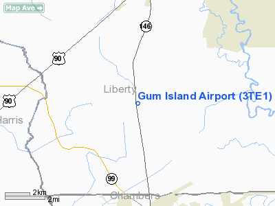
Location & QuickFacts
| FAA Information Effective: | 2008-09-25 |
| Airport Identifier: | 3TE1 |
| Airport Status: | Operational |
| Longitude/Latitude: | 094-54-15.7290W/29-57-05.7880N
-94.904369/29.951608 (Estimated) |
| Elevation: | 53 ft / 16.15 m (Estimated) |
| Land: | 0 acres |
| From nearest city: | 5 nautical miles S of Dayton, TX |
| Location: | Liberty County, TX |
| Magnetic Variation: | 06E (1985) |
Owner & Manager
| Ownership: | Privately owned |
| Owner: | Weldon Alders |
| Address: | Po Box 10
Dayton, TX 77535 |
| Manager: | Weldon Alders |
| Address: | Po Box 10
Dayton, TX 77535 |
Airport Operations and Facilities
| Airport Use: | Private |
| Wind indicator: | No |
| Segmented Circle: | No |
| Control Tower: | No |
| Sectional chart: | Houston |
| Region: | ASW - Southwest |
| Boundary ARTCC: | ZHU - Houston |
| Tie-in FSS: | CXO - Montgomery County |
| FSS on Airport: | No |
| FSS Toll Free: | 1-800-WX-BRIEF |
Airport Services
| Airframe Repair: | NONE |
| Power Plant Repair: | NONE |
Runway Information
Runway 16/34
| Dimension: | 2500 x 100 ft / 762.0 x 30.5 m |
| Surface: | TURF, |
| |
Runway 16 |
Runway 34 |
| Traffic Pattern: | Left | Left |
|
Radio Navigation Aids
| ID |
Type |
Name |
Ch |
Freq |
Var |
Dist |
| BVP | NDB | Nixin | | 326.00 | 05E | 16.4 nm |
| CBC | NDB | Anahuac | | 413.00 | 05E | 16.6 nm |
| JPA | NDB | Sanjac | | 347.00 | 05E | 19.1 nm |
| DWH | NDB | David Hooks | | 521.00 | 05E | 36.0 nm |
| GDE | NDB | Goodhue | | 368.00 | 07E | 37.2 nm |
| GLS | NDB | Galveston | | 206.00 | 08E | 37.9 nm |
| EYQ | NDB | Weiser | | 286.00 | 06E | 38.4 nm |
| SYG | NDB | Sandy Point | | 402.00 | 05E | 40.0 nm |
| HRD | NDB | Hardin County | | 524.00 | 04E | 40.7 nm |
| LYD | NDB | Lakeside | | 249.00 | 05E | 41.1 nm |
| SGR | NDB | Hull | | 388.00 | 05E | 43.7 nm |
| EFD | TACAN | Ellington | 031X | | 05E | 24.7 nm |
| MHF | VOR/DME | Trinity | 083X | 113.60 | 07E | 25.7 nm |
| HUB | VOR/DME | Hobby | 118X | 117.10 | 05E | 26.3 nm |
| BPT | VOR/DME | Beaumont | 092X | 114.50 | 07E | 46.3 nm |
| SBI | VOR/DME | Sabine Pass | 101X | 115.40 | 07E | 47.9 nm |
| DAS | VORTAC | Daisetta | 116X | 116.90 | 05E | 19.7 nm |
| IAH | VORTAC | Humble | 113X | 116.60 | 05E | 23.0 nm |
| VUH | VORTAC | Scholes | 077X | 113.00 | 06E | 41.1 nm |
| HOU | VOT | Houston Wm P Hobby | | 108.40 | | 26.8 nm |
Images and information placed above are from
http://www.airport-data.com/airport/3TE1/
We thank them for the data!
| General Info
|
| Country |
United States
|
| State |
TEXAS
|
| FAA ID |
3TE1
|
| Latitude |
29-57-05.788N
|
| Longitude |
094-54-15.729W
|
| Elevation |
53 feet
|
| Near City |
DAYTON
|
We don't guarantee the information is fresh and accurate. The data may
be wrong or outdated.
For more up-to-date information please refer to other sources.
|
|


