 |
|
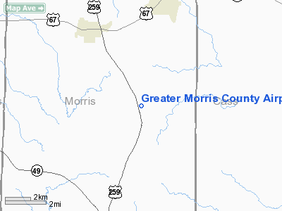
Greater Morris County Airport |
Location & QuickFacts
| FAA Information Effective: | 2008-09-25 |
| Airport Identifier: | 8F5 |
| Airport Status: | Operational |
| Longitude/Latitude: | 094-41-55.7410W/33-07-36.4450N
-94.698817/33.126790 (Estimated) |
| Elevation: | 402 ft / 122.53 m (Surveyed) |
| Land: | 56 acres |
| From nearest city: | 7 nautical miles N of Daingerfield, TX |
| Location: | Morris County, TX |
| Magnetic Variation: | 05E (1985) |
Owner & Manager
| Ownership: | Publicly owned |
| Owner: | County Of Morris
COUNTY JUDGE, J C JENNINGS. |
| Address: | 500 Broadnax
Daingerfield, TX 75638 |
| Phone number: | 903-645-3691 |
| Manager: | H G Mitchel
COUNTY COMMISSIONER. |
| Address: | 500 Broadnax
Daingerfield, TX 75638 |
| Phone number: | 903-645-3691 |
Airport Operations and Facilities
| Airport Use: | Open to public |
| Wind indicator: | Yes
WIND SOCK MISSING |
| Segmented Circle: | Yes |
| Control Tower: | No |
| Landing fee charge: | No |
| Sectional chart: | Memphis |
| Region: | ASW - Southwest |
| Boundary ARTCC: | ZFW - Fort Worth |
| Tie-in FSS: | FTW - Fort Worth |
| FSS on Airport: | No |
| FSS Phone: | 817-541-3474 |
| FSS Toll Free: | 1-800-WX-BRIEF |
| NOTAMs Facility: | FTW (NOTAM-d service avaliable) |
| Federal Agreements: | GY |
Airport Communications
Airport Services
| Airframe Repair: | NONE |
| Power Plant Repair: | NONE |
| Bottled Oxygen: | NONE |
| Bulk Oxygen: | NONE |
Runway Information
Runway 17/35
| Dimension: | 3080 x 50 ft / 938.8 x 15.2 m |
| Surface: | ASPH, Poor Condition
RUNWAY HAS LOOSE GRAVEL & GRASS |
| Weight Limit: | Single wheel: 4000 lbs. |
| |
Runway 17 |
Runway 35 |
| Traffic Pattern: | Left | Left |
| Markings: | Basic, Good Condition | Basic, Fair Condition |
| Displaced threshold: | 80.00 ft | 0.00 ft |
| Obstruction: | 27 ft tree, 600.0 ft from runway, 160 ft left of centerline, 14:1 slope to clear
APCH SLOPE 18:1 TO DSPLCD THLD. | 20 ft trees, 375.0 ft from runway, 8:1 slope to clear |
|
Radio Navigation Aids
| ID |
Type |
Name |
Ch |
Freq |
Var |
Dist |
| LST | NDB | Lone Star | | 305.00 | 05E | 12.2 nm |
| ATA | NDB | Atlanta | | 347.00 | 04E | 25.6 nm |
| VIV | NDB | Vivian | | 284.00 | 06E | 38.3 nm |
| ABG | NDB | Ambassador | | 404.00 | 07E | 38.7 nm |
| IBO | NDB | Idabel | | 271.00 | 03E | 47.4 nm |
| UIM | VOR/DME | Quitman | 087X | 114.00 | 08E | 36.8 nm |
| SLR | VOR/DME | Sulphur Springs | 027X | 109.00 | 08E | 42.7 nm |
| PRX | VOR/DME | Paris | 083X | 113.60 | 07E | 45.2 nm |
| TXK | VORTAC | Texarkana | 110X | 116.30 | 07E | 39.1 nm |
| GGG | VORTAC | Gregg County | 070X | 112.30 | 07E | 42.7 nm |
| EIC | VORTAC | Belcher | 121X | 117.40 | 07E | 49.7 nm |
Images and information placed above are from
http://www.airport-data.com/airport/8F5/
We thank them for the data!
| General Info
|
| Country |
United States
|
| State |
TEXAS
|
| FAA ID |
8F5
|
| Latitude |
33-07-36.445N
|
| Longitude |
094-41-55.741W
|
| Elevation |
402 feet
|
| Near City |
DAINGERFIELD
|
We don't guarantee the information is fresh and accurate. The data may
be wrong or outdated.
For more up-to-date information please refer to other sources.
|
|


