 |
|
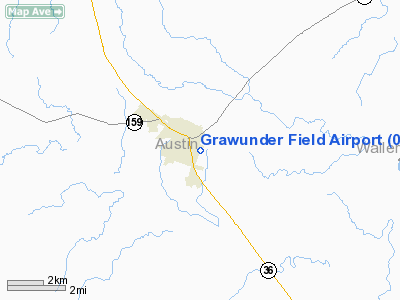
Location & QuickFacts
| FAA Information Effective: | 2008-09-25 |
| Airport Identifier: | 06R |
| Airport Status: | Operational |
| Longitude/Latitude: | 096-14-45.8680W/29-56-30.8120N
-96.246074/29.941892 (Estimated) |
| Elevation: | 289 ft / 88.09 m (Surveyed)
SOUTH END OF RY ELEV 45 FT LOWER THAN NORTH END. |
| Land: | 20 acres |
| From nearest city: | 1 nautical miles SE of Bellville, TX |
| Location: | Austin County, TX |
| Magnetic Variation: | 06E (1985) |
Owner & Manager
| Ownership: | Privately owned |
| Owner: | City Of Bellville
ARPT LEASED FROM MR. GRAWUNDER JR. |
| Address: | Po Box 817
Bellville, TX 77418 |
| Phone number: | 979-865-3136 |
| Manager: | H. Grawunder, Jr. |
| Address: | Po Box 159
Bellville, TX 77418 |
| Phone number: | 979-865-2614 |
Airport Operations and Facilities
| Airport Use: | Open to public |
| Wind indicator: | Yes |
| Segmented Circle: | Yes |
| Control Tower: | No |
| Lighting Schedule: | DUSK-DAWN |
| Landing fee charge: | No |
| Sectional chart: | Houston |
| Region: | ASW - Southwest |
| Boundary ARTCC: | ZHU - Houston |
| Tie-in FSS: | CXO - Montgomery County |
| FSS on Airport: | No |
| FSS Toll Free: | 1-800-WX-BRIEF
FOR FP FILING CALL CXO FSS 1-800-833-5602 |
| NOTAMs Facility: | CXO (NOTAM-d service avaliable) |
Airport Communications
| CTAF: | 123.000 |
| Unicom: | 123.000 |
Airport Services
| Airframe Repair: | NONE |
| Power Plant Repair: | NONE |
| Bottled Oxygen: | NONE |
| Bulk Oxygen: | NONE |
Runway Information
Runway 15/33
| Dimension: | 2480 x 30 ft / 755.9 x 9.1 m |
| Surface: | ASPH, Good Condition |
| Weight Limit: | Single wheel: 4000 lbs. |
| Edge Lights: | Non-standard lighting system
NSTD LIRL. NORTH 135 FT & SOUTH 126 FT UNLGTD. |
| |
Runway 15 |
Runway 33 |
| Traffic Pattern: | Left | Right |
| Obstruction: | 25 ft tree, 200.0 ft from runway, 75 ft left of centerline
+6 FT FENCE AT THLD 50 FT RIGHT OF CNTRLN, 6 FT FENCE 110 FT FM THLD ON CNTRLN. | 35 ft trees, 200.0 ft from runway, 100 ft right of centerline
+35 FT TREES AT THLD 100 FT L & R OF CNTRLN; +2 FT FENCE 50 FT L & R OF CNTRLN AT THLD; +3 FT BARRICADE ON CNTRLN 10 FT FM THLD. |
|
Radio Navigation Aids
| ID |
Type |
Name |
Ch |
Freq |
Var |
Dist |
| BNH | NDB | Brenham | | 362.00 | 06E | 18.1 nm |
| LYD | NDB | Lakeside | | 249.00 | 05E | 30.6 nm |
| EYQ | NDB | Weiser | | 286.00 | 06E | 31.5 nm |
| SGR | NDB | Hull | | 388.00 | 05E | 36.0 nm |
| DWH | NDB | David Hooks | | 521.00 | 05E | 37.1 nm |
| GYB | NDB | Lee County | | 385.00 | 07E | 40.5 nm |
| ARM | NDB | Wharton | | 245.00 | 06E | 41.6 nm |
| SYG | NDB | Sandy Point | | 402.00 | 05E | 48.4 nm |
| ELA | VOR/DME | Eagle Lake | 111X | 116.40 | 08E | 17.2 nm |
| IDU | VORTAC | Industry | 039X | 110.20 | 08E | 16.5 nm |
| TNV | VORTAC | Navasota | 106X | 115.90 | 08E | 23.0 nm |
| CLL | VORTAC | College Station | 080X | 113.30 | 08E | 40.9 nm |
| IAH | VORTAC | Humble | 113X | 116.60 | 05E | 46.9 nm |
Remarks
- 2 FT ELECTRIC FENCE AROUND RY FOR CATTLE GUARD.
- RY 15 THLD RELCTD 135 FT FOR NIGHT OPNS; RY 33 THLD RELCTD 126 FT FOR NIGHT OPNS. 2219 FT OF RY LGTD AT NIGHT.
- RY 15/33 UNMARKED.
- PRIMARY SURFACE OBSTUCTED BY 20-35 FT TREES AT AER 33, 65 FT WEST OF CNTRLN, FROM THLD TO 250 FT AND 90 FT EAST OF CNTRLN FROM THLD TO 400 FT.
- MAY PRE DATE THE ACT.
Images and information placed above are from
http://www.airport-data.com/airport/06R/
We thank them for the data!
| General Info
|
| Country |
United States
|
| State |
TEXAS
|
| FAA ID |
06R
|
| Latitude |
29-56-30.812N
|
| Longitude |
096-14-45.868W
|
| Elevation |
289 feet
|
| Near City |
BELLVILLE
|
We don't guarantee the information is fresh and accurate. The data may
be wrong or outdated.
For more up-to-date information please refer to other sources.
|
|


