 |
|
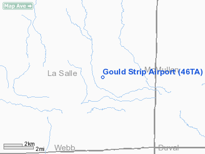
Location & QuickFacts
| FAA Information Effective: | 2008-09-25 |
| Airport Identifier: | 46TA |
| Airport Status: | Operational |
| Longitude/Latitude: | 098-51-35.0770W/28-07-34.0270N
-98.859744/28.126119 (Estimated) |
| Elevation: | 287 ft / 87.48 m (Estimated) |
| Land: | 0 acres |
| From nearest city: | 32 nautical miles SE of Cotulla, TX |
| Location: | La Salle County, TX |
| Magnetic Variation: | 08E (1985) |
Owner & Manager
| Ownership: | Privately owned |
| Owner: | Herradura Inc. |
| Address: | Po Box 698
Cotulla, TX 78014 |
| Phone number: | 512-373-4448 |
| Manager: | Tom Gould |
| Address: | Po Box 377
Tilden, TX 78072 |
Airport Operations and Facilities
| Airport Use: | Private
PERSONAL USE. |
| Wind indicator: | Yes |
| Segmented Circle: | No |
| Control Tower: | No |
| Sectional chart: | San Antonio |
| Region: | ASW - Southwest |
| Boundary ARTCC: | ZHU - Houston |
| Tie-in FSS: | SJT - San Angelo |
| FSS on Airport: | No |
| FSS Toll Free: | 1-800-WX-BRIEF |
Runway Information
Runway 01/19
| Dimension: | 4000 x 60 ft / 1219.2 x 18.3 m |
| Surface: | TURF, |
| |
Runway 01 |
Runway 19 |
| Traffic Pattern: | Left | Left |
| Displaced threshold: | 500.00 ft | 350.00 ft |
| Obstruction: | 25 ft pline | 23 ft pline, 100.0 ft from runway |
|
Radio Navigation Aids
| ID |
Type |
Name |
Ch |
Freq |
Var |
Dist |
| HBV | NDB | Hebbronville | | 266.00 | 06E | 46.8 nm |
| NOG | TACAN | Orange Grove | 063X | | 09E | 45.5 nm |
| COT | VORTAC | Cotulla | 105X | 115.80 | 09E | 24.4 nm |
| THX | VORTAC | Three Rivers | 051X | 111.40 | 08E | 43.9 nm |
| LRD | VORTAC | Laredo | 121X | 117.40 | 09E | 48.9 nm |
Remarks
- CATTLE & DEER ON & INVOF ARPT.
- HIGH BRUSH ALONG RY CAN MAKE STRONG X-WIND TURBULANCE.
- PRVDD PERSONAL USE ONLY; ANY POWERLINES CROSSING STRIP ARE REMOVED OR BURIED; AND POWERLINES AT ENDS OF STRIP ARE REMOVED; BURIED OR THRS ARE DSPLCD TO PROVIDE A 20:1 APCH SLOPE.
Images and information placed above are from
http://www.airport-data.com/airport/46TA/
We thank them for the data!
| General Info
|
| Country |
United States
|
| State |
TEXAS
|
| FAA ID |
46TA
|
| Latitude |
28-07-34.027N
|
| Longitude |
098-51-35.077W
|
| Elevation |
287 feet
|
| Near City |
COTULLA
|
We don't guarantee the information is fresh and accurate. The data may
be wrong or outdated.
For more up-to-date information please refer to other sources.
|
|


