 |
|
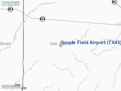
Location & QuickFacts
| FAA Information Effective: | 2008-09-25 |
| Airport Identifier: | TX43 |
| Airport Status: | Operational |
| Longitude/Latitude: | 096-00-09.8880W/32-30-35.4960N
-96.002747/32.509860 (Estimated) |
| Elevation: | 445 ft / 135.64 m (Estimated) |
| Land: | 0 acres |
| From nearest city: | 7 nautical miles SW of Canton, TX |
| Location: | Van Zandt County, TX |
| Magnetic Variation: | 06E (1990) |
Owner & Manager
| Ownership: | Privately owned |
| Owner: | Robert G. Goode |
| Address: | 1080 S. Peytonville Ave.
Southlake, TX 76092 |
| Phone number: | 817-481-3678 |
| Manager: | Robert G. Goode |
| Address: | 1080 S. Peytonville Ave.
Southlake, TX 76092 |
| Phone number: | 817-481-4211 |
Airport Operations and Facilities
| Airport Use: | Private |
| Segmented Circle: | No |
| Control Tower: | No |
| Lighting Schedule: | PHONE REQ
FOR LIRL RY 18/36 CALL 817-481-4211. |
| Sectional chart: | Dallas-ft Worth |
| Region: | ASW - Southwest |
| Boundary ARTCC: | ZFW - Fort Worth |
| Tie-in FSS: | FTW - Fort Worth |
| FSS on Airport: | No |
| FSS Phone: | 817-541-3474 |
| FSS Toll Free: | 1-800-WX-BRIEF |
Runway Information
Runway 18/36
| Dimension: | 3200 x 50 ft / 975.4 x 15.2 m |
| Surface: | TURF, |
| Edge Lights: | Low |
| |
Runway 18 |
Runway 36 |
| Traffic Pattern: | Left | Left |
| Obstruction: | 80 ft pline, 2000.0 ft from runway | 40 ft trees, 400.0 ft from runway |
|
Radio Navigation Aids
| ID |
Type |
Name |
Ch |
Freq |
Var |
Dist |
| AVZ | NDB | Travis | | 260.00 | 06E | 19.5 nm |
| AHX | NDB | Athens | | 269.00 | 06E | 22.8 nm |
| CSZ | NDB | Crossroads | | 215.00 | 08E | 26.9 nm |
| TY | NDB | Tyler | | 320.00 | 06E | 27.6 nm |
| JUG | NDB | Jecca | | 388.00 | 06E | 28.5 nm |
| SYW | NDB | Cash | | 428.00 | 05E | 28.6 nm |
| LIQ | NDB | Lochridge Ranch | | 335.00 | 09E | 30.1 nm |
| PQF | NDB | Mesquite | | 248.00 | 06E | 32.1 nm |
| MII | NDB | Caddo Mills | | 316.00 | 06E | 34.2 nm |
| CGQ | NDB | Powell | | 344.00 | 06E | 34.4 nm |
| CRS | NDB | Corsicana | | 396.00 | 06E | 35.2 nm |
| LNC | NDB | Lancaster | | 239.00 | 06E | 36.7 nm |
| PYF | NDB | Pyramid | | 418.00 | 06E | 40.1 nm |
| RBD | NDB | Redbird | | 287.00 | 06E | 45.1 nm |
| ABG | NDB | Ambassador | | 404.00 | 07E | 45.3 nm |
| PSN | NDB | Palestine | | 375.00 | 04E | 46.5 nm |
| XQH | NDB | Cedar Hill | | 353.00 | 08E | 49.6 nm |
| MJF | TACAN | Arvilla | 033X | | 05E | 33.6 nm |
| TYR | VOR/DME | Tyler | 089X | 114.20 | 06E | 31.8 nm |
| FZT | VOR/DME | Frankston | 051X | 111.40 | 06E | 35.5 nm |
| UIM | VOR/DME | Quitman | 087X | 114.00 | 08E | 39.1 nm |
| SLR | VOR/DME | Sulphur Springs | 027X | 109.00 | 08E | 47.5 nm |
| CQY | VORTAC | Cedar Creek | 095X | 114.80 | 06E | 22.3 nm |
| DAL | VOT | Dallas Love Field | | 113.30 | | 47.5 nm |
Images and information placed above are from
http://www.airport-data.com/airport/TX43/
We thank them for the data!
| General Info
|
| Country |
United States
|
| State |
TEXAS
|
| FAA ID |
TX43
|
| Latitude |
32-30-35.496N
|
| Longitude |
096-00-09.888W
|
| Elevation |
445 feet
|
| Near City |
CANTON
|
We don't guarantee the information is fresh and accurate. The data may
be wrong or outdated.
For more up-to-date information please refer to other sources.
|
|


