 |
|
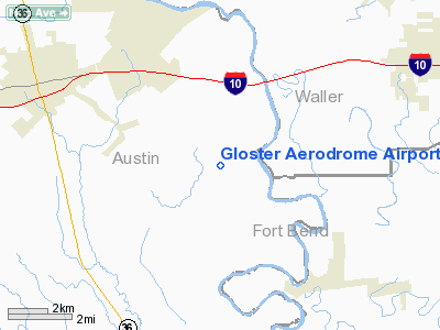
Gloster Aerodrome Airport |
Location & QuickFacts
| FAA Information Effective: | 2008-09-25 |
| Airport Identifier: | 1XA7 |
| Airport Status: | Operational |
| Longitude/Latitude: | 096-03-33.0500W/29-44-00.2100N
-96.059181/29.733392 (Estimated) |
| Elevation: | 145 ft / 44.20 m (Estimated) |
| Land: | 86 acres |
| From nearest city: | 7 nautical miles W of Sealy, TX |
| Location: | Austin County, TX |
| Magnetic Variation: | () |
Owner & Manager
| Ownership: | Privately owned |
| Owner: | John & Kim Couch |
| Address: | 31 E. Kitty Hawk
Richmond, TX 77469 |
| Phone number: | 281-341-9991 |
| Manager: | John A. Couch |
| Address: | 31 E. Kitty Hawk
Richmond, TX 77469 |
| Phone number: | 281-341-9991 |
Airport Operations and Facilities
| Airport Use: | Private |
| Wind indicator: | Yes |
| Control Tower: | No |
| Sectional chart: | Houston |
| Region: | ASW - Southwest |
| Boundary ARTCC: | ZHU - Houston |
| Tie-in FSS: | CXO - Montgomery County |
| FSS Toll Free: | 1-800-WX-BRIEF |
Airport Communications
Airport Services
| Fuel available: | 100LLMOGAS |
Runway Information
Runway 07/25
| Dimension: | 2400 x 150 ft / 731.5 x 45.7 m |
| Surface: | TURF, Good Condition |
| |
Runway 07 |
Runway 25 |
| Traffic Pattern: | Right | Left |
| Displaced threshold: | 0.00 ft | 200.00 ft
DSPLCD THLD MKD WITH ORANGE CONES. |
| Obstruction: | | 40 ft trees, 20.0 ft from runway |
|
Runway 09/27
| Dimension: | 2200 x 100 ft / 670.6 x 30.5 m |
| Surface: | TURF, Good Condition |
| |
Runway 09 |
Runway 27 |
| Traffic Pattern: | Right | Left |
| Displaced threshold: | 0.00 ft | 200.00 ft
DSPLCD THLD MKD WITH ORANGE CONES. |
| Obstruction: | | 40 ft trees, 20.0 ft from runway |
|
Radio Navigation Aids
| ID |
Type |
Name |
Ch |
Freq |
Var |
Dist |
| LYD | NDB | Lakeside | | 249.00 | 05E | 20.5 nm |
| SGR | NDB | Hull | | 388.00 | 05E | 21.9 nm |
| EYQ | NDB | Weiser | | 286.00 | 06E | 24.9 nm |
| ARM | NDB | Wharton | | 245.00 | 06E | 29.2 nm |
| BNH | NDB | Brenham | | 362.00 | 06E | 33.6 nm |
| SYG | NDB | Sandy Point | | 402.00 | 05E | 33.9 nm |
| DWH | NDB | David Hooks | | 521.00 | 05E | 34.9 nm |
| BVP | NDB | Nixin | | 326.00 | 05E | 46.7 nm |
| BYY | NDB | Bay City | | 344.00 | 06E | 46.9 nm |
| EFD | TACAN | Ellington | 031X | | 05E | 47.6 nm |
| ELA | VOR/DME | Eagle Lake | 111X | 116.40 | 08E | 14.1 nm |
| HUB | VOR/DME | Hobby | 118X | 117.10 | 05E | 41.1 nm |
| IDU | VORTAC | Industry | 039X | 110.20 | 08E | 29.4 nm |
| TNV | VORTAC | Navasota | 106X | 115.90 | 08E | 33.4 nm |
| IAH | VORTAC | Humble | 113X | 116.60 | 05E | 39.5 nm |
| HOU | VOT | Houston Wm P Hobby | | 108.40 | | 41.1 nm |
Remarks
Images and information placed above are from
http://www.airport-data.com/airport/1XA7/
We thank them for the data!
|
|


