 |
|
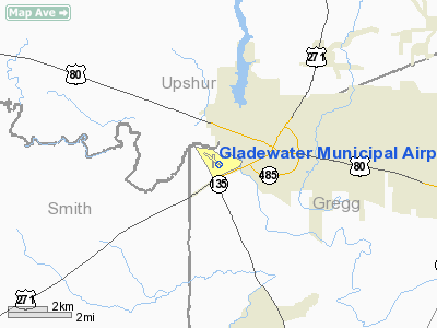
Location & QuickFacts
| FAA Information Effective: | 2008-09-25 |
| Airport Identifier: | 07F |
| Airport Status: | Operational |
| Longitude/Latitude: | 094-58-18.2877W/32-31-43.8268N
-94.971747/32.528841 (Estimated) |
| Elevation: | 296 ft / 90.22 m (Surveyed) |
| Land: | 146 acres |
| From nearest city: | 2 nautical miles SW of Gladewater, TX |
| Location: | Gregg County, TX |
| Magnetic Variation: | 07E (1965) |
Owner & Manager
| Ownership: | Publicly owned |
| Owner: | City Of Gladewater |
| Address: | Po Box 551
Gladewater, TX 75647 |
| Phone number: | 903-845-2196 |
| Manager: | Jay Stokes |
| Address: | Po Box 1725
Gladewater, TX 75647 |
| Phone number: | 903-845-2116 |
Airport Operations and Facilities
| Airport Use: | Open to public |
| Wind indicator: | Yes |
| Segmented Circle: | Yes |
| Control Tower: | No |
| Lighting Schedule: | DUSK-DAWN |
| Beacon Color: | Clear-Green (lighted land airport) |
| Landing fee charge: | No |
| Sectional chart: | Memphis |
| Region: | ASW - Southwest |
| Boundary ARTCC: | ZFW - Fort Worth |
| Tie-in FSS: | FTW - Fort Worth |
| FSS on Airport: | No |
| FSS Phone: | 817-541-3474 |
| FSS Toll Free: | 1-800-WX-BRIEF |
| NOTAMs Facility: | FTW (NOTAM-d service avaliable) |
| Federal Agreements: | NGY |
Airport Communications
Airport Services
| Fuel available: | 100LL |
| Airframe Repair: | MINOR |
| Power Plant Repair: | MINOR |
| Bottled Oxygen: | NONE |
| Bulk Oxygen: | NONE |
Runway Information
Runway 14/32
| Dimension: | 3301 x 75 ft / 1006.1 x 22.9 m |
| Surface: | ASPH, Good Condition |
| Weight Limit: | Single wheel: 12500 lbs. |
| Edge Lights: | Medium |
| |
Runway 14 |
Runway 32 |
| Longitude: | 094-58-31.1667W | 094-58-07.8014W |
| Latitude: | 32-31-59.5622N | 32-31-33.5831N |
| Elevation: | 285.00 ft | 296.00 ft |
| Alignment: | 127 | 127 |
| Traffic Pattern: | Left | Left |
| Markings: | Non-precision instrument, Fair Condition | Non-precision instrument, Fair Condition |
| Obstruction: | 20 ft tree, 274.0 ft from runway, 86 ft right of centerline, 3:1 slope to clear
+6 FT BRUSH 80 FT FM THLD 110 FT R. | 70 ft trees, 1075.0 ft from runway, 250 ft left of centerline, 12:1 slope to clear |
|
Runway 17/35
| Dimension: | 2301 x 50 ft / 701.3 x 15.2 m |
| Surface: | ASPH, Good Condition |
| Weight Limit: | Single wheel: 7000 lbs. |
| |
Runway 17 |
Runway 35 |
| Longitude: | 094-58-16.8468W | 094-58-16.2981W |
| Latitude: | 32-31-51.2706N | 32-31-28.5054N |
| Elevation: | 292.00 ft | 294.00 ft |
| Alignment: | 127 | 127 |
| Traffic Pattern: | Left | Left |
| Markings: | Basic, Good Condition | Basic, Good Condition |
| Obstruction: | 20 ft trees, 295.0 ft from runway, 62 ft right of centerline, 4:1 slope to clear | 58 ft trees, 1100.0 ft from runway, 125 ft right of centerline, 15:1 slope to clear |
|
Radio Navigation Aids
| ID |
Type |
Name |
Ch |
Freq |
Var |
Dist |
| ABG | NDB | Ambassador | | 404.00 | 07E | 7.9 nm |
| HNO | NDB | Henderson | | 371.00 | 06E | 21.2 nm |
| TY | NDB | Tyler | | 320.00 | 06E | 26.1 nm |
| LST | NDB | Lone Star | | 305.00 | 05E | 26.6 nm |
| RPF | NDB | Carthage | | 332.00 | 04E | 40.2 nm |
| JSO | NDB | Cherokee County | | 263.00 | 05E | 41.5 nm |
| AHX | NDB | Athens | | 269.00 | 06E | 48.9 nm |
| TYR | VOR/DME | Tyler | 089X | 114.20 | 06E | 24.2 nm |
| UIM | VOR/DME | Quitman | 087X | 114.00 | 08E | 29.1 nm |
| FZT | VOR/DME | Frankston | 051X | 111.40 | 06E | 39.4 nm |
| SLR | VOR/DME | Sulphur Springs | 027X | 109.00 | 08E | 49.5 nm |
| GGG | VORTAC | Gregg County | 070X | 112.30 | 07E | 12.9 nm |
Images and information placed above are from
http://www.airport-data.com/airport/07F/
We thank them for the data!
| General Info
|
| Country |
United States
|
| State |
TEXAS
|
| FAA ID |
07F
|
| Latitude |
32-31-43.819N
|
| Longitude |
094-58-18.284W
|
| Elevation |
297 feet
|
| Near City |
GLADEWATER
|
We don't guarantee the information is fresh and accurate. The data may
be wrong or outdated.
For more up-to-date information please refer to other sources.
|
|


