 |
|
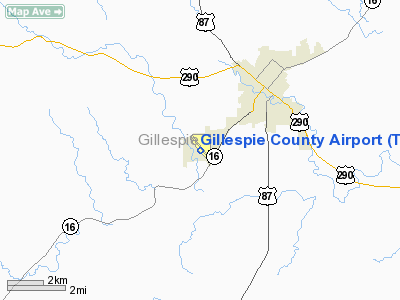
Location & QuickFacts
| FAA Information Effective: | 2008-09-25 |
| Airport Identifier: | T82 |
| Airport Status: | Operational |
| Longitude/Latitude: | 098-54-33.1000W/30-14-35.7000N
-98.909194/30.243250 (Estimated) |
| Elevation: | 1695 ft / 516.64 m (Surveyed) |
| Land: | 216 acres |
| From nearest city: | 3 nautical miles SW of Fredericksburg, TX |
| Location: | Gillespie County, TX |
| Magnetic Variation: | 06E (2005) |
Owner & Manager
| Ownership: | Publicly owned |
| Owner: | Gillespie County |
| Address: | 101 W Main Unit 9
Fredericksburg, TX 78624 |
| Phone number: | 830-997-7502 |
| Manager: | Roger Hansen |
| Address: | 101 W Main Unit 9
Fredericksburg, TX 78624 |
| Phone number: | 830-990-5764 |
Airport Operations and Facilities
| Airport Use: | Open to public |
| Wind indicator: | Yes |
| Segmented Circle: | Yes |
| Control Tower: | No |
| Lighting Schedule: | DUSK-DAWN
MIRL RY 14/32 PRESET LOW INTST; TO INCR INTST ACTVT - CTAF. |
| Beacon Color: | Clear-Green (lighted land airport) |
| Landing fee charge: | No |
| Sectional chart: | San Antonio |
| Region: | ASW - Southwest |
| Boundary ARTCC: | ZHU - Houston |
| Tie-in FSS: | SJT - San Angelo |
| FSS on Airport: | No |
| FSS Toll Free: | 1-800-WX-BRIEF |
| NOTAMs Facility: | T82 (NOTAM-d service avaliable) |
| Federal Agreements: | N1 |
Airport Communications
| CTAF: | 122.700 |
| Unicom: | 122.700 |
Airport Services
| Fuel available: | 100LLA
FUEL AVBL 24 HRS WITH MAJOR CREDIT CARD. |
| Airframe Repair: | MAJOR |
| Power Plant Repair: | MAJOR |
| Bottled Oxygen: | NONE |
| Bulk Oxygen: | NONE |
Runway Information
Runway 14/32
| Dimension: | 5001 x 75 ft / 1524.3 x 22.9 m |
| Surface: | ASPH, Good Condition |
| Weight Limit: | Single wheel: 30000 lbs. |
| Edge Lights: | Medium |
| |
Runway 14 |
Runway 32 |
| Longitude: | 098-54-48.7070W | 098-54-17.4397W |
| Latitude: | 30-14-56.3718N | 30-14-14.9784N |
| Elevation: | 1695.00 ft | 1677.00 ft |
| Alignment: | 127 | 127 |
| Traffic Pattern: | Right | Left |
| Markings: | Non-precision instrument, Good Condition | Non-precision instrument, Good Condition |
| Crossing Height: | 35.00 ft | 35.00 ft |
| VASI: | 2-light PAPI on left side | 2-light PAPI on left side |
| Visual Glide Angle: | 3.00° | 3.00° |
| Obstruction: | 3 ft fence, 200.0 ft from runway, 216 ft right of centerline
RY 14 +3 FT FENCE 190-200 FT FM THLD 216 FT RIGHT. | , 50:1 slope to clear |
|
Radio Navigation Aids
| ID |
Type |
Name |
Ch |
Freq |
Var |
Dist |
| ER | NDB | Shein | | 263.00 | 08E | 20.4 nm |
| MFS | NDB | Horseshoe Bay Resort | | 403.00 | 07E | 33.2 nm |
| BMQ | NDB | Burnet | | 341.00 | 07E | 45.9 nm |
| STV | VORTAC | Stonewall | 085X | 113.80 | 08E | 10.8 nm |
| CSI | VORTAC | Center Point | 122X | 117.50 | 08E | 25.0 nm |
| LLO | VORTAC | Llano | 019X | 108.20 | 08E | 33.8 nm |
| SAT | VORTAC | San Antonio | 115X | 116.80 | 08E | 42.9 nm |
| SAT | VOT | San Antonio Intl | | 110.40 | | 48.4 nm |
Remarks
- CALM WIND RY 14.
- 75 FT TANK 300 FT SE OF ROTG BCN.
- PREDATES THE ACT.
Images and information placed above are from
http://www.airport-data.com/airport/T82/
We thank them for the data!
| General Info
|
| Country |
United States
|
| State |
TEXAS
|
| FAA ID |
T82
|
| Latitude |
30-14-37.300N
|
| Longitude |
098-54-34.300W
|
| Elevation |
1695 feet
|
| Near City |
FREDERICKSBURG
|
We don't guarantee the information is fresh and accurate. The data may
be wrong or outdated.
For more up-to-date information please refer to other sources.
|
|


