 |
|
Giddings-lee County Airport |
| Giddings-Lee County Airport |
| IATA: none – ICAO: KGYB – FAA LID: GYB |
| Summary |
| Airport type |
Public |
| Owner |
City of Giddings & Lee County |
| Serves |
Giddings, Texas |
| Elevation AMSL |
485 ft / 148 m |
| Coordinates |
30°10′09″N 096°58′48″W / 30.16917°N 96.98°W / 30.16917; -96.98 |
| Runways |
| Direction |
Length |
Surface |
| ft |
m |
| 17/35 |
4,000 |
1,219 |
Asphalt |
| Statistics (2005) |
| Aircraft operations |
4,500 |
| Based aircraft |
17 |
| Source: Federal Aviation Administration |
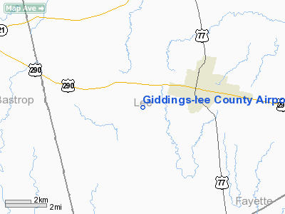
Giddings-Lee County Airport (ICAO: KGYB, FAA LID: GYB) is a public airport located three miles (5 km) west of the central business district of Giddings, a city in Lee County, Texas, United States. It is owned by the City of Giddings and Lee County.
Facilities and aircraft
Giddings-Lee County Airport covers an area of 84 acres (34 ha) which contains one runway designated 17/35 with a 4,000 x 75 ft (1,219 x 23 m) asphalt surface. For the 12-month period ending January 25, 2005, the airport had 4,500 general aviation aircraft operations, an average of 12 per day. At that time there were 17 aircraft based at this airport: 82% single-engine, 6% multi-engine and 12% ultralight.
The above content comes from Wikipedia and is published under free licenses – click here to read more.
Location & QuickFacts
| FAA Information Effective: | 2008-09-25 |
| Airport Identifier: | GYB |
| Airport Status: | Operational |
| Longitude/Latitude: | 096-58-48.0640W/30-10-09.3615N
-96.980018/30.169267 (Estimated) |
| Elevation: | 485 ft / 147.83 m (Surveyed) |
| Land: | 84 acres |
| From nearest city: | 3 nautical miles W of Giddings, TX |
| Location: | Lee County, TX |
| Magnetic Variation: | 06E (2000) |
Owner & Manager
| Ownership: | Publicly owned |
| Owner: | City Of Giddings & Lee Co |
| Address: | 118 E Richmond
Giddings, TX 78942 |
| Phone number: | 979-542-2710 |
| Manager: | David Glass |
| Address: | 1234 Cr 206
Giddings, TX 78942 |
| Phone number: | 979-542-6081 |
Airport Operations and Facilities
| Airport Use: | Open to public |
| Wind indicator: | Yes |
| Segmented Circle: | Yes |
| Control Tower: | No |
| Lighting Schedule: | DUSK-DAWN |
| Beacon Color: | Clear-Green (lighted land airport) |
| Landing fee charge: | No |
| Sectional chart: | Houston |
| Region: | ASW - Southwest |
| Boundary ARTCC: | ZHU - Houston |
| Tie-in FSS: | CXO - Montgomery County |
| FSS on Airport: | No |
| FSS Toll Free: | 1-800-WX-BRIEF |
| NOTAMs Facility: | GYB (NOTAM-d service avaliable) |
| Federal Agreements: | N |
Airport Communications
| CTAF: | 123.050 |
| Unicom: | 123.050 |
Airport Services
| Fuel available: | 100LLA |
| Bottled Oxygen: | NONE |
| Bulk Oxygen: | NONE |
Runway Information
Runway 17/35
| Dimension: | 4000 x 75 ft / 1219.2 x 22.9 m |
| Surface: | ASPH, Good Condition |
| Weight Limit: | Single wheel: 12500 lbs. |
| Edge Lights: | Medium |
| |
Runway 17 |
Runway 35 |
| Longitude: | 096-58-50.3399W | 096-58-45.7884W |
| Latitude: | 30-10-29.0582N | 30-09-49.6648N |
| Elevation: | 484.00 ft | 440.00 ft |
| Alignment: | 127 | 127 |
| Traffic Pattern: | Left | Left |
| Markings: | Non-precision instrument, Good Condition | Non-precision instrument, Good Condition |
| Obstruction: | 30 ft trees, 200.0 ft from runway, 230 ft left of centerline
+5 FT FENCE 240 FT R 180 FT FM THLD, +30 FT TREES 230 FT L FM THLD TO 200 FT. | 42 ft tree, 900.0 ft from runway, 22 ft left of centerline, 16:1 slope to clear |
|
Radio Navigation Aids
| ID |
Type |
Name |
Ch |
Freq |
Var |
Dist |
| BNH | NDB | Brenham | | 362.00 | 06E | 31.7 nm |
| GUO | NDB | Georgetown | | 332.00 | 06E | 47.7 nm |
| ELA | VOR/DME | Eagle Lake | 111X | 116.40 | 08E | 46.1 nm |
| IDU | VORTAC | Industry | 039X | 110.20 | 08E | 25.2 nm |
| CWK | VORTAC | Centex | 075X | 112.80 | 06E | 31.2 nm |
| CLL | VORTAC | College Station | 080X | 113.30 | 08E | 39.1 nm |
| TNV | VORTAC | Navasota | 106X | 115.90 | 08E | 48.4 nm |
Remarks
Images and information placed above are from
http://www.airport-data.com/airport/GYB/
We thank them for the data!
| General Info
|
| Country |
United States
|
| State |
TEXAS
|
| FAA ID |
GYB
|
| Latitude |
30.169267
30° 10' 09.36" N
|
| Longitude |
-96.980017
096° 58' 48.06" W
|
| Elevation |
485 feet
148 meters
|
| Magnetic Variation |
004° E (01/06)
|
| Beacon |
Yes
|
| Operating Agency |
U.S.CIVIL AIRPORT WHEREIN PERMIT COVERS USE BY TRANSIT MILITARY AIRCRAFT
|
| Daylight Saving Time |
Second Sunday in March at 0200 to first Sunday in November at 0200 local time (Exception Arizona and that portion of Indiana in the Eastern Time Zone)
|
We don't guarantee the information is fresh and accurate. The data may
be wrong or outdated.
For more up-to-date information please refer to other sources.
|
|


