|
|
George Bush Intercontinental/houston Airport |
George Bush Intercontinental Airport
Houston-Intercontinental |
 |
 |
| IATA: IAH – ICAO: KIAH – FAA LID: IAH
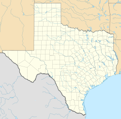
Location of the George Bush Intercontinental Airport
|
| Summary |
| Airport type |
Public |
| Owner |
City of Houston |
| Operator |
Houston Airport System |
| Serves |
Greater Houston |
| Location |
Houston, Texas, United States |
| Hub for |
Continental Airlines |
| Elevation AMSL |
97 ft / 30 m |
| Coordinates |
29°59′04″N 095°20′29″W / 29.98444°N 95.34139°W / 29.98444; -95.34139Coordinates: 29°59′04″N 095°20′29″W / 29.98444°N 95.34139°W / 29.98444; -95.34139 |
| Website |
www.fly2houston.com/iah |
| Runways |
| Direction |
Length |
Surface |
| ft |
m |
| 15L/33R |
12,001 |
3,658 |
Concrete |
| 15R/33L |
9,999 |
3,048 |
Concrete |
| 9/27 |
10,000 |
3,048 |
Concrete |
| 8L/26R |
9,000 |
2,743 |
Concrete |
| 8R/26L |
9,402 |
2,866 |
Concrete |
| Statistics (2009) |
| Passengers |
40,007,354 |
| Aircraft operations |
538,168 |
Sources: Airports Council International
 |
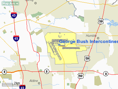
George Bush Intercontinental Airport, (IATA: IAH, ICAO: KIAH, FAA LID: IAH) is a Class B international airport in the city of Houston, Texas, United States, serving the Greater Houston area. Located 20 miles (32 km) drive north of Downtown Houston between Interstate 45 and U.S. Highway 59, Bush Intercontinental is Texas's second-largest air facility—after Dallas/Fort Worth International Airport—covering an area of 10,000 acres (40 km²). The airport has scheduled flights to destinations in the United States and international destinations in Asia, Canada, the Caribbean, Central America, Europe, Mexico, South America, the Middle East and scheduled charter flights to Africa. George Bush Intercontinental Airport is named after George H. W. Bush, the 41st President of the United States.
George Bush Intercontinental Airport served 40,007,354 passengers in 2009 making the airport the eighth busiest for total passengers in North America. In 2006, the airport was named the fastest growing of the top ten airports in the United States by the United States Department of Transportation. Houston is home to the headquarters of Continental Airlines, and Bush Intercontinental is Continental's largest hub with an average of 700 daily departures. HistoryThe site for Bush Intercontinental Airport was originally purchased by a group of civic-minded Houston businessmen in 1957 to preserve the site until the city of Houston could formulate a plan for a second airport. The holding company for the land was named the Jet Era Ranch Corporation, but a typo-graphical error transformed the words “Jet Era” into “Jetero” and the airport site subsequently became known as the Jetero airport site. Although the name Jetero was no longer used in official planning documents after 1961, the eastern entrance to the airport was named Jetero Boulevard. Most of Jetero Boulevard was subsequently renamed Will Clayton Parkway. The Jetero name was also applied to a telephone exchange in north Houston and a rail-road crossing on East Hardy Road.
 | |
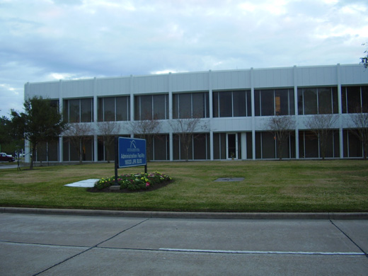
The Houston Airport System Administration Building is located on the airport grounds |
Houston Intercontinental Airport, as it was originally known, opened in June 1969. All passenger traffic from William P. Hobby Airport moved to Intercontinental upon the airport's completion. Hobby remained open as a general aviation airport and reopened two years later when Southwest Airlines initiated domestic services.
Houston Intercontinental had been scheduled to open in 1967, but design changes regarding the terminals created cost overruns and construction delays. The prime contractor, R.F. Ball Construction of San Antonio, sued the city of Houston for $11 million in damages, but assistant city attorney Joseph Guy Rollins, Jr. successfully defended the municipality on appeal to the Texas Supreme Court. The airport was named "Intercontinental" instead of "International" as Hobby airport had long been known as Houston International Airport.
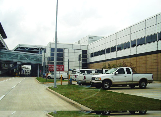
In the late 1980s, Houston City Council considered a plan to rename the airport after Mickey Leland—an African-American congressman who died in an aviation accident in Ethiopia. Instead of renaming the whole airport, the city named Mickey Leland International Airlines Building, which would later become Mickey Leland Terminal D, after the congressman. Houston renamed the airport George Bush Intercontinental Airport/Houston, after George H. W. Bush, the 41st President of the United States, in 1997.
On August 28, 1990, Continental Airlines agreed to build its maintenance center at George Bush Intercontinental Airport; Continental agreed to do so because the city of Houston agreed to provide city-owned land near the airport so that Continental could build its maintenance facility there.
As of 2007, Terminals A and B remain from the original design of the airport. Lewis W. Cutrer Terminal C opened in 1981, the Mickey Leland International Airlines Building (now called Terminal D) opened in May 1990, and the new Terminal E partially opened on June 3, 2003. The rest of Terminal E opened on January 7, 2004. Terminal D is the arrival point for all international flights arriving into Houston except for flights operated by Continental Airlines which uses Terminal E. Terminal D also held customs and INS until the opening of the new Federal Inspection Service (FIS) building, completed on January 25, 2005.
On January 7, 2009, a Continental Airlines Boeing 737-800 departing Bush Intercontinental was the first U.S. commercial jet to fly on a mix of conventional jet fuel and biofuel.
In December 2009 the Houston City Council approved a plan to allow Midway Cos. to develop 10 acres (4.0 ha) of land owned by Houston Airport System on the grounds of Bush Airport. Midway plans to develop a travel center for the airport's rental car facility. The city dictated that the developer needed to place a convenience store and gas station facility, a flight information board, a fast casual restaurant, and a sit-down restaurant. Beyond the required buildings, the developer plans to add an office facility between 20,000 square feet (1,900 m) and 40,000 square feet (3,700 m) and additional retail; the developer may add a hotel.
Operations
 | |
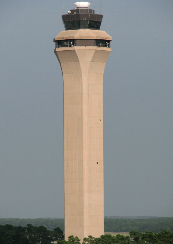
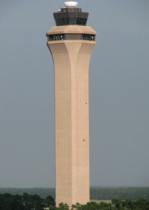
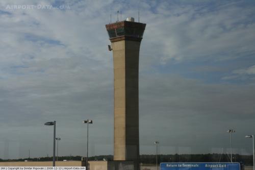
George Bush Intercontinental Airport control tower |
 | |
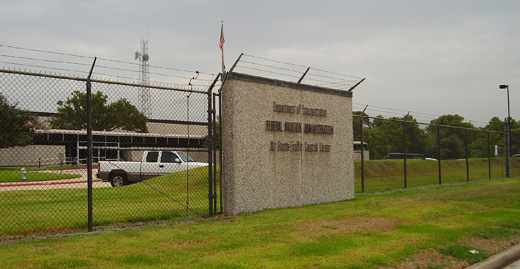
The Houston Air Route Traffic Control Center is on the airport grounds |
George Bush Intercontinental Airport served 40,007,354 passengers in 2009 making the airport the eighth busiest for total passengers in North America. IAH is the seventh largest international passenger gateway in the United States and the 6th busiest airport in the world for total aircraft movements. In 2006, the United States Department of Transportation named George Bush Intercontinental Airport the fastest growing of the top ten airports in the United States.
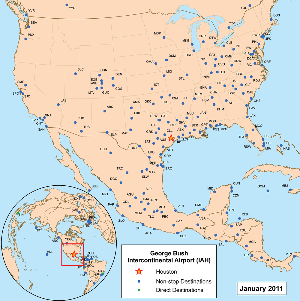
The airport currently ranks third in the United States for non-stop domestic and international service with 182 destinations, trailing Chicago O'Hare International Airport with 192 destinations and Hartsfield-Jackson Atlanta International Airport with 239 destinations. Furthermore, about 45 percent of the airport's passengers begin or terminate (O&D) their journey at the airport. Bush Intercontinental ranks as one of the major United States airports with the highest on-time performance, according to a 2009 United States Department of Transportation report.
As of 2007, with 31 destinations in Mexico, the airport offers service to more Mexican destinations than any other United States airport.
The Houston Air Route Traffic Control Center, located on the airport grounds at 16600 JFK Boulevard, serves as the airport's ARTCC.
Terminals, airlines and destinations
 | |
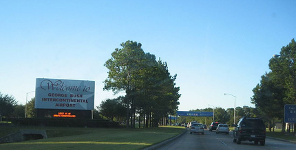
Main entrance to the airport |
There are three main entrances into IAH's terminal areas. JFK Boulevard is the main artery into the airport and intersects with Greens Road becoming a freeway. Will Clayton Parkway runs east to west is another main road for IAH. The Hardy Tollway Connector runs from west to east connecting JFK Boulevard to the Hardy Toll Road.
 | |
Destinations with service from IAH
|
Houston George Bush Intercontinental Airport has a total of five terminals encompassing 250 acres (1 km²):
- Terminal A was one of the original two terminals to open in 1969. Like Terminal B, it originally had four circular modules (called "Flight Stations" locally) at the end of corridors radiating out of the corners of the terminal. However, in the late-1990s and early-2000s, the North and South Concourses were rebuilt into linear facilities which provide a smoother operation within the terminal. Terminal A has 20 gates, with 10 gates in the North Concourse and 10 gates in the South Concourse. Today, in the terminal all non-Continental domestic and Canada operations (including Air Canada Jazz operations) and all Continental Connection operations are handled.
 | |
Terminal B |
- Terminal B was also one of the original two terminals of the airport to open in 1969. It is mostly an unaltered terminal from its original design and is now used solely by Continental Express. For this reason, the jet bridges are considerably lower to the ground than most others. There are 37 gates and 20 hardstand gates. The terminal serves all Continental Express flights except for arrivals that require customs and immigration which are handled in Terminal D.
 | |
Lewis W. Cutrer Terminal C |
- Terminal C (also known as Lewis W. Cutrer Terminal) was the third terminal to open at the airport following A and B in 1981. It serves as Continental Airlines's main base of domestic operations and they operate 2 President's Clubs in the terminal. The terminal was refurbished and modernized from 2008 to 2010. Terminal C has 31 gates. The terminal includes the airport's interfaith chapel.
 | |
Mickey Leland Terminal D |
 | |
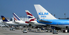
A typical lineup at Terminal D showing Air France, British Airways, KLM and Lufthansa aircraft. |
- Terminal D (also known as Mickey Leland Terminal) opened in 1990 and took over the international operations of the entire airport. Originally Terminal D, named Terminal IAB, was the only terminal to have a Federal Inspection Facility (FIS), and US Customs. At the time, all international arrivals used the terminal. The original name of Terminal D was Mickey Leland International Arrivals Building. Since the opening of Terminal E/FIS, Terminal D now houses all non-Continental international flights except for Continental Express international arrivals. In 2007 the airport authority began renovations in which 20 additional common-use ticket counters, upscale retail and restaurant shops, and new on-airport spa/beauty lounge will be added over the next few years. Terminal D has 12 gates and several international lounges including a British Airways Executive, British Airways FIRST, Lufthansa Senator, KLM Crown, Air France, and an Executive Lounge for Singapore, Emirates, Qatar, and Lufthansa.
 | |
Terminal E |
 | |
Continental Airlines's Boeing 777-200ER "Peter Max". Downtown Houston is visible in the background |
 | |
View from Terminal E |
- Terminal E is IAH's newest terminal, and houses Continental Airlines's international operations and some domestic operations. The terminal opened in two phases. The first phase opened with 14 gates, and the second phase added 16 gates in 2003 for a total of 30. Continental operates one President's Club in Terminal E. Originally Continental used the terminal solely for domestic flights, but relocated its international services to the new terminal after the new Federal Inspection Service (FIS) building opened. The terminal was designed for maximum flexibility, with jetways that were able to handle any aircraft. Currently, all Continental international mainline flights arrive at Terminal E while all Continental Express international flights arrive at Terminal D. In addition to international flights, Continental domestic mainline flights also operate out of the terminal.
| Airlines |
Destinations |
Terminal |
| Aeroméxico |
Mexico City |
D |
| Aeroméxico Connect |
Mexico City, Monterrey |
D |
| Air Canada Jazz |
Calgary, Montréal-Trudeau, Toronto-Pearson |
A |
| Air France |
Paris-Charles de Gaulle |
D |
| Alaska Airlines |
Seattle/Tacoma |
A |
| American Airlines |
Dallas/Fort Worth, Miami |
A |
| American Eagle |
Chicago-O'Hare |
A |
| British Airways |
London-Heathrow |
D |
| Continental Airlines |
Albuquerque, Anchorage, Atlanta, Austin, Baltimore, Boston, Calgary, Charlotte, Chicago-O'Hare, Cleveland, Columbus (OH), Dallas/Fort Worth, Denver, Detroit, Edmonton, El Paso, Fort Lauderdale, Fort Myers, Honolulu, Indianapolis, Las Vegas, Los Angeles, McAllen, Miami, Minneapolis/St. Paul, New Orleans, New York-LaGuardia, Newark, Oklahoma City, Omaha, Ontario, Orange County, Orlando, Philadelphia, Phoenix, Pittsburgh, Portland (OR), Raleigh/Durham, Sacramento, Salt Lake City, San Antonio, San Diego, San Francisco, San Jose (CA), San Juan, Seattle/Tacoma, Tampa, Tucson, Tulsa, Vancouver, Washington-Reagan, West Palm Beach
Seasonal: Eagle/Vail, Gunnison/Crested Butte [begins December 16], Hayden/Steamboat Springs, Montrose |
C, E
|
| Continental Airlines |
Acapulco, Amsterdam, Aruba, Belize City, Bogotá, Bonaire, Buenos Aires-Ezeiza, Cancún, Caracas, Cozumel, Frankfurt, Grand Cayman, Guadalajara, Guatemala City, Liberia (Costa Rica), Lima, London-Heathrow, Managua, Mazatlán, Mérida, Mexico City, Montego Bay, Monterrey, Panama City, Paris-Charles de Gaulle, Port of Spain, Puerto Vallarta, Quito, Rio de Janeiro-Galeão, Roatán, San José de Costa Rica, San José del Cabo, San Pedro Sula, San Salvador, São Paulo-Guarulhos, Tegucigalpa, Tokyo-Narita
Seasonal: Ixtapa/Zihuatanejo, Nassau
New Routes: Auckland [November 16, 2011], Lagos [November 10, 2011] |
E
|
| Continental Connection operated by Colgan Air |
Alexandria (LA), Beaumont, College Station, Del Rio, Killeen, Lafayette (LA), Lake Charles, Monroe (LA), Shreveport, Tyler, Victoria (TX), Waco |
A |
| Continental Express operated by Chautauqua Airlines |
Atlanta, Baton Rouge, Columbus (OH), Dallas/Fort Worth, Louisville, Oklahoma City, St. Louis |
B |
| Continental Express operated by ExpressJet Airlines |
Aguascalientes, Albuquerque, Alexandria (LA), Amarillo, Asheville, Atlanta, Austin, Baton Rouge, Birmingham (AL), Brownsville, Charleston (SC), Charleston (WV), Charlotte, Chihuahua, Cincinnati/Northern Kentucky, Ciudad del Carmen, Colorado Springs, Columbia (SC), Columbus (OH), Corpus Christi, Dallas/Fort Worth, Dallas-Love, Dayton, Des Moines, Detroit, Durango, El Paso, Fayetteville (AR), Fort Walton Beach, Grand Rapids, Greensboro, Greenville/Spartanburg, Guadalajara, Gulfport/Biloxi, Harlingen, Huatulco, Huntsville, Indianapolis, Ixtapa/Zihuatanejo, Jackson, Jacksonville, Kansas City, Knoxville, Lafayette (LA), Laredo, León/El Bajio, Lexington, Little Rock, Louisville, Lubbock, Manzanillo, Mazatlán, McAllen, Memphis, Mexico City, Midland/Odessa, Milwaukee, Minneapolis/St. Paul, Mobile, Monroe (LA), Monterrey, Morelia, Nashville, New Orleans, Norfolk, Oaxaca, Oklahoma City, Omaha, Pensacola, Phoenix, Pittsburgh, Puebla, Querétaro, Raleigh/Durham, Richmond, St. Louis, Salt Lake City, Saltillo, San Antonio, San José del Cabo, San Luis Potosí, Savannah, Shreveport, Tampico, Toluca, Toronto-Pearson, Torreón/Gómez Palacio, Tucson, Tulsa, Tuxtla Gutiérrez, Veracruz, Villahermosa, Washington-Dulles, West Palm Beach, Wichita
Seasonal: Acapulco, Fort Myers, Montrose, Nassau |
B |
| Delta Air Lines |
Atlanta |
A |
| Delta Connection operated by Atlantic Southeast Airlines |
Atlanta |
A |
| Delta Connection operated by Comair |
Atlanta, Cincinnati/Northern Kentucky, New York-JFK |
A |
| Delta Connection operated by Compass Airlines |
Atlanta, Detroit, Minneapolis/St. Paul |
A |
| Delta Connection operated by Mesaba Airlines |
Atlanta, Detroit, Minneapolis/St. Paul, Salt Lake City |
A |
| Delta Connection operated by Pinnacle Airlines |
Cincinnati/Northern Kentucky, Memphis |
A |
| Delta Connection operated by SkyWest Airlines |
Salt Lake City |
A |
| Emirates |
Dubai |
D |
| Frontier Airlines |
Denver [ends November 17] |
A |
| KLM |
Amsterdam |
D |
| KLM operated by PrivatAir |
Amsterdam |
D |
| Lufthansa |
Frankfurt |
D |
| Qatar Airways |
Doha |
D |
| Singapore Airlines |
Moscow-Domodedovo, Singapore |
D |
| TACA |
San Salvador
Seasonal: Roatán |
D |
| United Airlines |
Chicago-O'Hare, Denver, San Francisco, Washington-Dulles |
C |
| United Express operated by Mesa Airlines |
Chicago-O'Hare |
C |
| United Express operated by Shuttle America |
Chicago-O'Hare, Denver, Washington-Dulles |
C |
| United Express operated by SkyWest Airlines |
Chicago-O'Hare, Los Angeles
Seasonal: Aspen [begins January 4] |
C |
| US Airways |
Charlotte, Phoenix |
A |
| US Airways Express operated by Republic Airlines |
Philadelphia |
A |
| VivaAerobus |
Monterrey |
D |
Other services
Atlas Air offers a thrice-weekly charter service to Luanda, Angola on behalf of SonAir. Atlas Air replaced World Airways in June 2010.
These charter flights are intended to service companies operating in the oil industry in Angola which are members of the US/Africa Energy Association (USAEA).
Statistics
Busiest Domestic Routes Out of Houston Intercontinetal
| Rank |
City |
Passengers per 12 months |
Top Carriers |
| 1 |
Denver, CO |
576,000 |
Continental, Frontier, United |
| 2 |
Los Angeles, CA |
565,000 |
Continental, United |
| 3 |
Newark, NJ |
515,000 |
Continental |
| 4 |
Chicago, IL |
496,000 |
American, Continental, United |
| 5 |
Phoenix, AZ |
431,000 |
Continental, US Airways |
| 6 |
New Orleans, LA |
431,000 |
Continental |
| 7 |
Las Vegas, NV |
430,000 |
Continental |
| 8 |
Dallas/Fort Worth, TX |
400,000 |
American, Continental |
| 9 |
Atlanta, GA |
383,000 |
Continental, Delta |
| 10 |
Seattle, WA |
374,000 |
Alaska, Continental |
Terminal transportation
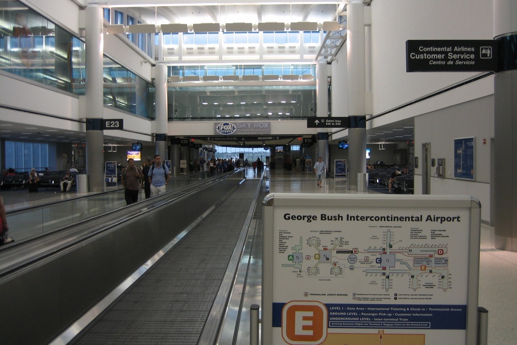
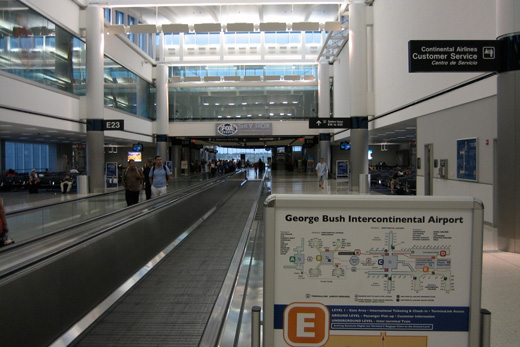
An above ground train called TerminaLink connects Terminals A, B, C, D, E and the International Arrivals Building (IAB) for those with connecting flights in different terminals and provides sterile airside connections. This allows passengers to travel within the airport without having to re-enter security. TerminaLink has four stops: Terminal A, Terminal B, Terminal C, and Terminals D/E including the IAB. The airport has expanded the line to Terminal A at a cost of US $100 million. Construction began on the extension in early 2008 and was completed in 2010.
An underground inter-terminal train outside of the sterile zone connects all five terminals and the airport hotel which can be accessed by all. This system is based on the WEDway PeopleMover technology developed by the Walt Disney Company.
In addition to train service a bus-shuttle service is offered from Terminal A to Terminal B. This allows passengers needing to travel to/from Terminal A to access other terminals without having to leave the sterile zone.
Ground transportation
Bus
The Metropolitan Transit Authority of Harris County, Texas, or METRO, offers bus service available at the south side of Terminal C. The 102 Bush IAH Express and the METRO Airport Direct serve the airport.
Courtesy vans
Courtesy vans are operated by various hotels and motels in and around the Houston Area. There are courtesy telephones in the baggage claim areas to request pick-up for most hotels and motels.
Shuttle service
Regularly scheduled bus and shuttle service is provided by various carriers to locations from IAH to Reliant Park/Reliant Astrodome, Downtown Houston, Uptown, Greenway Plaza, the Texas Medical Center, Westside hotels, the city of College Station and William P. Hobby Airport. Super Shuttle also provides service from George Bush Intercontinental Airport to the surrounding communities via shared vans.
Taxi
Taxis can be hailed through the Ground Transportation employees outside each terminal. All destinations within Houston's city limits to/from Bush Intercontinental Airport are charged according to the flat Zone Rate or the meter rate.
Taxi drivers at Bush airport wait longer to the dispatched for pickups of passengers than drivers at other airports in major U.S. cities. Josh Harkinson of the Houston Press said "Houston cabbies can easily wait six hours." The lives of many taxi drivers working at the airport revolve around the airport's taxi lot, nicknamed "Cabbieville." Taxi drivers servicing the airport come from many countries around the world.
Artwork
Ed Carpenter's "Light Wings", a multicolored glass sculpture suspended below a sky light, adorns the Terminal A North Concourse. In Terminal A, South Concourse stands Terry Allen's "Countree Music." Allen's piece is a cast bronze tree that plays instrumental music by Joe Ely and David Byrne, though the music is normally turned off. The corridor leading to Terminal A displays Leamon Green's "Passing Through," a 200-foot (61 m) etched glass wall depicting airport travelers.
The elevators in Terminal B are cased in stainless steel accordion shaped structures designed by Rachel Hecker. The corridor leading to Terminal B has Dixie Friend Gay's "Houston Bayou." This work is composed of an 8 x 75 ft (2.4 x 23 m) Byzantine glass mosaic mural depicting scenes from Houston's bayous and wetlands, several bronze animals embedded in the floor, and five mosaic columns.
Lights Spikes was created by Jay Baker, shown in the photo, were created for the 1990 G7 Summit when it was hosted by President George H. W. Bush in Houston. The sculpture was relocated to the airport outside of E Terminal after the meetings from its original location in front of the George R. Brown Convention Center.
The distance between each “spike” and this point is relative to the distance between Houston and the capital of the country the flags represent. The countries represented are the United States, the United Kingdom, France, Japan, Canada, Italy and Germany, as well as the European community and the columns lean at a ten degree angle toward a central point that represents Houston.
Cargo
George Bush Intercontinental ranks as the 11-largest gateway in the United States in terms of international air cargo moved. The facility moved over 387,000 metric tons of air cargo in 2007, a 5.4 percent increase over 2006.
In January 2003, the Houston Airport System decided to create a new 125 million dollar, 550,000 square feet (51,095 square meters), called the George Bush Intercontinental CargoCenter.
The facility can handle up to 20 widebody aircraft at one time and has expanded to an operational area of 880,000 sq ft (81,752 m2) over the last five years. The CargoCenter has its own separate Federal Inspection Facitilty (FIS) that houses Customs, United States Citizenship and Immigration Services (USCIS), United States Department of Agriculture, and Animal and Plant Health Inspection Service.
The facility also includes the International Air CargoCenter II, a 60,000 sq ft (18,288 m2) perishable cargo handling facility. It is located in the IAH CargoCenter and offer direct ramp access for cargo airlines as well as importers and distributors of perishable goods. The center is recoginized as an official Certified Cargo Screening Facility (CCSF).
For five years in a row, Air Cargo World has honored Bush Intercontinental Airport with the ACE Award for Excellence in the category of airports with less than 500,000 tons of air cargo annually.
Trade Data
- Europe 44%
- Asia 23%
- Middle East 16%
- Africa 8%
- Latin America 7%
- North America 1%
Cargo Airlines
- ABX Air (DHL)
- Air Cargo Carriers
- Air France Cargo
- Atlas Air
- Ameriflight
- Ameristar Jet Charter
- Antonov Airlines
- Baron Aviation Services (FedEx Feeder)
- BAX Global
- British Airways World Cargo
- Cargolux
- Cathay Pacific Cargo
- China Airlines Cargo
- EVA Airways Cargo
- FedEx Express
- Martinaire (UPS)
- Polar Air Cargo
- Polet Airlines
- Saudi Arabian Airlines Cargo
- Southern Air
- UPS Airlines
- Volga-Dnepr
Master plan
The city of Houston presented its master plan update for IAH in 2005. The near-term plan calls for Terminal B's circular flight stations to be rebuilt into linear facilities similar to Terminal A. Construction of a new 155,000-square-foot (14,400 m) pier at Terminal D, capable of handling six additional wide body aircraft, is slated for completion in 2013.
The long-term plans call for the existing unit terminals to be demolished and the North and South Concourses to be linked midway. Soon after, all of the facilities in the North and South Concourses will be linked together to form two long continuous facilities. In addition, a new Central Passenger Processing facility will also be built, called the East Terminal along with an underground people mover.
Airfield improvements include a new Runway 8C-26C, a new Runway 9R-27L, a perimeter taxiway, and access roadways. If the FAA selects new sites for runways, the FAA may buy land from the Glen Lee Place and Heather Ridge Village subdivisions, which are located off of Lee Road.
Accidents and incidents
The following involved flights departing or arriving at the airport:
- 1973: National Airlines (NA): Depressurization ejected a passenger after the fan assembly disintegrated on route to McCarran International Airport.
- 1975: February 1, Douglas DC-3 N15HC of Horizon Properties crashed on approach when the port wing collided with an electricity pylon. The aircraft was on a domestic non-scheduled passenger flight from Lawton Municipal Airport, Oklahoma to Huntsville Regional Airport, Texas. Due to weather conditions, the flight was diverted to Houston. Of the 16 occupants, two crew and three passengers were killed.
- 1990: Executive/Grumman G1 Operated by Rowan Drilling Company: Power loss in engine after take-off resulted in a failed attempt to regain altitude on route to New Orleans International Airport. The aircraft crashed on departure from Runway 15L and came to rest midfield along a parallel taxiway. There were three fatalities.
- 1991: Continental Express Flight 2574 (Britt Airways): Broke into pieces on route from Laredo to Houston Intercontinental. There were 14 fatalities.
- On February 19, 1996, a Continental Airlines McDonnell Douglas DC-9-32 operating as Continental Airlines Flight 1943 from Ronald Reagan National Airport arriving in Houston, Texas landed with its landing gear in the stowed position on Runway 27. The aircraft slid for 6,915 feet (2,108 m) on its belly before coming to a stop on the runway 140 feet (43 m) left of the runway centerline approximately at the departure end of the runway. There were no fatalities and only minor injuries. The aircraft was written off.
- On December 20, 2008, a Continental Airlines Boeing 737-500 operating as Flight 1404 from Denver International Airport in Denver, Colorado to Bush Airport overran Runway 34R, and caught fire during its takeoff roll. There was no snow or ice on the runway, however there were 31 knot (36 mph) crosswinds at the time of the accident. The NTSB has not discovered a reason for the crash. Of the 115 people on board, at least 38 sustained injuries: at least two of these injured critically.
- On April 28, 2010, a Continental Express ERJ-145 operating as flight 3006, made an emergency landing in Greensboro, N.C., after the word "bomb" was written on the lavatory mirror. The flight was traveling to Washington Dulles International Airport, and no one was injured.[66]
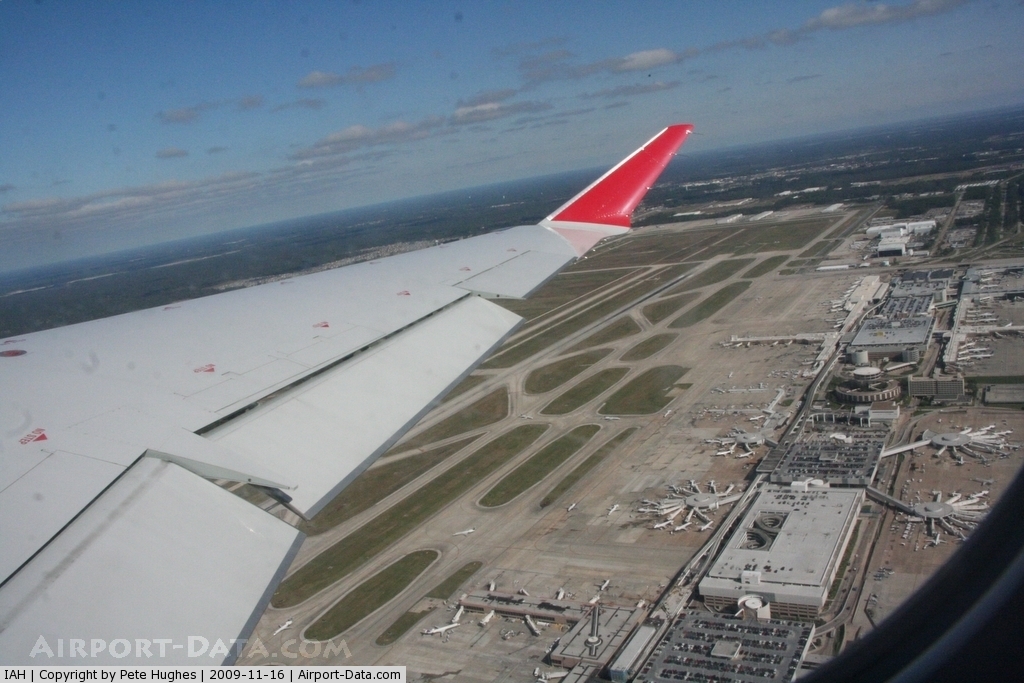
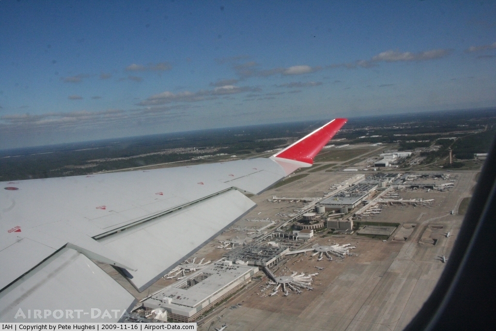
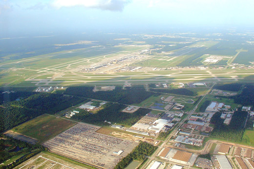
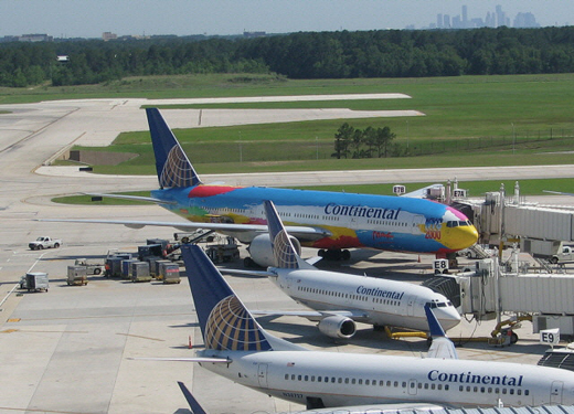
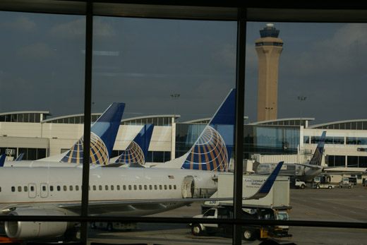
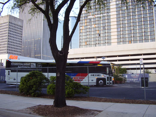
Gallery
The above content comes from Wikipedia and is published under free licenses – click here to read more.
 |
(Click on the photo to enlarge) |
 |
(Click on the photo to enlarge) |
 |
(Click on the photo to enlarge) |
 |
(Click on the photo to enlarge) |
Location & QuickFacts
| FAA Information Effective: | 2008-09-25 |
| Airport Identifier: | IAH |
| Airport Status: | Operational |
| Longitude/Latitude: | 095-20-29.1920W/29-59-03.9610N
-95.341442/29.984434 (Estimated) |
| Elevation: | 97 ft / 29.57 m (Surveyed) |
| Land: | 10000 acres |
| From nearest city: | 15 nautical miles N of Houston, TX |
| Location: | Harris County, TX |
| Magnetic Variation: | 05E (2000) |
Owner & Manager
| Ownership: | Publicly owned |
| Owner: | City Of Houston |
| Address: | Po Box 60106
Houston, TX 77205 |
| Phone number: | 281-233-3000
DEPT OF AVIATION, ADMIN OFFICE. |
| Manager: | Charles T Wall |
| Address: | Po Box 60106
Houston, TX 77205 |
| Phone number: | 281-230-3100 |
Airport Operations and Facilities
| Airport Use: | Open to public |
| Wind indicator: | Yes |
| Segmented Circle: | No |
| Control Tower: | Yes |
| Lighting Schedule: | DUSK-DAWN |
| Beacon Color: | Clear-Green (lighted land airport) |
| Sectional chart: | Houston |
| Region: | ASW - Southwest |
| Boundary ARTCC: | ZHU - Houston |
| Tie-in FSS: | CXO - Montgomery County |
| FSS on Airport: | No |
| FSS Toll Free: | 1-800-WX-BRIEF |
| NOTAMs Facility: | IAH (NOTAM-d service avaliable) |
| Certification type/date: | I E S 05/1973 |
| Federal Agreements: | NGY |
Airport Communications
Airport Services
| Fuel available: | 100LLA |
| Airframe Repair: | MAJOR |
| Power Plant Repair: | MAJOR |
| Bottled Oxygen: | NONE |
| Bulk Oxygen: | LOW |
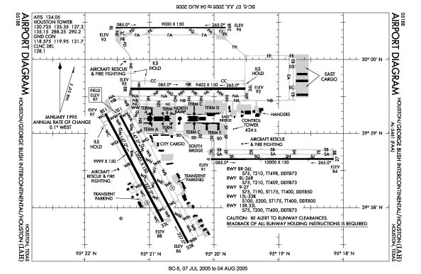
Runway Information
Runway 08L/26R
| Dimension: | 9000 x 150 ft / 2743.2 x 45.7 m |
| Surface: | CONC, Good Condition |
| Surface Treatment: | Saw-cut or plastic Grooved |
| Weight Limit: | Single wheel: 75000 lbs.
Dual wheel: 210000 lbs.
Dual tandem wheel: 409000 lbs.
Dual dual tandem wheel: 873000 lbs. |
| Edge Lights: | High |
| |
Runway 08L |
Runway 26R |
| Longitude: | 095-21-31.6473W | 095-19-49.2895W |
| Latitude: | 30-00-25.7782N | 30-00-25.8587N |
| Elevation: | 92.00 ft | 95.00 ft |
| Alignment: | 90 | 127 |
| ILS Type: | ILS/DME
| ILS/DME
|
| Traffic Pattern: | Left | Left |
| Markings: | Precision instrument, Good Condition | Precision instrument, Good Condition |
| RVR Equipment: | touchdown, midfield, rollout | touchdown, midfield, rollout |
| Approach lights: | ALSF2 | ALSF2 |
| Centerline Lights: | Yes | Yes |
| Touchdown Lights: | Yes | Yes |
| Decleard distances: | Take off run available 9000.00 ft
Take off distance available 9000.00 ft
Actual stop distance available 9000.00 ft
Landing distance available 9000.00 ft
| Take off run available 9000.00 ft
Take off distance available 9000.00 ft
Actual stop distance available 9000.00 ft
Landing distance available 9000.00 ft
|
|
Runway 08R/26L
| Dimension: | 9402 x 150 ft / 2865.7 x 45.7 m |
| Surface: | CONC, Good Condition |
| Surface Treatment: | Saw-cut or plastic Grooved |
| Weight Limit: | Single wheel: 75000 lbs.
Dual wheel: 210000 lbs.
Dual tandem wheel: 498000 lbs.
Dual dual tandem wheel: 873000 lbs. |
| Edge Lights: | High |
| |
Runway 08R |
Runway 26L |
| Longitude: | 095-21-17.8703W | 095-19-30.9548W |
| Latitude: | 29-59-36.2993N | 29-59-36.3793N |
| Elevation: | 96.00 ft | 94.00 ft |
| Alignment: | 90 | 127 |
| ILS Type: | ILS/DME
| ILS/DME
|
| Traffic Pattern: | Left | Left |
| Markings: | Precision instrument, Good Condition | Precision instrument, Good Condition |
| Crossing Height: | 71.00 ft | 72.00 ft |
| VASI: | 4-light PAPI on left side | 4-light PAPI on right side |
| Visual Glide Angle: | 3.00° | 3.00° |
| RVR Equipment: | touchdown, midfield, rollout | touchdown, midfield, rollout |
| Approach lights: | MALSR | ALSF2 |
| Centerline Lights: | Yes | Yes |
| Touchdown Lights: | Yes | Yes |
| Decleard distances: | Take off run available 9402.00 ft
Take off distance available 9402.00 ft
Actual stop distance available 9402.00 ft
Landing distance available 9402.00 ft
| Take off run available 9402.00 ft
Take off distance available 9402.00 ft
Actual stop distance available 9402.00 ft
Landing distance available 9402.00 ft
|
|
Runway 09/27
| Dimension: | 10000 x 150 ft / 3048.0 x 45.7 m |
| Surface: | ASPH, Good Condition |
| Surface Treatment: | Saw-cut or plastic Grooved |
| Weight Limit: | Single wheel: 75000 lbs.
Dual wheel: 190000 lbs.
Dual tandem wheel: 400000 lbs.
Dual dual tandem wheel: 850000 lbs. |
| Edge Lights: | High |
| |
Runway 09 |
Runway 27 |
| Longitude: | 095-20-02.7925W | 095-18-09.0921W |
| Latitude: | 29-58-39.3343N | 29-58-39.4056N |
| Elevation: | 91.00 ft | 84.00 ft |
| Alignment: | 90 | 127 |
| ILS Type: | ILS/DME
| ILS/DME
|
| Traffic Pattern: | Left | Left |
| Markings: | Precision instrument, Good Condition | Precision instrument, Good Condition |
| Crossing Height: | 71.00 ft | 70.00 ft |
| VASI: | 4-light PAPI on right side | 4-light PAPI on left side |
| Visual Glide Angle: | 3.00° | 3.00° |
| RVR Equipment: | touchdown, midfield, rollout | touchdown, midfield, rollout |
| Approach lights: | MALSR | ALSF2 |
| Centerline Lights: | Yes | Yes |
| Touchdown Lights: | No | Yes |
| Decleard distances: | Take off run available 10000.00 ft
Take off distance available 10000.00 ft
Actual stop distance available 10000.00 ft
Landing distance available 10000.00 ft
| Take off run available 10000.00 ft
Take off distance available 10000.00 ft
Actual stop distance available 10000.00 ft
Landing distance available 10000.00 ft
|
|
Runway 15L/33R
| Dimension: | 12001 x 150 ft / 3657.9 x 45.7 m |
| Surface: | CONC, Good Condition |
| Surface Treatment: | Saw-cut or plastic Grooved |
| Weight Limit: | Single wheel: 100000 lbs.
Dual wheel: 200000 lbs.
Dual tandem wheel: 400000 lbs.
Dual dual tandem wheel: 800000 lbs. |
| Edge Lights: | High |
| |
Runway 15L |
Runway 33R |
| Longitude: | 095-21-28.3289W | 095-20-24.1883W |
| Latitude: | 29-59-16.4027N | 29-57-31.5487N |
| Elevation: | 96.00 ft | 86.00 ft |
| Alignment: | 127 | 127 |
| ILS Type: | LOCALIZER
| ILS
|
| Traffic Pattern: | Left | Left |
| Markings: | Non-precision instrument, Good Condition | Precision instrument, Good Condition |
| Crossing Height: | 58.00 ft | 0.00 ft |
| VASI: | 4-light PAPI on right side | |
| Visual Glide Angle: | 3.00° | 0.00° |
| RVR Equipment: | touchdown, midfield, rollout | touchdown, midfield, rollout |
| Approach lights: | | MALSR |
| Centerline Lights: | Yes | Yes |
| Touchdown Lights: | No | No |
| Decleard distances: | Take off run available 12001.00 ft
Take off distance available 12001.00 ft
Actual stop distance available 12001.00 ft
Landing distance available 12001.00 ft
| Take off run available 12001.00 ft
Take off distance available 12001.00 ft
Actual stop distance available 12001.00 ft
Landing distance available 12001.00 ft
|
|
Runway 15R/33L
| Dimension: | 9999 x 150 ft / 3047.7 x 45.7 m |
| Surface: | CONC, Good Condition |
| Surface Treatment: | Saw-cut or plastic Grooved |
| Weight Limit: | Single wheel: 75000 lbs.
Dual wheel: 200000 lbs.
Dual tandem wheel: 400000 lbs.
Dual dual tandem wheel: 873000 lbs. |
| Edge Lights: | High |
| |
Runway 15R |
Runway 33L |
| Longitude: | 095-21-41.0326W | 095-20-47.5812W |
| Latitude: | 29-59-16.1002N | 29-57-48.7463N |
| Elevation: | 97.00 ft | 88.00 ft |
| Alignment: | 127 | 127 |
| ILS Type: | LOC/GS
| |
| Traffic Pattern: | Left | Left |
| Markings: | Precision instrument, Good Condition | Non-precision instrument, Good Condition |
| Crossing Height: | 71.00 ft | 59.00 ft |
| VASI: | 4-light PAPI on left side | 4-light PAPI on right side |
| Visual Glide Angle: | 3.00° | 3.00° |
| RVR Equipment: | touchdown, midfield, rollout | touchdown, midfield, rollout |
| Approach lights: | MALSR | |
| Centerline Lights: | Yes | Yes |
| Touchdown Lights: | Yes | Yes |
| Decleard distances: | Take off run available 9999.00 ft
Take off distance available 9999.00 ft
Actual stop distance available 9999.00 ft
Landing distance available 9999.00 ft
| Take off run available 9999.00 ft
Take off distance available 9999.00 ft
Actual stop distance available 9999.00 ft
Landing distance available 9999.00 ft
|
|
Radio Navigation Aids
| ID |
Type |
Name |
Ch |
Freq |
Var |
Dist |
| BVP | NDB | Nixin | | 326.00 | 05E | 6.6 nm |
| DWH | NDB | David Hooks | | 521.00 | 05E | 14.4 nm |
| EYQ | NDB | Weiser | | 286.00 | 06E | 15.9 nm |
| LYD | NDB | Lakeside | | 249.00 | 05E | 20.2 nm |
| JPA | NDB | Sanjac | | 347.00 | 05E | 23.7 nm |
| SGR | NDB | Hull | | 388.00 | 05E | 26.8 nm |
| SYG | NDB | Sandy Point | | 402.00 | 05E | 29.7 nm |
| CBC | NDB | Anahuac | | 413.00 | 05E | 37.6 nm |
| UTS | NDB | Huntsville | | 308.00 | 06E | 47.3 nm |
| GLS | NDB | Galveston | | 206.00 | 08E | 49.6 nm |
| EFD | TACAN | Ellington | 031X | | 05E | 24.6 nm |
| HUB | VOR/DME | Hobby | 118X | 117.10 | 05E | 20.1 nm |
| MHF | VOR/DME | Trinity | 083X | 113.60 | 07E | 40.7 nm |
| IAH | VORTAC | Humble | 113X | 116.60 | 05E | 1.7 nm |
| DAS | VORTAC | Daisetta | 116X | 116.90 | 05E | 38.3 nm |
| TNV | VORTAC | Navasota | 106X | 115.90 | 08E | 41.5 nm |
| VUH | VORTAC | Scholes | 077X | 113.00 | 06E | 49.6 nm |
| HOU | VOT | Houston Wm P Hobby | | 108.40 | | 20.7 nm |
Remarks
- TWY 'NR' CLSD TO ACFT WITH WING SPANS GREATER THAN 125 FT BTN TWY 'WD' & TWY 'WB'.
- TWY 'SF' BTN THE SOUTH RAMP & TWY 'NB' IS DESIGNATED NON-MOVEMENT AREAS.
- FOR FP FILING CALL 1-800-WX-BRIEF.
- DUAL TWY OPNS TWY NK BTN TWY NB & NORTH RAMP; WEST CNTRLN RSTRD TO ACFT MAX WING SPANS 125 FT & EAST CNTRLN MAX WING SPANS 214 FT.
- BIRDS ON & IN VCNTY OF ARPT.
- THE FLWG MOVEMENT AREAS ARE NOT VSB FM THE ATCT: PORTIONS OF TWYS 'WA' & 'WB' FM TWY 'WH' TO THE AER 33R; TWYS 'WA' & 'WB' FM TWY 'WD' NORTH FOR 400 FT; TWY 'WD' FM TWY 'WA' TO TWY 'NR'; TWY 'NR'; TWY 'WL' FM RY 15L TO TWY 'WB' & TWY 'WM'.
- NORTH RAMP NORTH & SOUTH TAXI LANES CLSD TO ACFT WITH WING SPANS GREATER THAN 125 FT.
- NORTH RAMP CONNECTOR RSTRD TO ACFT WITH WING SPAN 125 FT AND BLO.
- TWYS 'RA', 'RB' & 'SC' NORTH OF TWY 'SB' ARE DESIGNATED NON-MOVEMENT AREAS OPERATED BY COA RAMP CTL.
- RY 15L/33R MAGNETIC ANOMALIES MAY AFFECT COMPASS HDG FOR TKOF.
- TWYS WA & WB MAGNETIC ANOMALIES MAY AFFECT COMPASS HDG.
- NORTH RAMP NORTH TAXILANE BTN TWY NG/SPOT 6 CLSD FM 2100-0800.
- NORTH RAMP TAXILANE BTN TWYS NF & NR RSTRD TO ACFT WITH WING SPAN 125 FT & BLO.
- CAUTION: AER 26L BRIGHT LGTS APRXLY ONE MILE FROM THLD & 900 FT S OF CNTRLN.
- TWY WC WEST OF RY 15R/33L RSTRD TO ACFT WITH 118 FT WING SPAN AND BLO.
- ASDE-X SURVEILLANCE SYSTEM IN USE: PILOTS SHOULD OPERATE TRANSPONDERS WITH MODE C ON ALL TWYS AND RWYS.
- NOISE SENSITIVE AREA NORTH, EAST AND WEST OF ARPT.
- TWY LANE RC CLSD TO ACFT WITH WINGSPAN GREATER THAN 135 FT.
- 9 FT AGL UNMKD SECURITY FENCE ADJ TO FBO & CORPORATE BASE OPERATOR RAMPS AND NONMOVEMENT AREA TAXILANES. HELICOPTER HOVER/TAXI RSTRD TO HARD SFC MOVEMENT AREAS ONLY.
Images and information placed above are from
http://www.airport-data.com/airport/IAH/
We thank them for the data!
| General Info
|
| Country |
United States
|
| State |
TEXAS
|
| FAA ID |
IAH
|
| Latitude |
29-58-49.700N
|
| Longitude |
095-20-23.000W
|
| Elevation |
97 feet
|
| Near City |
HOUSTON
|
We don't guarantee the information is fresh and accurate. The data may
be wrong or outdated.
For more up-to-date information please refer to other sources.
|
|