 |
|
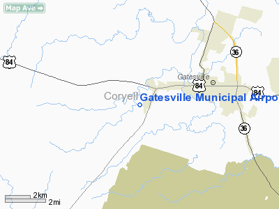
Gatesville Municipal Airport
(formerly City-County Airport) |
| IATA: none – ICAO: KGOP – FAA LID: GOP |
| Summary |
| Airport type |
Public |
| Owner |
City of Gatesville |
| Location |
Gatesville, Texas |
| Elevation AMSL |
905 ft / 276 m |
| Coordinates |
31°25′17″N 097°47′49″W / 31.42139°N 97.79694°W / 31.42139; -97.79694 |
| Runways |
| Direction |
Length |
Surface |
| ft |
m |
| 17/35 |
3,400 |
1,036 |
Asphalt |
| Statistics (2003) |
| Aircraft operations |
4,200 |
| Source: Federal Aviation Administration |
Gatesville Municipal Airport (ICAO: KGOP, FAA LID: GOP) is a public airport located three miles (5 km) west of the central business district of Gatesville, a city in Coryell County, Texas, United States. This general aviation airport is owned by the City of Gatesville. It was formerly known as City-County Airport, at which time it was co-owned by Coryell County.
Although most U.S. airports use the same three-letter location identifier for the FAA and IATA, Gatesville Municipal Airport is assigned GOP (formerly 05F) by the FAA but has no designation from the IATA (which assigned GOP to Gorakhpur Airport in Gorakhpur, India).
Facilities and aircraft
Gatesville Municipal Airport covers an area of 51 acres (21 ha) which contains one Asphalt paved runway, 17/35, measuring 3,400 x 60 ft (1,036 x 18 m).
For the 12-month period ending February 19, 2003, the airport had 4,200 aircraft operations, 100% of which were general aviation.
The above content comes from Wikipedia and is published under free licenses – click here to read more.
Location & QuickFacts
| FAA Information Effective: | 2008-09-25 |
| Airport Identifier: | GOP |
| Airport Status: | Operational |
| Longitude/Latitude: | 097-47-49.0840W/31-25-16.5920N
-97.796968/31.421276 (Estimated) |
| Elevation: | 905 ft / 275.84 m (Estimated) |
| Land: | 51 acres |
| From nearest city: | 3 nautical miles W of Gatesville, TX |
| Location: | Coryell County, TX |
| Magnetic Variation: | 07E (1985) |
Owner & Manager
| Ownership: | Publicly owned |
| Owner: | City Of Gatesville |
| Address: | 110 N. 8th
Gatesville, TX 76528 |
| Phone number: | 254-865-8951 |
| Manager: | Roger Mumby
CITY MGR. |
| Address: | 110 N 8th
Gatesville, TX 76528 |
| Phone number: | 254-865-8951 |
Airport Operations and Facilities
| Airport Use: | Open to public |
| Wind indicator: | Yes |
| Segmented Circle: | Yes |
| Control Tower: | No |
| Lighting Schedule: | DUSK-DAWN
MIRL RY 17/35 PRESET LOW INTST, TO INCR INTST ACTVT - CTAF. |
| Beacon Color: | Clear-Green (lighted land airport) |
| Landing fee charge: | No |
| Sectional chart: | San Antonio |
| Region: | ASW - Southwest |
| Boundary ARTCC: | ZFW - Fort Worth |
| Tie-in FSS: | FTW - Fort Worth |
| FSS on Airport: | No |
| FSS Phone: | 817-541-3474 |
| FSS Toll Free: | 1-800-WX-BRIEF |
| NOTAMs Facility: | GOP (NOTAM-d service avaliable) |
| Federal Agreements: | NY1 |
Airport Communications
Airport Services
| Fuel available: | 100LL
FOR FUEL CALL 254-248-1545; AFTER HRS CALL 254-535-1661. |
| Airframe Repair: | MAJOR |
| Power Plant Repair: | MAJOR |
| Bottled Oxygen: | HIGH/LOW |
| Bulk Oxygen: | HIGH/LOW |
Runway Information
Runway 17/35
| Dimension: | 3400 x 60 ft / 1036.3 x 18.3 m |
| Surface: | ASPH, Good Condition |
| Weight Limit: | Single wheel: 12000 lbs. |
| Edge Lights: | Medium |
| |
Runway 17 |
Runway 35 |
| Traffic Pattern: | Left | Left |
| Markings: | Non-precision instrument, Good Condition | Non-precision instrument, Good Condition |
| Crossing Height: | 30.00 ft | 30.00 ft |
| VASI: | 2-light PAPI on left side | 2-light PAPI on left side |
| Visual Glide Angle: | 3.00° | 3.00° |
| Obstruction: | 8 ft trees, 300.0 ft from runway, 76 ft right of centerline, 12:1 slope to clear | 5 ft trees, 300.0 ft from runway, 20:1 slope to clear |
|
Radio Navigation Aids
| ID |
Type |
Name |
Ch |
Freq |
Var |
Dist |
| GR | NDB | Starn | | 323.00 | 07E | 15.8 nm |
| HLR | NDB | Hood | | 347.00 | 07E | 18.1 nm |
| MNZ | NDB | Hamilton | | 251.00 | 07E | 21.6 nm |
| IL | NDB | Iresh | | 278.00 | 07E | 24.3 nm |
| ROB | NDB | Robinson | | 400.00 | 07E | 37.6 nm |
| GUO | NDB | Georgetown | | 332.00 | 06E | 44.7 nm |
| BMQ | NDB | Burnet | | 341.00 | 07E | 46.8 nm |
| TPL | VOR/DME | Temple | 041X | 110.40 | 09E | 23.0 nm |
| GRK | VOR/DME | Gray | 055X | 111.80 | 07E | 23.4 nm |
| LZZ | VORTAC | Lampasas | 072X | 112.50 | 08E | 22.7 nm |
| ACT | VORTAC | Waco | 100X | 115.30 | 09E | 30.7 nm |
| JEN | VORTAC | Glen Rose | 097X | 115.00 | 06E | 44.6 nm |
Remarks
- LOW FLYING MILITARY JET ACFT & HELICOPTER IN VICINITY.
Images and information placed above are from
http://www.airport-data.com/airport/GOP/
We thank them for the data!
| General Info
|
| Country |
United States
|
| State |
IDAHO
|
| FAA ID |
ID97
|
| Latitude |
47-06-25.630N
|
| Longitude |
116-48-40.590W
|
| Elevation |
2635 feet
|
| Near City |
DE SMET
|
We don't guarantee the information is fresh and accurate. The data may
be wrong or outdated.
For more up-to-date information please refer to other sources.
|
|


