 |
|
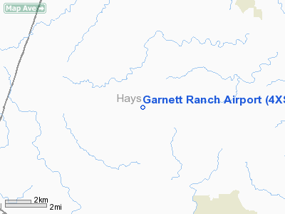
Location & QuickFacts
| FAA Information Effective: | 2008-09-25 |
| Airport Identifier: | 4XS9 |
| Airport Status: | Operational |
| Longitude/Latitude: | 098-09-46.0430W/30-05-45.7540N
-98.162790/30.096043 (Estimated) |
| Elevation: | 1300 ft / 396.24 m (Estimated) |
| Land: | 0 acres |
| From nearest city: | 7 nautical miles NW of Wimberley, TX |
| Location: | Hays County, TX |
| Magnetic Variation: | 07E (1985) |
Owner & Manager
| Ownership: | Privately owned |
| Address: |
|
| Manager: | R D Garnett |
| Address: | Route 2 Box 140a
Marion, TX 78124 |
| Phone number: | 512-420-3588 |
Airport Operations and Facilities
| Airport Use: | Private |
| Wind indicator: | No |
| Segmented Circle: | No |
| Control Tower: | No |
| Landing fee charge: | No |
| Sectional chart: | San Antonio |
| Region: | ASW - Southwest |
| Boundary ARTCC: | ZHU - Houston |
| Tie-in FSS: | SJT - San Angelo |
| FSS on Airport: | No |
| FSS Toll Free: | 1-800-WX-BRIEF |
Airport Services
| Airframe Repair: | NONE |
| Power Plant Repair: | NONE |
Runway Information
Runway NW/SE
| Dimension: | 2350 x 30 ft / 716.3 x 9.1 m |
| Surface: | DIRT, |
| |
Runway NW |
Runway SE |
| Traffic Pattern: | Right | Right |
| Obstruction: | | 30 ft pline |
|
Radio Navigation Aids
| ID |
Type |
Name |
Ch |
Freq |
Var |
Dist |
| MFS | NDB | Horseshoe Bay Resort | | 403.00 | 07E | 27.6 nm |
| BMQ | NDB | Burnet | | 341.00 | 07E | 38.9 nm |
| GUO | NDB | Georgetown | | 332.00 | 06E | 43.3 nm |
| ER | NDB | Shein | | 263.00 | 08E | 45.4 nm |
| DHK | TACAN | Randolph | 036X | | 09E | 34.0 nm |
| KSY | TACAN | Kelly | 057X | | 07E | 47.6 nm |
| STV | VORTAC | Stonewall | 085X | 113.80 | 08E | 29.0 nm |
| SAT | VORTAC | San Antonio | 115X | 116.80 | 08E | 31.3 nm |
| RND | VORTAC | Randolph | 70X | 112.30 | 09E | 35.3 nm |
| CWK | VORTAC | Centex | 075X | 112.80 | 06E | 37.0 nm |
| SAT | VOT | San Antonio Intl | | 110.40 | | 37.4 nm |
Remarks
- PERSONAL LANDING STRIP FOR CONVENIENCE ONLY.
- RWY-NW/SE--A WIRE GATE CROSS RWY MIDFIELD. OPENED FOR ACFT OPERATIONS.
- WILDLIFE MAY BE O N RWY.
- CATTLE AND HORSES MAY BE ON RY.
- PREDATES THE ACT.
Images and information placed above are from
http://www.airport-data.com/airport/4XS9/
We thank them for the data!
| General Info
|
| Country |
United States
|
| State |
TEXAS
|
| FAA ID |
4XS9
|
| Latitude |
30-05-45.754N
|
| Longitude |
098-09-46.043W
|
| Elevation |
1300 feet
|
| Near City |
WIMBERLEY
|
We don't guarantee the information is fresh and accurate. The data may
be wrong or outdated.
For more up-to-date information please refer to other sources.
|
|


