|
|
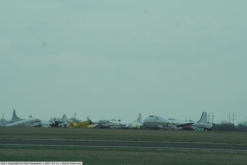
| Gainesville Municipal Airport |
 |
| IATA: GLE – ICAO: KGLE – FAA LID: GLE |
| Summary |
| Airport type |
Public |
| Owner |
City of Gainesville |
| Serves |
Gainesville, Texas |
| Elevation AMSL |
845 ft / 258 m |
| Coordinates |
33°39′05″N 097°11′49″W / 33.65139°N 97.19694°W / 33.65139; -97.19694 |
| Runways |
| Direction |
Length |
Surface |
| ft |
m |
| 12/30 |
4,296 |
1,309 |
Asphalt |
| 17/35 |
6,000 |
1,829 |
Asphalt |
| Statistics (2005) |
| Aircraft operations |
20,200 |
| Based aircraft |
70 |
| Source: Federal Aviation Administration |
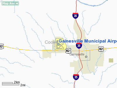
Gainesville Municipal Airport (IATA: GLE, ICAO: KGLE, FAA LID: GLE) is a public-use airport located three miles (5 km) west of the central business district of Gainesville, a city in Cooke County, Texas, United States. It is owned and operated by the City of Gainesville. History
The airport was opened in August 1941 as Gainesville Army Airfield and was used by the United States Army Air Forces Third Air Force as a training base to provide photographic intelligence for air and ground forces.
Known units which trained at Gainesville were the 8th and 426th Reconnaissance Groups. They flew a wide variety of aircraft, including the P-38 Lightning (F-5), P-51 Mustang (F-6), B-24 Liberator (F-7) and P-40 Warhawk.
The 8th Reconnaissance group was deployed to India in 1944 to support 10th and 14th Air Forces in the China-Burma-India (CBI) Theater.
Reassigned from Third Air Force in April 1944 to AAF Central Flying Training Command. Hosted AAF Pilot School (Advanced, Single Engine). At the end of the war the airfield was determined to be excess by the military and turned over to the local government for civil use.
Facilities and aircraft
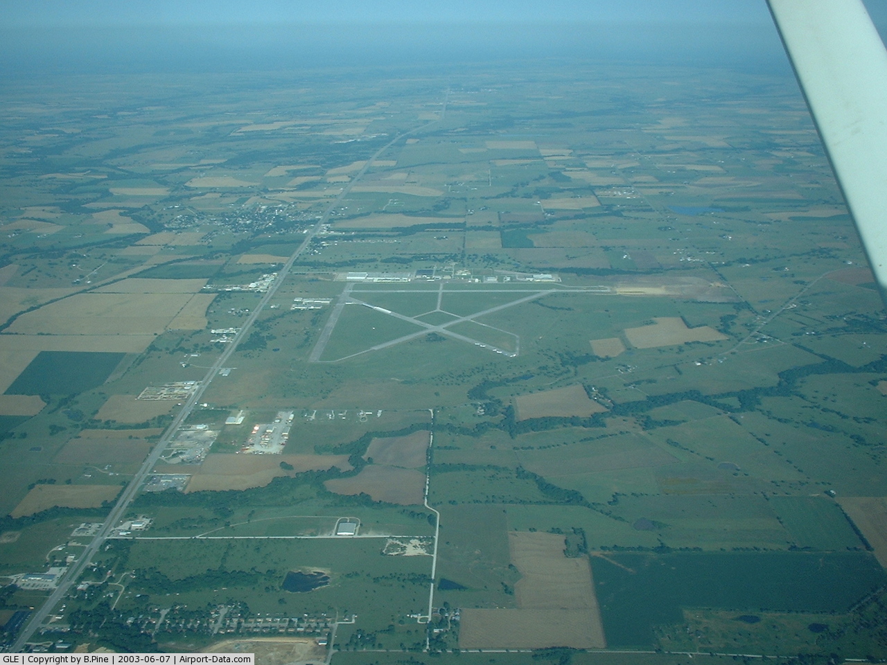
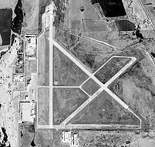
Gainesville Municipal Airport covers an area of 1,336 acres (541 ha) which contains two asphalt paved runways: 17/35 measuring 6,000 x 100 ft (1,829 x 30 m) and 12/30 measuring 4,296 x 80 ft (1,309 x 24 m).
For the 12-month period ending August 30, 2005, the airport had 20,200 aircraft operations, an average of 55 per day: 99.5% general aviation and 0.5% military. At that time there were 70 aircraft based at this airport: 66% single-engine, 21% multi-engine, 9% jet, 3% helicopter and 1% ultralight.
The above content comes from Wikipedia and is published under free licenses – click here to read more.
 |
(Click on the photo to enlarge) |
 |
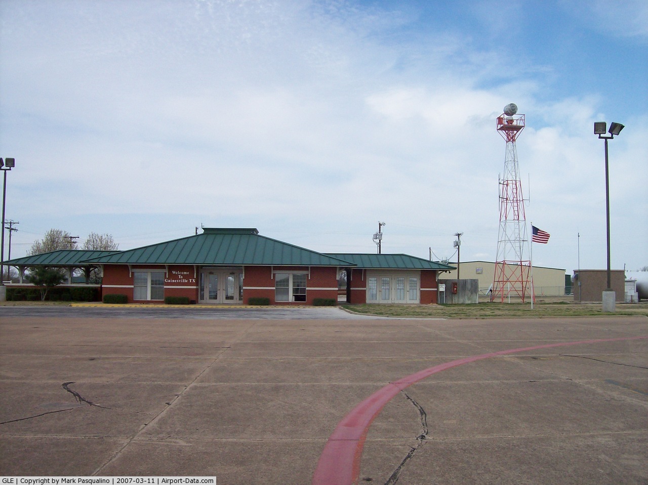
(Click on the photo to enlarge) |
 |
(Click on the photo to enlarge) |
Location & QuickFacts
| FAA Information Effective: | 2008-09-25 |
| Airport Identifier: | GLE |
| Airport Status: | Operational |
| Longitude/Latitude: | 097-11-50.2000W/33-39-07.9000N
-97.197278/33.652194 (Estimated) |
| Elevation: | 845 ft / 257.56 m (Estimated) |
| Land: | 1336 acres |
| From nearest city: | 3 nautical miles W of Gainesville, TX |
| Location: | Cooke County, TX |
| Magnetic Variation: | 06E (1990) |
Owner & Manager
| Ownership: | Publicly owned |
| Owner: | City Of Gainesville |
| Address: | 200 S. Rusk
Gainesville, TX 76240 |
| Phone number: | 940-668-4500 |
| Manager: | David Vinton
AIRPORT DIRECTOR. |
| Address: | 2300 Airport Dr
Gainesville, TX 76240 |
| Phone number: | 940-668-4565 |
Airport Operations and Facilities
| Airport Use: | Open to public |
| Wind indicator: | Yes |
| Segmented Circle: | Yes |
| Control Tower: | No |
| Lighting Schedule: | DUSK-DAWN
MIRL RY 17/35 PRESET LOW INTST; TO INCR INTST ACTVT - CTAF. PAPI RYS 17 & 35 OPER CONT. |
| Beacon Color: | Clear-Green (lighted land airport) |
| Landing fee charge: | No |
| Sectional chart: | Dallas-ft Worth |
| Region: | ASW - Southwest |
| Boundary ARTCC: | ZFW - Fort Worth |
| Tie-in FSS: | FTW - Fort Worth |
| FSS on Airport: | No |
| FSS Phone: | 817-541-3474 |
| FSS Toll Free: | 1-800-WX-BRIEF |
| NOTAMs Facility: | GLE (NOTAM-d service avaliable) |
| Federal Agreements: | NGPY |
Airport Communications
| CTAF: | 123.000 |
| Unicom: | 123.000 |
Airport Services
| Fuel available: | 100LLA
100LL FUEL AVBL 24 HRS WITH CREDIT CARD. FOR JET A FUEL AFT HRS CTC 940-736-4289 OR 940-902-1314. |
| Airframe Repair: | MAJOR |
| Power Plant Repair: | MAJOR |
| Bulk Oxygen: | NONE |
Runway Information
Runway 12/30
| Dimension: | 4307 x 80 ft / 1312.8 x 24.4 m |
| Surface: | ASPH, Good Condition |
| Weight Limit: | Single wheel: 15000 lbs. |
| |
Runway 12 |
Runway 30 |
| Longitude: | 097-11-56.8895W | 097-11-19.4563W |
| Latitude: | 33-39-18.3534N | 33-38-49.4502N |
| Elevation: | 826.00 ft | 792.00 ft |
| Alignment: | 127 | 127 |
| Traffic Pattern: | Left | Left |
| Markings: | Basic, Good Condition
RY HAS AIM POINTS. | Basic, Good Condition
RY HAS AIM POINTS. |
|
Runway 17/35
| Dimension: | 6001 x 100 ft / 1829.1 x 30.5 m |
| Surface: | ASPH, Good Condition |
| Weight Limit: | Single wheel: 15000 lbs. |
| Edge Lights: | Medium |
| |
Runway 17 |
Runway 35 |
| Longitude: | 097-11-58.1154W | 097-11-59.5101W |
| Latitude: | 33-39-40.4922N | 33-38-41.1380N |
| Elevation: | 845.00 ft | 792.00 ft |
| Alignment: | 127 | 1 |
| Traffic Pattern: | Left | Left |
| Markings: | Non-precision instrument, Good Condition | Non-precision instrument, Good Condition |
| Crossing Height: | 45.00 ft | 45.00 ft |
| VASI: | 2-light PAPI on right side | 2-light PAPI on left side |
| Visual Glide Angle: | 3.00° | 3.00° |
| Runway End Identifier: | Yes | Yes |
| Obstruction: | 31 ft tree, 1303.0 ft from runway, 100 ft left of centerline, 35:1 slope to clear | 30 ft pline, 1100.0 ft from runway, 30:1 slope to clear |
|
Radio Navigation Aids
| ID |
Type |
Name |
Ch |
Freq |
Var |
Dist |
| GLE | NDB | Gainesville | | 330.00 | 06E | 4.0 nm |
| DNI | NDB | Denison | | 341.00 | 06E | 28.3 nm |
| GMZ | NDB | Grindstone Mountain | | 356.00 | 07E | 29.0 nm |
| AUV | NDB | Arbuckle | | 284.00 | 07E | 30.2 nm |
| DUA | NDB | Durant | | 359.00 | 05E | 43.5 nm |
| URH | VOR/DME | Texoma | 090X | 114.30 | 05E | 43.9 nm |
| TTT | VOR/DME | Maverick | 078X | 113.10 | 06E | 47.7 nm |
| CVE | VOR/DME | Cowboy | 109X | 116.20 | 06E | 48.1 nm |
| UKW | VORTAC | Bowie | 071X | 112.40 | 06E | 32.0 nm |
| ADM | VORTAC | Ardmore | 114X | 116.70 | 06E | 33.7 nm |
| FUZ | VORTAC | Ranger | 104X | 115.70 | 06E | 45.9 nm |
| BYP | VORTAC | Bonham | 093X | 114.60 | 06E | 48.7 nm |
Remarks
- GCO AVBL ON FREQ 121.725 THRU FLT SVCS.
- HELICOPTER TAXIING PROHIBITED IN VICINITY OF BLDGS.
- PRE-DATES ACT.
Images and information placed above are from
http://www.airport-data.com/airport/GLE/
We thank them for the data!
| General Info
|
| Country |
United States
|
| State |
TEXAS
|
| FAA ID |
GLE
|
| Latitude |
33-39-04.900N
|
| Longitude |
097-11-49.300W
|
| Elevation |
839 feet
|
| Near City |
GAINESVILLE
|
We don't guarantee the information is fresh and accurate. The data may
be wrong or outdated.
For more up-to-date information please refer to other sources.
|
|