 |
|
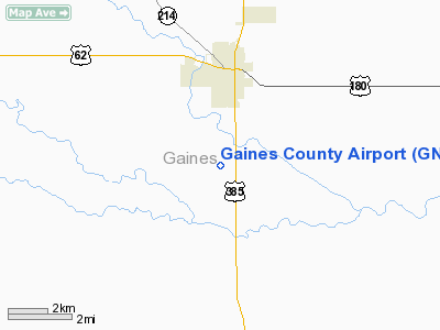
Location & QuickFacts
| FAA Information Effective: | 2008-09-25 |
| Airport Identifier: | GNC |
| Airport Status: | Operational |
| Longitude/Latitude: | 102-39-09.6000W/32-40-31.2000N
-102.652667/32.675333 (Estimated) |
| Elevation: | 3315 ft / 1010.41 m (Surveyed) |
| Land: | 428 acres |
| From nearest city: | 3 nautical miles S of Seminole, TX |
| Location: | Gaines County, TX |
| Magnetic Variation: | 09E (2000) |
Owner & Manager
| Ownership: | Publicly owned |
| Owner: | Gaines County |
| Address: | Gaines County Courthouse
Seminole, TX 79360 |
| Phone number: | 432-758-5411 |
| Manager: | Lex Hinds |
| Address: | Box 1626
Seminole, TX 79360 |
| Phone number: | 432-758-6455 |
Airport Operations and Facilities
| Airport Use: | Open to public |
| Wind indicator: | Yes |
| Segmented Circle: | Yes |
| Control Tower: | No |
| Lighting Schedule: | DUSK-DAWN
MIRL RYS 08/26 & 17/35 PRESET LOW INTST; TO INCR INTST ACTVT - CTAF. |
| Beacon Color: | Clear-Green (lighted land airport) |
| Landing fee charge: | No |
| Sectional chart: | Albuquerque |
| Region: | ASW - Southwest |
| Traffic Pattern Alt: | 1017 ft |
| Boundary ARTCC: | ZFW - Fort Worth |
| Tie-in FSS: | FTW - Fort Worth |
| FSS on Airport: | No |
| FSS Phone: | 817-541-3474 |
| FSS Toll Free: | 1-800-WX-BRIEF |
| NOTAMs Facility: | GNC (NOTAM-d service avaliable) |
| Federal Agreements: | NGY |
Airport Communications
| CTAF: | 122.800 |
| Unicom: | 122.800 |
Airport Services
| Fuel available: | 100LLA |
| Airframe Repair: | MAJOR |
| Power Plant Repair: | MAJOR |
| Bottled Oxygen: | HIGH |
| Bulk Oxygen: | HIGH |
Runway Information
Runway 08/26
| Dimension: | 5381 x 75 ft / 1640.1 x 22.9 m |
| Surface: | ASPH, Good Condition |
| Weight Limit: | Single wheel: 12500 lbs. |
| Edge Lights: | Medium |
| |
Runway 08 |
Runway 26 |
| Longitude: | 102-39-55.1227W | 102-38-52.1817W |
| Latitude: | 32-40-42.7061N | 32-40-42.9731N |
| Elevation: | 3313.00 ft | 3282.00 ft |
| Alignment: | 90 | 127 |
| Traffic Pattern: | Right | Left |
| Markings: | Basic, Good Condition | Basic, Good Condition |
| Crossing Height: | 0.00 ft | 18.00 ft |
| VASI: | | 2-light PAPI on left side |
| Visual Glide Angle: | 0.00° | 3.00° |
| Obstruction: | , 50:1 slope to clear | 30 ft pline, 848.0 ft from runway, 21:1 slope to clear |
|
Runway 17/35
| Dimension: | 4999 x 75 ft / 1523.7 x 22.9 m |
| Surface: | ASPH, Good Condition |
| Weight Limit: | Single wheel: 12500 lbs. |
| Edge Lights: | Medium |
| |
Runway 17 |
Runway 35 |
| Longitude: | 102-38-54.7404W | 102-38-54.1007W |
| Latitude: | 32-40-43.4394N | 32-39-53.9833N |
| Elevation: | 3284.00 ft | 3265.00 ft |
| Alignment: | 127 | 127 |
| Traffic Pattern: | Right | Left |
| Markings: | Basic, Good Condition | Non-precision instrument, Fair Condition |
| Crossing Height: | 23.00 ft | 23.00 ft |
| VASI: | 2-light PAPI on left side | 2-light PAPI on left side |
| Visual Glide Angle: | 3.00° | 3.00° |
| Obstruction: | 25 ft pline, 1350.0 ft from runway, 46:1 slope to clear
169' ANT 410' RIGHT OF CNTRLN. | , 50:1 slope to clear |
|
Radio Navigation Aids
| ID |
Type |
Name |
Ch |
Freq |
Var |
Dist |
| GNC | NDB | Gaines County | | 344.00 | 09E | 0.4 nm |
| ANR | NDB | Andrews | | 245.00 | 09E | 20.5 nm |
| LSA | NDB | Lamesa | | 338.00 | 09E | 37.6 nm |
| BFE | NDB | Brownfield | | 311.00 | 09E | 38.2 nm |
| MA | NDB | Farly | | 326.00 | 09E | 44.5 nm |
| HOB | VORTAC | Hobbs | 047X | 111.00 | 11E | 31.3 nm |
| MAF | VORTAC | Midland | 095X | 114.80 | 11E | 46.4 nm |
| MAF | VOT | Midland International | | 108.20 | | 49.8 nm |
Images and information placed above are from
http://www.airport-data.com/airport/GNC/
We thank them for the data!
| General Info
|
| Country |
United States
|
| State |
TEXAS
|
| FAA ID |
GNC
|
| Latitude |
32.675336
32° 40' 31.21" N
|
| Longitude |
-102.652661
102° 39' 09.58" W
|
| Elevation |
3315 feet
1010 meters
|
| Type |
Civil
|
| Magnetic Variation |
008° E (01/06)
|
| Beacon |
Yes
|
| Operating Agency |
U.S.CIVIL AIRPORT WHEREIN PERMIT COVERS USE BY TRANSIT MILITARY AIRCRAFT
|
| Daylight Saving Time |
Second Sunday in March at 0200 to first Sunday in November at 0200 local time (Exception Arizona and that portion of Indiana in the Eastern Time Zone)
|
We don't guarantee the information is fresh and accurate. The data may
be wrong or outdated.
For more up-to-date information please refer to other sources.
|
|


