 |
|
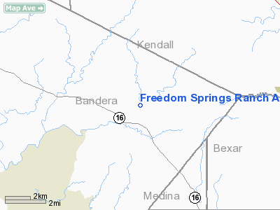
Freedom Springs Ranch Airport |
Location & QuickFacts
| FAA Information Effective: | 2008-09-25 |
| Airport Identifier: | TA66 |
| Airport Status: | Operational |
| Longitude/Latitude: | 098-51-36.1030W/29-42-50.8040N
-98.860029/29.714112 (Estimated) |
| Elevation: | 1400 ft / 426.72 m (Estimated) |
| Land: | 0 acres |
| From nearest city: | 4 nautical miles SE of Pipe Creek, TX |
| Location: | Bandera County, TX |
| Magnetic Variation: | 07E (1985) |
Owner & Manager
| Ownership: | Privately owned |
| Owner: | F. S. Trust |
| Address: | 606 Red Bluff Road
Pipe Creek, TX 78063 |
| Phone number: | 210-510-4836 |
| Manager: | William D. Walker |
| Address: | 606 Red Bluff Road
Pipe Creek, TX 78063 |
| Phone number: | 210-510-4836 |
Airport Operations and Facilities
| Airport Use: | Private |
| Wind indicator: | Yes |
| Segmented Circle: | No |
| Control Tower: | No |
| Landing fee charge: | No |
| Sectional chart: | San Antonio |
| Region: | ASW - Southwest |
| Boundary ARTCC: | ZHU - Houston |
| Tie-in FSS: | SJT - San Angelo |
| FSS on Airport: | No |
| FSS Toll Free: | 1-800-WX-BRIEF |
Runway Information
Runway 05/23
| Dimension: | 2150 x 100 ft / 655.3 x 30.5 m |
| Surface: | DIRT, |
| |
Runway 05 |
Runway 23 |
| Traffic Pattern: | Left | Left |
| Obstruction: | 50 ft trees, 75.0 ft from runway | , 300.0 ft from runway |
|
Radio Navigation Aids
| ID |
Type |
Name |
Ch |
Freq |
Var |
Dist |
| ER | NDB | Shein | | 263.00 | 08E | 14.4 nm |
| CVB | NDB | Castroville | | 338.00 | 08E | 22.1 nm |
| HMA | NDB | Hondo | | 329.00 | 08E | 26.2 nm |
| HHH | NDB | Devine | | 359.00 | 07E | 34.9 nm |
| PEZ | NDB | Pleasanton | | 275.00 | 07E | 49.0 nm |
| KSY | TACAN | Kelly | 057X | | 07E | 24.3 nm |
| DHK | TACAN | Randolph | 036X | | 09E | 32.7 nm |
| SSF | VOR | Stinson | | 108.40 | 09E | 35.0 nm |
| HDO | VOR/DME | Hondo | 31X | 109.40 | 08E | 27.5 nm |
| SAT | VORTAC | San Antonio | 115X | 116.80 | 08E | 21.2 nm |
| CSI | VORTAC | Center Point | 122X | 117.50 | 08E | 22.3 nm |
| STV | VORTAC | Stonewall | 085X | 113.80 | 08E | 30.7 nm |
| RND | VORTAC | Randolph | 70X | 112.30 | 09E | 32.2 nm |
| SAT | VOT | San Antonio Intl | | 110.40 | | 23.1 nm |
Remarks
- DRAINAGE DITCH ALONG EAST SIDE OF RWY.
- VFR PRVDD APCH SLOPES TO LNDG ARE ARE MAINTAINED IAW PART 77 OF FAR'S.
Images and information placed above are from
http://www.airport-data.com/airport/TA66/
We thank them for the data!
| General Info
|
| Country |
United States
|
| State |
TEXAS
|
| FAA ID |
TA66
|
| Latitude |
29-42-50.804N
|
| Longitude |
098-51-36.103W
|
| Elevation |
1400 feet
|
| Near City |
PIPE CREEK
|
We don't guarantee the information is fresh and accurate. The data may
be wrong or outdated.
For more up-to-date information please refer to other sources.
|
|


