 |
|
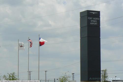
Fort Worth Spinks Airport |
| Fort Worth Spinks Airport |
| IATA: none – ICAO: KFWS – FAA LID: FWS |
| Summary |
| Airport type |
Public |
| Owner |
City of Fort Worth |
| Serves |
Fort Worth, Texas |
| Elevation AMSL |
700 ft / 213 m |
| Coordinates |
32°33′55″N 097°18′29″W / 32.56528°N 97.30806°W / 32.56528; -97.30806 |
| Website |
fortworthgov.org/... |
| Runways |
| Direction |
Length |
Surface |
| ft |
m |
| 17R/35L |
6,002 |
1,829 |
Asphalt |
| 17L/35R |
4,000 |
1,219 |
Turf |
| Statistics (2008) |
| Aircraft operations |
82,948 |
| Based aircraft |
199 |
| Source: Federal Aviation Administration |
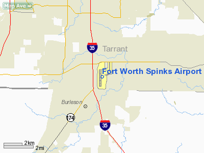
Fort Worth Spinks Airport (ICAO: KFWS, FAA LID: FWS) is a city-owned, public-use airport located 14 nautical miles (26 km) south of the central business district of Fort Worth, in Tarrant County, Texas, United States. It is the newest of the three airports that are owned by the City of Fort Worth and it serves the cities of Fort Worth, Burleson, and Mansfield. The airport is located at the intersection of Interstate 35W and HWY 1187 and serves as a reliever airport for Fort Worth Meacham International Airport and Dallas-Fort Worth International Airport. It is one of few airports in the country to have Class E airspace and a control tower.
Although most U.S. airports use the same three-letter location identifier for the FAA and IATA, this airport is assigned FWS by the FAA but has no designation from the IATA. History
Spinks Airport was named for Maurice Hunger "Pappy" Spinks, a renowned aerobatic competitor and aviation manufacturer who built the nearby Oak Grove Airport, portions of which have been encompassed by Spinks Airport. Pappy was a patron of the Aerobatic Club of America and was described by fellow aerobatic pilots as a "rough edged old millionaire", who had made a fortune during the Vietnam War as a vendor for nearby Bell Helicopter.
Facilities and aircraft
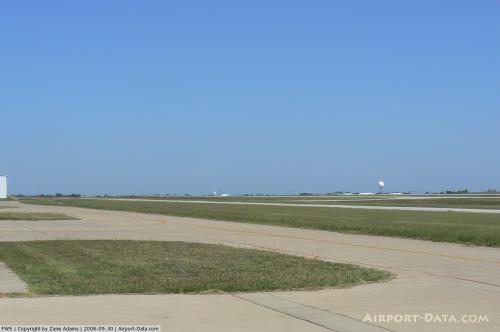
Fort Worth Spinks Airport covers an area of 822 acres (333 ha) at an elevation of 700 feet (213 m) above mean sea level. It has two runways: 17R/35L is 6,002 by 100 feet (1,829 x 30 m) with an asphalt surface; 17L/35R is 4,000 by 60 feet (1,219 x 18 m) with a turf surface. The fixed based operator (Harrison Aviation) has constructed a 7,400 square feet (690 m) terminal building that houses their operations and the offices of the airport manager.
For the 12-month period ending September 30, 2008, the airport had 82,948 aircraft operations, an average of 227 per day: 99.4% general aviation, 0.4% air taxi, and 0.3% military. At that time there were 199 aircraft based at this airport: 78% single-engine, 18% multi-engine, 3% jet and 1% helicopter.
The above content comes from Wikipedia and is published under free licenses – click here to read more.
 |
(Click on the photo to enlarge) |
 |
(Click on the photo to enlarge) |
Location & QuickFacts
| FAA Information Effective: | 2008-09-25 |
| Airport Identifier: | FWS |
| Airport Status: | Operational |
| Longitude/Latitude: | 097-18-29.0800W/32-33-54.8200N
-97.308078/32.565228 (Estimated) |
| Elevation: | 700 ft / 213.36 m (Surveyed) |
| Land: | 822 acres |
| From nearest city: | 14 nautical miles S of Fort Worth, TX |
| Location: | Tarrant County, TX |
| Magnetic Variation: | 07E (1985) |
Owner & Manager
| Ownership: | Publicly owned |
| Owner: | City Of Fort Worth |
| Address: | Meacham Intl Arpt Ste 200
Fort Worth, TX 76106 |
| Phone number: | 817-871-5400 |
| Manager: | Ryan Cox |
| Address: | 13451 Wing Way Suite 110
Burleson, TX 76028 |
| Phone number: | 817-447-8304
EMERGENCY PHONE: 817-992-9033. |
Airport Operations and Facilities
| Airport Use: | Open to public |
| Wind indicator: | Yes |
| Segmented Circle: | Yes |
| Control Tower: | Yes |
| Lighting Schedule: | DUSK-DAWN
ACTVT MALSR RY 35L - CTAF. |
| Beacon Color: | Clear-Green (lighted land airport) |
| Sectional chart: | Dallas-ft Worth |
| Region: | ASW - Southwest |
| Traffic Pattern Alt: | 1000 ft |
| Boundary ARTCC: | ZFW - Fort Worth |
| Tie-in FSS: | FTW - Fort Worth |
| FSS Phone: | 817-541-3474 |
| FSS Toll Free: | 1-800-WX-BRIEF |
| NOTAMs Facility: | FWS (NOTAM-d service avaliable) |
| Federal Agreements: | NGY |
Airport Communications
| CTAF: | 124.625 |
| Unicom: | 122.700 |
Airport Services
| Fuel available: | 100LLA
100LL SELF-SERVE 24 HR WITH MAJOR CREDIT CARD. |
| Airframe Repair: | MAJOR |
| Power Plant Repair: | MAJOR |
Runway Information
Runway 17L/35R
| Dimension: | 4000 x 60 ft / 1219.2 x 18.3 m |
| Surface: | TURF, Good Condition |
| |
Runway 17L |
Runway 35R |
| Longitude: | 097-18-23.1000W | 097-18-23.1000W |
| Latitude: | 32-34-21.1000N | 32-33-41.5000N |
| Alignment: | 127 | 0 |
| Traffic Pattern: | Left | Right |
| Obstruction: | , 50:1 slope to clear | 8 ft gnd, 320.0 ft from runway, 40:1 slope to clear |
|
Runway 17R/35L
| Dimension: | 6002 x 100 ft / 1829.4 x 30.5 m |
| Surface: | ASPH, Good Condition |
| Weight Limit: | Single wheel: 40000 lbs.
Dual wheel: 50000 lbs.
Dual tandem wheel: 90000 lbs. |
| Edge Lights: | Medium |
| |
Runway 17R |
Runway 35L |
| Longitude: | 097-18-34.7550W | 097-18-34.8880W |
| Latitude: | 32-34-21.0520N | 32-33-21.6620N |
| Elevation: | 700.00 ft | 689.00 ft |
| Alignment: | 127 | 127 |
| ILS Type: | | ILS
|
| Traffic Pattern: | Right | Left |
| Markings: | Precision instrument, Good Condition | Precision instrument, Good Condition |
| Crossing Height: | 40.00 ft | 52.00 ft |
| VASI: | 4-light PAPI on left side | 4-light PAPI on left side |
| Visual Glide Angle: | 3.00° | 3.00° |
| Approach lights: | | MALSR |
| Obstruction: | 100 ft pline, 4150.0 ft from runway, 39:1 slope to clear | , 50:1 slope to clear |
|
Radio Navigation Aids
| ID |
Type |
Name |
Ch |
Freq |
Var |
Dist |
| XQH | NDB | Cedar Hill | | 353.00 | 08E | 16.9 nm |
| RBD | NDB | Redbird | | 287.00 | 06E | 23.1 nm |
| LNC | NDB | Lancaster | | 239.00 | 06E | 29.7 nm |
| JUG | NDB | Jecca | | 388.00 | 06E | 39.8 nm |
| MWL | NDB | Mineral Wells | | 266.00 | 06E | 40.1 nm |
| PQF | NDB | Mesquite | | 248.00 | 06E | 42.1 nm |
| NFW | TACAN | Nas Jrb Fort Worth | 024X | | 07E | 14.1 nm |
| TTT | VOR/DME | Maverick | 078X | 113.10 | 06E | 22.7 nm |
| CVE | VOR/DME | Cowboy | 109X | 116.20 | 06E | 28.3 nm |
| FUZ | VORTAC | Ranger | 104X | 115.70 | 06E | 20.5 nm |
| MQP | VORTAC | Millsap | 124X | 117.70 | 09E | 36.2 nm |
| JEN | VORTAC | Glen Rose | 097X | 115.00 | 06E | 37.8 nm |
| FTW | VOT | Fort Worth Meacham | | 108.20 | | 15.4 nm |
| DAL | VOT | Dallas Love Field | | 113.30 | | 28.6 nm |
Remarks
- NOISE ABATEMENT PROCEDURE: AVOID NOISE SENSITIVE AREAS ALL QUADRANT OF ARPT; MAINTAIN ALTITUDES AT OR ABOVE 1000 FT AGL OVER THESE AREAS.
- BIRDS INVOF ARPT.
- GCO AVBL ON FREQ 121.725 THRU DFW CD & FLT SVCS.
- UNLGTD ANT ARRAY 212 FT AGL 5 NM SE OF ARPT.
- ROTORCRAFT OPNS RSTD IN SELF SVC FUEL AREAS.
Images and information placed above are from
http://www.airport-data.com/airport/FWS/
We thank them for the data!
| General Info
|
| Country |
United States
|
| State |
TEXAS
|
| FAA ID |
FWS
|
| Latitude |
32-33-54.820N
|
| Longitude |
097-18-29.080W
|
| Elevation |
700 feet
|
| Near City |
FORT WORTH
|
We don't guarantee the information is fresh and accurate. The data may
be wrong or outdated.
For more up-to-date information please refer to other sources.
|
|


