|
|
Fort Worth Alliance Airport |
| Fort Worth Alliance Airport |
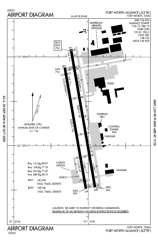 |
| FAA airport diagram |
| IATA: AFW – ICAO: KAFW – FAA LID: AFW |
| Summary |
| Airport type |
Public |
| Owner |
City of Fort Worth |
| Serves |
Fort Worth, Texas |
| Hub for |
FedEx Express |
| Elevation AMSL |
722 ft / 220 m |
| Coordinates |
32°59′16″N 097°19′08″W / 32.98778°N 97.31889°W / 32.98778; -97.31889 |
| Website |
www.AllianceAirport.com |
| Runways |
| Direction |
Length |
Surface |
| ft |
m |
| 16L/34R |
9,600 |
2,926 |
Concrete |
| 16R/34L |
8,220 |
2,505 |
Concrete |
| Statistics (2007) |
| Aircraft operations |
80,332 |
| Based aircraft |
124 |
| Source: Federal Aviation Administration |
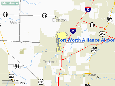
Fort Worth Alliance Airport (IATA: AFW, ICAO: KAFW, FAA LID: AFW) is a city-owned public-use airport located 14 miles (23 km) north of the central business district of Fort Worth, city in Tarrant County, Texas, United States.
Billed as the world's first purely industrial airport, it was developed in a joint venture between the City of Fort Worth, the Federal Aviation Administration and Hillwood Development Company, a real estate development company owned by H. Ross Perot, Jr. The official groundbreaking ceremonies were held in July 1988, and the airport officially opened on December 14, 1989. The airport is owned by the City of Fort Worth and managed by Alliance Air Services, a subsidiary of Hillwood.
Alliance filled in for Los Angeles International Airport during the filming of the TV drama LAX.
By the 1990s, the annual passenger air traffic at Dallas-Fort Worth International Airport had exceeded the airport's capacity, and a solution was proposed to repeal the Wright Amendment and open Alliance Airport to passenger service, effectively providing DFW with two reliever airports. But DFW opposed the solution and no passenger service was introduced at Alliance Airport.
In April 2004 Alliance Airport operating company Hillwood entered in to a management contract with EP-Team (Energy & Projects Team) for sales and marketing development to attract Cargo Airlines to the airport. EP-Team is a Project Freight/Logistics Management company with its Head Office in Dallas, Texas. Facilities and aircraft
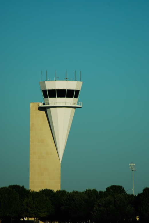 | |
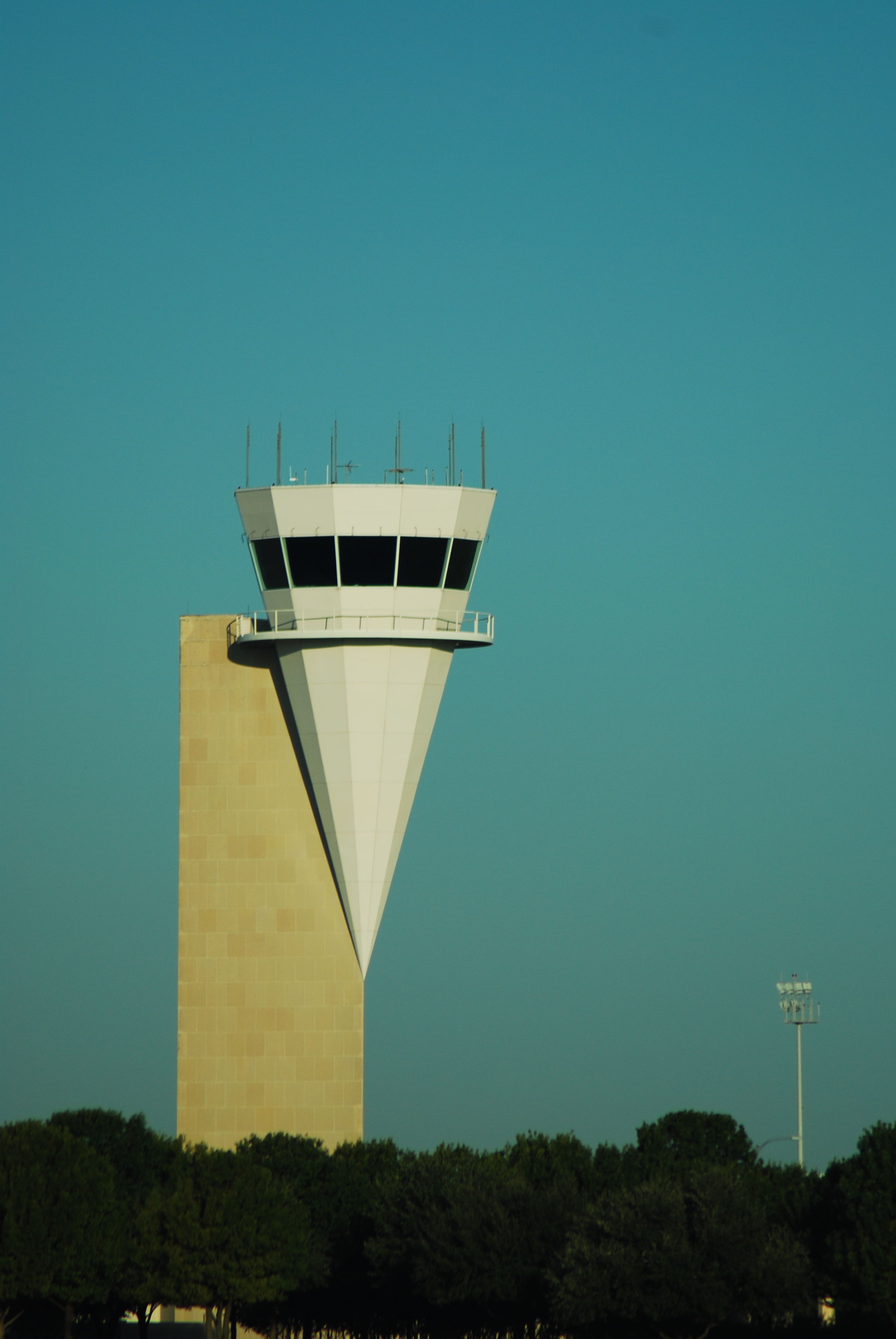
The iconic tower at Alliance. |
Fort Worth Alliance Airport covers an area of 1,198 acres (485 ha) which contains two concrete paved runways: 16L/34R measuring 9,600 x 150 ft (2,926 x 46 m) and 16R/34L measuring 8,220 x 150 ft (2,505 x 46 m). Currently Alliance Airport is in the process of a Runway extension to 11,000 feet.
For the 12-month period ending June 30, 2007, the airport had 80,332 aircraft operations, an average of 220 per day: 73% general aviation, 11% scheduled commercial, 8% military and 7% air taxi. At that time there were 124 aircraft based at this airport: 40% single-engine, 18% multi-engine, 11% jet and 31% helicopter.
Major Tenants
- American Airlines (maintenance base)
- Bell Helicopter Textron (customer acceptance center)
- DynCorp International (main operations center)
- FedEx Express (cargo hub)
The above content comes from Wikipedia and is published under free licenses – click here to read more.
 |
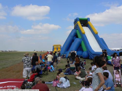
(Click on the photo to enlarge) |
 |
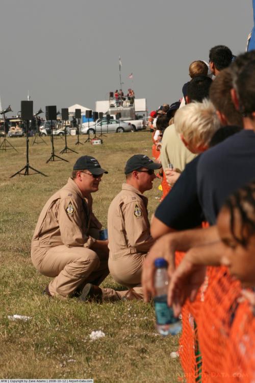
(Click on the photo to enlarge) |
 |
(Click on the photo to enlarge) |
 |
(Click on the photo to enlarge) |
 |
(Click on the photo to enlarge) |
 |
(Click on the photo to enlarge) |
 |
(Click on the photo to enlarge) |
 |
(Click on the photo to enlarge) |
 |
(Click on the photo to enlarge) |
 |
(Click on the photo to enlarge) |
Location & QuickFacts
| FAA Information Effective: | 2008-09-25 |
| Airport Identifier: | AFW |
| Airport Status: | Operational |
| Longitude/Latitude: | 097-19-07.7000W/32-59-15.5000N
-97.318806/32.987639 (Estimated) |
| Elevation: | 722 ft / 220.07 m (Surveyed) |
| Land: | 1198 acres |
| From nearest city: | 14 nautical miles N of Fort Worth, TX |
| Location: | Tarrant County, TX |
| Magnetic Variation: | 07E (1990) |
Owner & Manager
| Ownership: | Publicly owned |
| Owner: | City Of Fort Worth |
| Address: | 1000 Throckmorton
Fort Worth, TX 76177 |
| Phone number: | 817-392-6116 |
| Manager: | Tim Ward |
| Address: | 2221 Alliance Blvd Suite 100
Fort Worth, TX 76102 |
| Phone number: | 817-890-1000 |
Airport Operations and Facilities
| Airport Use: | Open to public |
| Wind indicator: | Yes |
| Segmented Circle: | Yes |
| Control Tower: | Yes |
| Lighting Schedule: | DUSK-DAWN |
| Beacon Color: | Clear-Green (lighted land airport) |
| Sectional chart: | Dallas-ft Worth |
| Region: | ASW - Southwest |
| Boundary ARTCC: | ZFW - Fort Worth |
| Tie-in FSS: | FTW - Fort Worth |
| FSS on Airport: | No |
| FSS Phone: | 817-541-3474 |
| FSS Toll Free: | 1-800-WX-BRIEF |
| NOTAMs Facility: | AFW (NOTAM-d service avaliable) |
| Certification type/date: | IV A U 12/198
ARFF INDEX E AVAILABLE. PPR FOR ACR OPNS WITH MORE THAN 30 PSGR SEATS CALL 817-890-1000 OR 800-318-9268. |
| Federal Agreements: | NGY |
Airport Services
| Fuel available: | 100LLA1+ |
| Airframe Repair: | MAJOR
PRIOR ARRANGEMENTS REQUIRED FOR AIRFRAME OR POWER PLANT REPAIRS FOR DESIGN GROUP III & ABOVE. |
| Power Plant Repair: | MAJOR |
| Bottled Oxygen: | LOW |
Runway Information
Runway 16L/34R
| Dimension: | 9600 x 150 ft / 2926.1 x 45.7 m |
| Surface: | CONC, Good Condition |
| Surface Treatment: | Saw-cut or plastic Grooved |
| Weight Limit: | Dual wheel: 200000 lbs.
Dual tandem wheel: 400000 lbs.
Dual dual tandem wheel: 870000 lbs. |
| Edge Lights: | High |
| |
Runway 16L |
Runway 34R |
| Longitude: | 097-19-14.7020W | 097-18-55.5440W |
| Latitude: | 33-00-05.8890N | 32-58-32.2960N |
| Elevation: | 722.00 ft | 664.00 ft |
| Alignment: | 127 | 127 |
| ILS Type: | ILS/DME
| ILS/DME
|
| Traffic Pattern: | Right | Left |
| Markings: | Precision instrument, Good Condition | Precision instrument, Good Condition |
| Displaced threshold: | 1390.00 ft | 0.00 ft |
| RVR Equipment: | touchdown, midfield, rollout | touchdown, midfield, rollout |
| Approach lights: | ALSF2 | MALSR |
| Centerline Lights: | Yes | Yes |
| Touchdown Lights: | Yes | |
| Obstruction: | , 50:1 slope to clear | 182 ft pline, 7920.0 ft from runway, 590 ft right of centerline, 42:1 slope to clear |
| Decleard distances: | Take off run available 9600.00 ft
Take off distance available 9600.00 ft
Actual stop distance available 9600.00 ft
Landing distance available 8210.00 ft
| Take off run available 9600.00 ft
Take off distance available 9600.00 ft
Actual stop distance available 8516.00 ft
Landing distance available 8516.00 ft
|
|
Runway 16R/34L
| Dimension: | 8220 x 150 ft / 2505.5 x 45.7 m |
| Surface: | CONC, Good Condition |
| Surface Treatment: | Saw-cut or plastic Grooved |
| Weight Limit: | Dual wheel: 200000 lbs.
Dual tandem wheel: 400000 lbs.
Dual dual tandem wheel: 870000 lbs. |
| Edge Lights: | Medium |
| |
Runway 16R |
Runway 34L |
| Longitude: | 097-19-18.8730W | 097-19-02.4660W |
| Latitude: | 32-59-51.3310N | 32-58-31.1880N |
| Elevation: | 716.00 ft | 665.00 ft |
| Alignment: | 127 | 127 |
| Traffic Pattern: | Right | Left |
| Markings: | Basic, Good Condition | Basic, Good Condition |
| Displaced threshold: | 501.00 ft | 601.00 ft |
| VASI: | 4-light PAPI on left side | 4-light PAPI on left side |
| Runway End Identifier: | Yes | Yes |
| Obstruction: | 19 ft rr, 607.0 ft from runway, 287 ft right of centerline, 21:1 slope to clear
APCH RATIO 0:1 BASED ON DSPLCD THLD; +5 FT FENCE 0 FT, 250 FT R. | 4 ft fence, 200.0 ft from runway, 250 ft left of centerline
APCH RATIO 50:1 TO DSPLCD THLD.
+4 FT FENCE 0 FT, 250 FT R, APCH RATIO 0:1 BASED ON DSPLCD THLD. |
| Decleard distances: | Take off run available 8220.00 ft
Take off distance available 8220.00 ft
Actual stop distance available 7619.00 ft
Landing distance available 7118.00 ft
| Take off run available 8220.00 ft
Take off distance available 8220.00 ft
Actual stop distance available 7719.00 ft
Landing distance available 7118.00 ft
|
|
Radio Navigation Aids
| ID |
Type |
Name |
Ch |
Freq |
Var |
Dist |
| RBD | NDB | Redbird | | 287.00 | 06E | 29.3 nm |
| XQH | NDB | Cedar Hill | | 353.00 | 08E | 29.4 nm |
| LNC | NDB | Lancaster | | 239.00 | 06E | 39.0 nm |
| MWL | NDB | Mineral Wells | | 266.00 | 06E | 39.2 nm |
| PQF | NDB | Mesquite | | 248.00 | 06E | 41.3 nm |
| GMZ | NDB | Grindstone Mountain | | 356.00 | 07E | 43.6 nm |
| JUG | NDB | Jecca | | 388.00 | 06E | 44.1 nm |
| GLE | NDB | Gainesville | | 330.00 | 06E | 44.4 nm |
| NFW | TACAN | Nas Jrb Fort Worth | 024X | | 07E | 14.3 nm |
| TTT | VOR/DME | Maverick | 078X | 113.10 | 06E | 15.7 nm |
| CVE | VOR/DME | Cowboy | 109X | 116.20 | 06E | 21.7 nm |
| FUZ | VORTAC | Ranger | 104X | 115.70 | 06E | 9.2 nm |
| MQP | VORTAC | Millsap | 124X | 117.70 | 09E | 37.7 nm |
| UKW | VORTAC | Bowie | 071X | 112.40 | 06E | 41.5 nm |
| FTW | VOT | Fort Worth Meacham | | 108.20 | | 10.4 nm |
| DAL | VOT | Dallas Love Field | | 113.30 | | 25.0 nm |
Remarks
- ARFF INDEX E AVBL.
- FLIGHT NOTIFICATION SERVICE (ADCUS) AVBL.
- PRVDD CONDITIONS CONTAINED IN 08/01/89 LTR TO MR. DAVID IVORY ARE ADHERED TOO.
Images and information placed above are from
http://www.airport-data.com/airport/AFW/
We thank them for the data!
| General Info
|
| Country |
United States
|
| State |
TEXAS
|
| FAA ID |
AFW
|
| Latitude |
32-59-15.500N
|
| Longitude |
097-19-07.700W
|
| Elevation |
722 feet
|
| Near City |
FORT WORTH
|
We don't guarantee the information is fresh and accurate. The data may
be wrong or outdated.
For more up-to-date information please refer to other sources.
|
|