 |
|
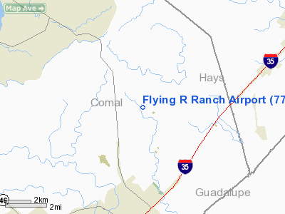
Location & QuickFacts
| FAA Information Effective: | 2008-09-25 |
| Airport Identifier: | 77TS |
| Airport Status: | Operational |
| Longitude/Latitude: | 098-05-06.0000W/29-47-58.0000N
-98.085000/29.799444 (Estimated) |
| Elevation: | 850 ft / 259.08 m (Estimated) |
| Land: | 0 acres |
| From nearest city: | 6 nautical miles S of New Braunfels, TX |
| Location: | Comal County, TX |
| Magnetic Variation: | 07E (1995) |
Owner & Manager
| Ownership: | Privately owned |
| Owner: | Nunez Company |
| Address: | 20417 Cordill Lane
Austin, TX 78669 |
| Phone number: | 512-264-0609 |
| Manager: | Rany Nunez |
| Address: | 3220 Rolling Oaks, Drive
New Braunfels, TX 07813 |
| Phone number: | 830-625-7255 |
Airport Operations and Facilities
| Airport Use: | Private |
| Wind indicator: | Yes |
| Segmented Circle: | No |
| Control Tower: | No |
| Sectional chart: | San Antonio |
| Region: | ASW - Southwest |
| Boundary ARTCC: | ZHU - Houston |
| Tie-in FSS: | SJT - San Angelo |
| FSS on Airport: | No |
| FSS Toll Free: | 1-800-WX-BRIEF |
Runway Information
Runway 18/36
| Dimension: | 2000 x 45 ft / 609.6 x 13.7 m |
| Surface: | ASPH, Good Condition |
| |
Runway 18 |
Runway 36 |
| Traffic Pattern: | Left | Left |
| Obstruction: | 75 ft hill, 800.0 ft from runway | |
|
Radio Navigation Aids
| ID |
Type |
Name |
Ch |
Freq |
Var |
Dist |
| MFS | NDB | Horseshoe Bay Resort | | 403.00 | 07E | 45.8 nm |
| CVB | NDB | Castroville | | 338.00 | 08E | 48.4 nm |
| ER | NDB | Shein | | 263.00 | 08E | 48.7 nm |
| DHK | TACAN | Randolph | 036X | | 09E | 18.4 nm |
| KSY | TACAN | Kelly | 057X | | 07E | 35.7 nm |
| SSF | VOR | Stinson | | 108.40 | 09E | 37.5 nm |
| RND | VORTAC | Randolph | 70X | 112.30 | 09E | 19.8 nm |
| SAT | VORTAC | San Antonio | 115X | 116.80 | 08E | 21.8 nm |
| STV | VORTAC | Stonewall | 085X | 113.80 | 08E | 40.5 nm |
| CWK | VORTAC | Centex | 075X | 112.80 | 06E | 45.2 nm |
| SAT | VOT | San Antonio Intl | | 110.40 | | 25.7 nm |
Images and information placed above are from
http://www.airport-data.com/airport/77TS/
We thank them for the data!
| General Info
|
| Country |
United States
|
| State |
TEXAS
|
| FAA ID |
TX94
|
| Latitude |
33-27-10.403N
|
| Longitude |
097-16-36.000W
|
| Elevation |
880 feet
|
| Near City |
ERA
|
We don't guarantee the information is fresh and accurate. The data may
be wrong or outdated.
For more up-to-date information please refer to other sources.
|
|


