 |
|
Location & QuickFacts
| FAA Information Effective: | 2008-09-25 |
| Airport Identifier: | 11TE |
| Airport Status: | Operational |
| Longitude/Latitude: | 097-12-16.0380W/32-18-00.5240N
-97.204455/32.300146 (Estimated) |
| Elevation: | 700 ft / 213.36 m (Estimated) |
| Land: | 9 acres |
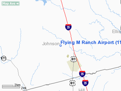
| From nearest city: | 2 nautical miles N of Grandview, TX |
| Location: | Johnson County, TX |
| Magnetic Variation: | 07E (1985) |
Owner & Manager
| Ownership: | Privately owned |
| Owner: | W.d. Moyer |
| Address: | Rt 4, Box 60
Grandview, TX 76050 |
| Phone number: | 817-866-3696 |
| Manager: | W.d. Moyer |
| Address: | Rt 4, Box 60
Grandview, TX 76050 |
| Phone number: | 817-866-3696 |
Airport Operations and Facilities
| Airport Use: | Private |
| Wind indicator: | Yes |
| Segmented Circle: | No |
| Control Tower: | No |
| Landing fee charge: | No |
| Sectional chart: | Dallas-ft Worth |
| Region: | ASW - Southwest |
| Boundary ARTCC: | ZFW - Fort Worth |
| Tie-in FSS: | FTW - Fort Worth |
| FSS on Airport: | No |
| FSS Phone: | 817-541-3474 |
| FSS Toll Free: | 1-800-WX-BRIEF |
Airport Services
| Airframe Repair: | NONE |
| Power Plant Repair: | NONE |
Runway Information
Runway 15/33
| Dimension: | 1900 x 50 ft / 579.1 x 15.2 m |
| Surface: | TURF, Fair Condition |
| |
Runway 15 |
Runway 33 |
| Traffic Pattern: | Left | Left |
| Obstruction: | 4 ft fence | 3 ft sign, 0.0 ft from runway |
|
Radio Navigation Aids
| ID |
Type |
Name |
Ch |
Freq |
Var |
Dist |
| XQH | NDB | Cedar Hill | | 353.00 | 08E | 21.0 nm |
| RBD | NDB | Redbird | | 287.00 | 06E | 28.3 nm |
| LNC | NDB | Lancaster | | 239.00 | 06E | 29.6 nm |
| JUG | NDB | Jecca | | 388.00 | 06E | 40.6 nm |
| CGQ | NDB | Powell | | 344.00 | 06E | 42.0 nm |
| CRS | NDB | Corsicana | | 396.00 | 06E | 44.3 nm |
| PQF | NDB | Mesquite | | 248.00 | 06E | 45.9 nm |
| ROB | NDB | Robinson | | 400.00 | 07E | 48.4 nm |
| NFW | TACAN | Nas Jrb Fort Worth | 024X | | 07E | 30.7 nm |
| TTT | VOR/DME | Maverick | 078X | 113.10 | 06E | 35.2 nm |
| CVE | VOR/DME | Cowboy | 109X | 116.20 | 06E | 38.6 nm |
| JEN | VORTAC | Glen Rose | 097X | 115.00 | 06E | 35.3 nm |
| FUZ | VORTAC | Ranger | 104X | 115.70 | 06E | 35.4 nm |
| ACT | VORTAC | Waco | 100X | 115.30 | 09E | 38.5 nm |
| MQP | VORTAC | Millsap | 124X | 117.70 | 09E | 47.7 nm |
| FTW | VOT | Fort Worth Meacham | | 108.20 | | 32.1 nm |
| DAL | VOT | Dallas Love Field | | 113.30 | | 37.4 nm |
Remarks
- CAUTION: CATTLE ON & INVOF OF RWY.
- PRE DATES THE ACT.
Images and information placed above are from
http://www.airport-data.com/airport/11TE/
We thank them for the data!
| General Info
|
| Country |
United States
|
| State |
TEXAS
|
| FAA ID |
7TA7
|
| Latitude |
31-50-23.620N
|
| Longitude |
094-57-40.780W
|
| Elevation |
310 feet
|
| Near City |
REKLAW
|
We don't guarantee the information is fresh and accurate. The data may
be wrong or outdated.
For more up-to-date information please refer to other sources.
|
|


