 |
|
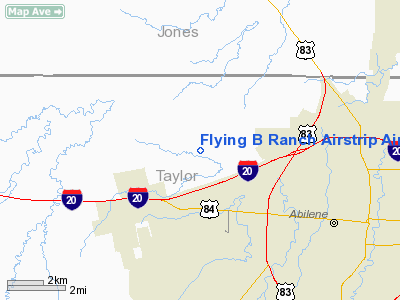
Flying B Ranch Airstrip Airport |
Location & QuickFacts
| FAA Information Effective: | 2008-09-25 |
| Airport Identifier: | 35TX |
| Airport Status: | Operational |
| Longitude/Latitude: | 099-49-32.3280W/32-29-02.4440N
-99.825647/32.484012 (Estimated) |
| Elevation: | 1750 ft / 533.40 m (Estimated) |
| Land: | 5 acres |
| From nearest city: | 4 nautical miles SE of Abilene, TX |
| Location: | Taylor County, TX |
| Magnetic Variation: | 08E (1985) |
Owner & Manager
| Ownership: | Privately owned |
| Owner: | Brian W. Bauries |
| Address: | 2450 Fulwiler Road
Abilene, TX 79603-9704 |
| Phone number: | 915-691-9403 |
| Manager: | Brian W. Bauries |
| Address: | 2450 Fulwiler Road
Abilene, TX 79603-9704 |
| Phone number: | 915-691-9403 |
Airport Operations and Facilities
| Airport Use: | Private
PERSONAL USE. |
| Wind indicator: | Yes |
| Segmented Circle: | Yes |
| Control Tower: | No |
| Sectional chart: | Dallas-ft Worth |
| Region: | ASW - Southwest |
| Boundary ARTCC: | ZFW - Fort Worth |
| Tie-in FSS: | FTW - Fort Worth |
| FSS on Airport: | No |
| FSS Phone: | 817-541-3474 |
| FSS Toll Free: | 1-800-WX-BRIEF |
Airport Services
Runway Information
Runway 16/34
| Dimension: | 2700 x 75 ft / 823.0 x 22.9 m |
| Surface: | TURF, |
| |
Runway 16 |
Runway 34 |
| Traffic Pattern: | Left | Right |
| Obstruction: | 30 ft pline, 800.0 ft from runway | 25 ft bldg, 700.0 ft from runway |
|
Radio Navigation Aids
| ID |
Type |
Name |
Ch |
Freq |
Var |
Dist |
| TMV | NDB | Stamford | | 290.00 | 08E | 23.6 nm |
| SWW | NDB | Sweetwater | | 275.00 | 08E | 32.5 nm |
| IEW | NDB | Winters | | 396.00 | 08E | 33.4 nm |
| AKL | NDB | Haskell | | 407.00 | 08E | 42.8 nm |
| COM | NDB | Coleman | | 385.00 | 07E | 44.1 nm |
| UBC | NDB | Ballinger | | 239.00 | 08E | 48.9 nm |
| BKD | NDB | Breckenridge | | 245.00 | 07E | 49.9 nm |
| DYS | TACAN | Dyess | 063X | | 08E | 4.2 nm |
| TQA | VOR/DME | Tuscola | 053X | 111.60 | 10E | 14.9 nm |
| ABI | VORTAC | Abilene | 084X | 113.70 | 10E | 1.9 nm |
Remarks
- PRVDD EST. LETTER OF AGREEMENT WITH DYESS AIR FORCE BASE BASED ON 2-WAY RADIO & TRANSPONDER REQUIREMENTS. CLEARLY DEFINE DEPARTURES & ARRIVAL PROCEDURES.
Images and information placed above are from
http://www.airport-data.com/airport/35TX/
We thank them for the data!
| General Info
|
| Country |
United States
|
| State |
TEXAS
|
| FAA ID |
35TX
|
| Latitude |
32-29-02.444N
|
| Longitude |
099-49-32.328W
|
| Elevation |
1750 feet
|
| Near City |
ABILENE
|
We don't guarantee the information is fresh and accurate. The data may
be wrong or outdated.
For more up-to-date information please refer to other sources.
|
|


