 |
|
Coordinates: 29°32′15.846″N 095°25′25.786″W / 29.537735°N 95.42382944°W / 29.537735; -95.42382944 Flyin' B Airport (FAA LID: 39R) is an airport located in unincorporated Brazoria County, Texas, United States. The airport is located near Pearland.
The airport is privately owned by Ned Lewis Beaman.
The above content comes from Wikipedia and is published under free licenses – click here to read more.
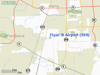
Location & QuickFacts
| FAA Information Effective: | 2008-09-25 |
| Airport Identifier: | 39R |
| Airport Status: | Operational |
| Longitude/Latitude: | 095-25-25.7860W/29-32-15.8460N
-95.423829/29.537735 (Estimated) |
| Elevation: | 70 ft / 21.34 m (Estimated) |
| Land: | 11 acres |
| From nearest city: | 15 nautical miles S of Houston, TX |
| Location: | Brazoria County, TX |
| Magnetic Variation: | 06E (1985) |
Owner & Manager
| Ownership: | Privately owned |
| Owner: | Ned Lewis Beaman |
| Address: | 1422 Co Rd 59
Rosh Ron, TX 77583 |
| Phone number: | 281-489-8436 |
| Manager: | Ned Lewis Beaman |
| Address: | Po Box 45501
Houston, TX 77245 |
| Phone number: | 281-489-8436 |
Airport Operations and Facilities
| Airport Use: | Open to public |
| Wind indicator: | Yes |
| Segmented Circle: | No |
| Control Tower: | No |
| Landing fee charge: | No |
| Sectional chart: | Houston |
| Region: | ASW - Southwest |
| Boundary ARTCC: | ZHU - Houston |
| Tie-in FSS: | CXO - Montgomery County |
| FSS on Airport: | No |
| FSS Toll Free: | 1-800-WX-BRIEF
FOR FP FILING CALL CXO FSS 1-800-992-7433. |
| NOTAMs Facility: | CXO (NOTAM-d service avaliable) |
Airport Communications
Airport Services
| Airframe Repair: | MAJOR |
| Power Plant Repair: | MAJOR |
Runway Information
Runway 17/35
| Dimension: | 2100 x 75 ft / 640.1 x 22.9 m |
| Surface: | TURF, Poor Condition
RY SFC IS NOT SMOOTH AND CONTINUOUS; COVERED WITH 1-2 FT HIGH VEGETATION AND HAS ROUGH AREAS WHERE THE SOIL HAS BEEN ERODED. |
| |
Runway 17 |
Runway 35 |
| Traffic Pattern: | Left | Left |
| Obstruction: | 30 ft pline, 20.0 ft from runway | 35 ft trees, 600.0 ft from runway, 17:1 slope to clear |
|
Radio Navigation Aids
| ID |
Type |
Name |
Ch |
Freq |
Var |
Dist |
| SYG | NDB | Sandy Point | | 402.00 | 05E | 3.2 nm |
| SGR | NDB | Hull | | 388.00 | 05E | 13.4 nm |
| JPA | NDB | Sanjac | | 347.00 | 05E | 20.1 nm |
| LYD | NDB | Lakeside | | 249.00 | 05E | 21.4 nm |
| EYQ | NDB | Weiser | | 286.00 | 06E | 26.4 nm |
| BVP | NDB | Nixin | | 326.00 | 05E | 29.5 nm |
| DWH | NDB | David Hooks | | 521.00 | 05E | 36.1 nm |
| GLS | NDB | Galveston | | 206.00 | 08E | 37.0 nm |
| BYY | NDB | Bay City | | 344.00 | 06E | 40.9 nm |
| ARM | NDB | Wharton | | 245.00 | 06E | 41.8 nm |
| CBC | NDB | Anahuac | | 413.00 | 05E | 42.2 nm |
| EFD | TACAN | Ellington | 031X | | 05E | 14.4 nm |
| HUB | VOR/DME | Hobby | 118X | 117.10 | 05E | 10.5 nm |
| MHF | VOR/DME | Trinity | 083X | 113.60 | 07E | 35.4 nm |
| ELA | VOR/DME | Eagle Lake | 111X | 116.40 | 08E | 47.3 nm |
| IAH | VORTAC | Humble | 113X | 116.60 | 05E | 25.5 nm |
| VUH | VORTAC | Scholes | 077X | 113.00 | 06E | 33.3 nm |
| HOU | VOT | Houston Wm P Hobby | | 108.40 | | 10.0 nm |
Remarks
- BAYOU AT SOUTH END OF RWY.
- GND DROPS OFF SHARPLY AT END OF RY 17 20 FT FM THLD.
Images and information placed above are from
http://www.airport-data.com/airport/39R/
We thank them for the data!
| General Info
|
| Country |
United States
|
| State |
TEXAS
|
| FAA ID |
39R
|
| Latitude |
29-32-15.846N
|
| Longitude |
095-25-25.786W
|
| Elevation |
70 feet
|
| Near City |
HOUSTON
|
We don't guarantee the information is fresh and accurate. The data may
be wrong or outdated.
For more up-to-date information please refer to other sources.
|
|


