 |
|
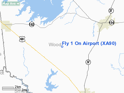
Location & QuickFacts
| FAA Information Effective: | 2008-09-25 |
| Airport Identifier: | XA90 |
| Airport Status: | Operational |
| Longitude/Latitude: | 095-31-40.0000W/32-45-26.0000N
-95.527778/32.757222 (Estimated) |
| Elevation: | 474 ft / 144.48 m (Estimated) |
| Land: | 30 acres |
| From nearest city: | 3 nautical miles E of Golden, TX |
| Location: | Wood County, TX |
| Magnetic Variation: | () |
Owner & Manager
| Ownership: | Privately owned |
| Owner: | Monty Brittain |
| Address: | 2845 Fm 779
Mineola, TX 75773 |
| Phone number: | 903-768-2883 |
| Manager: | Monty Brittain |
| Address: | 2845 Fm 779
Mineola, TX 75773 |
| Phone number: | 903-768-2883 |
Airport Operations and Facilities
| Airport Use: | Private |
| Wind indicator: | Yes |
| Control Tower: | No |
| Lighting Schedule: | PHONE REQ
FOR LIRL RY 18/36 CALL 903-768-2883. |
| Sectional chart: | Dallas-ft Worth |
| Region: | ASW - Southwest |
| Boundary ARTCC: | ZFW - Fort Worth |
| Tie-in FSS: | FTW - Fort Worth |
| FSS Phone: | 817-541-3474 |
| FSS Toll Free: | 1-800-WX-BRIEF |
Runway Information
Runway 18/36
| Dimension: | 2300 x 40 ft / 701.0 x 12.2 m |
| Surface: | TURF, |
| Edge Lights: | Non-standard lighting system
NSTD LIRL DUE TO SPACING. |
| |
Runway 18 |
Runway 36 |
| Traffic Pattern: | Right | Left |
| Obstruction: | 40 ft pline, 500.0 ft from runway | 50 ft trees, 200.0 ft from runway |
|
Radio Navigation Aids
| ID |
Type |
Name |
Ch |
Freq |
Var |
Dist |
| TY | NDB | Tyler | | 320.00 | 06E | 20.7 nm |
| ABG | NDB | Ambassador | | 404.00 | 07E | 23.4 nm |
| SYW | NDB | Cash | | 428.00 | 05E | 30.4 nm |
| AVZ | NDB | Travis | | 260.00 | 06E | 36.5 nm |
| AHX | NDB | Athens | | 269.00 | 06E | 39.1 nm |
| MII | NDB | Caddo Mills | | 316.00 | 06E | 40.2 nm |
| LST | NDB | Lone Star | | 305.00 | 05E | 40.9 nm |
| CSZ | NDB | Crossroads | | 215.00 | 08E | 47.1 nm |
| HNO | NDB | Henderson | | 371.00 | 06E | 48.1 nm |
| LIQ | NDB | Lochridge Ranch | | 335.00 | 09E | 49.8 nm |
| MJF | TACAN | Arvilla | 033X | | 05E | 32.7 nm |
| UIM | VOR/DME | Quitman | 087X | 114.00 | 08E | 11.0 nm |
| TYR | VOR/DME | Tyler | 089X | 114.20 | 06E | 24.9 nm |
| SLR | VOR/DME | Sulphur Springs | 027X | 109.00 | 08E | 26.5 nm |
| FZT | VOR/DME | Frankston | 051X | 111.40 | 06E | 41.0 nm |
| PRX | VOR/DME | Paris | 083X | 113.60 | 07E | 47.4 nm |
| GGG | VORTAC | Gregg County | 070X | 112.30 | 07E | 44.2 nm |
| CQY | VORTAC | Cedar Creek | 095X | 114.80 | 06E | 49.0 nm |
Remarks
- SEE AIRSPACE DETERMINATION DATED 10/3/05 FOR CONDITIONS.
Images and information placed above are from
http://www.airport-data.com/airport/XA90/
We thank them for the data!
|
|


