|
|
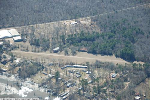 |
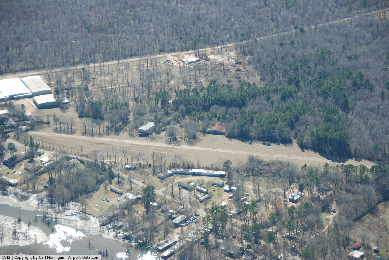
(Click on the photo to enlarge) |
Location & QuickFacts
| FAA Information Effective: | 2008-09-25 |
| Airport Identifier: | TA42 |
| Airport Status: | Operational |
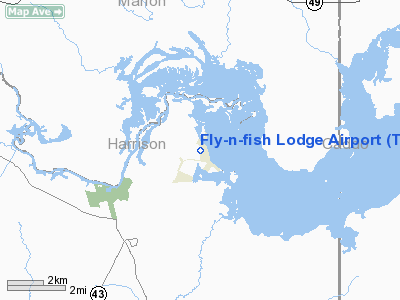
| Longitude/Latitude: | 094-07-29.6680W/32-42-46.5170N
-94.124908/32.712921 (Estimated) |
| Elevation: | 195 ft / 59.44 m (Estimated) |
| Land: | 16 acres |
| From nearest city: | 0 nautical miles NW of Uncertain, TX |
| Location: | Harrison County, TX |
| Magnetic Variation: | 05E (1985) |
Owner & Manager
| Ownership: | Privately owned |
| Owner: | Ken Drusch |
| Address: | 2300 Bamboo Dr. N-101
Arlington, TX 76006 |
| Phone number: | 817-633-3465 |
| Manager: | Ken Drusch |
| Address: | 2300 Bamboo Dr. N-101
Arlington, TX 76006 |
| Phone number: | 817-649-2456 |
Airport Operations and Facilities
| Airport Use: | Private |
| Wind indicator: | Yes |
| Segmented Circle: | No |
| Control Tower: | No |
| Landing fee charge: | No |
| Sectional chart: | Memphis |
| Region: | ASW - Southwest |
| Boundary ARTCC: | ZFW - Fort Worth |
| Tie-in FSS: | FTW - Fort Worth |
| FSS on Airport: | No |
| FSS Phone: | 817-541-3474 |
| FSS Toll Free: | 1-800-WX-BRIEF |
Airport Services
| Airframe Repair: | NONE |
| Power Plant Repair: | NONE |
| Bottled Oxygen: | NONE |
| Bulk Oxygen: | NONE |
Runway Information
Runway 13/31
| Dimension: | 4000 x 40 ft / 1219.2 x 12.2 m |
| Surface: | TRTD-DIRT, Poor Condition
SFC TRTD OILED DIRT. RY NOT REGULARLY MAINTAINED; ROUGH & OVERGROWN. |
| |
Runway 13 |
Runway 31 |
| Traffic Pattern: | Left | Left |
| Obstruction: | 60 ft trees, 75 ft right of centerline | 20 ft trees, 0.0 ft from runway |
|
Radio Navigation Aids
| ID |
Type |
Name |
Ch |
Freq |
Var |
Dist |
| VIV | NDB | Vivian | | 284.00 | 06E | 10.6 nm |
| ATA | NDB | Atlanta | | 347.00 | 04E | 23.7 nm |
| RPF | NDB | Carthage | | 332.00 | 04E | 33.2 nm |
| LST | NDB | Lone Star | | 305.00 | 05E | 33.8 nm |
| SPH | NDB | Springhill | | 375.00 | 05E | 38.2 nm |
| MNE | NDB | Minden | | 201.00 | 04E | 41.9 nm |
| MSD | NDB | Mansfield | | 414.00 | 04E | 43.1 nm |
| HNO | NDB | Henderson | | 371.00 | 06E | 48.9 nm |
| BAD | TACAN | Barksdale | 105X | | 05E | 26.4 nm |
| DTN | VOR | Downtown | | 108.60 | 07E | 22.0 nm |
| EIC | VORTAC | Belcher | 121X | 117.40 | 07E | 16.3 nm |
| EMG | VORTAC | Elm Grove | 049X | 111.20 | 07E | 32.8 nm |
| GGG | VORTAC | Gregg County | 070X | 112.30 | 07E | 36.4 nm |
| TXK | VORTAC | Texarkana | 110X | 116.30 | 07E | 48.2 nm |
| SHV | VOT | Shreveport Regional | | 108.20 | | 15.7 nm |
Remarks
- PRVDD LNDG THRS ARE DSPLCD A SUFFICIENT DISTANCE TO PRVD AN APCH CLNC OF 20:1 OVER ANY OBSTRUCTIONS IN THE APCH AREAS.
Images and information placed above are from
http://www.airport-data.com/airport/TA42/
We thank them for the data!
| General Info
|
| Country |
United States
|
| State |
TEXAS
|
| FAA ID |
TA42
|
| Latitude |
32-42-46.517N
|
| Longitude |
094-07-29.668W
|
| Elevation |
195 feet
|
| Near City |
UNCERTAIN
|
We don't guarantee the information is fresh and accurate. The data may
be wrong or outdated.
For more up-to-date information please refer to other sources.
|
|