 |
|
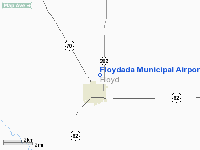
Location & QuickFacts
| FAA Information Effective: | 2008-09-25 |
| Airport Identifier: | 41F |
| Airport Status: | Operational |
| Longitude/Latitude: | 101-19-48.9000W/34-00-05.5000N
-101.330250/34.001528 (Estimated) |
| Elevation: | 3187 ft / 971.40 m (Estimated) |
| Land: | 72 acres |
| From nearest city: | 1 nautical miles N of Floydada, TX |
| Location: | Floyd County, TX |
| Magnetic Variation: | 09E (1985) |
Owner & Manager
| Ownership: | Publicly owned |
| Owner: | City Of Floydada |
| Address: | 114 W. Virginia
Floydada, TX 79235-2717 |
| Phone number: | 806-983-2834 |
| Manager: | Mitch Probasco |
| Address: | Po Box 128
Floydada, TX 79235-0128 |
| Phone number: | 806-983-2314 |
Airport Operations and Facilities
| Airport Use: | Open to public |
| Wind indicator: | Yes |
| Segmented Circle: | Yes |
| Control Tower: | No |
| Lighting Schedule: | DUSK-DAWN |
| Beacon Color: | Clear-Green (lighted land airport) |
| Landing fee charge: | No |
| Sectional chart: | Dallas-ft Worth |
| Region: | ASW - Southwest |
| Boundary ARTCC: | ZFW - Fort Worth |
| Tie-in FSS: | FTW - Fort Worth |
| FSS on Airport: | No |
| FSS Phone: | 817-541-3474 |
| FSS Toll Free: | 1-800-WX-BRIEF |
| NOTAMs Facility: | FTW (NOTAM-d service avaliable) |
| Federal Agreements: | NGY |
Airport Communications
| CTAF: | 122.800 |
| Unicom: | 122.800 |
Airport Services
Runway Information
Runway 17/35
| Dimension: | 4600 x 60 ft / 1402.1 x 18.3 m |
| Surface: | ASPH, Good Condition |
| Weight Limit: | Single wheel: 15000 lbs. |
| Edge Lights: | Medium |
| |
Runway 17 |
Runway 35 |
| Longitude: | 101-19-49.2050W | 101-19-48.5970W |
| Latitude: | 34-00-28.2330N | 33-59-42.7290N |
| Elevation: | 3187.00 ft | 3185.00 ft |
| Alignment: | 127 | 127 |
| Traffic Pattern: | Left | Right |
| Markings: | Non-precision instrument, Good Condition | Non-precision instrument, Good Condition |
| Crossing Height: | 40.00 ft | 39.00 ft |
| VASI: | 2-light PAPI on left side | 2-light PAPI on left side |
| Visual Glide Angle: | 3.00° | 3.00° |
| Obstruction: | , 50:1 slope to clear | 155 ft bldg, 3300.0 ft from runway, 202 ft left of centerline, 20:1 slope to clear |
|
Radio Navigation Aids
| ID |
Type |
Name |
Ch |
Freq |
Var |
Dist |
| CZX | NDB | Crosbyton | | 332.00 | 09E | 23.1 nm |
| PVW | VOR/DME | Plainview | 076X | 112.90 | 11E | 23.5 nm |
| LBB | VORTAC | Lubbock | 029X | 109.20 | 11E | 34.2 nm |
Remarks
- NUMEROUS AGRICULTURAL ACFT OPNS SPRING SUMMER & FALL.
Images and information placed above are from
http://www.airport-data.com/airport/41F/
We thank them for the data!
| General Info
|
| Country |
United States
|
| State |
TEXAS
|
| FAA ID |
41F
|
| Time |
UTC-6(-5DT)
|
| Latitude |
34.002300
34° 00' 08.28" N
|
| Longitude |
-101.330436
101° 19' 49.57" W
|
| Elevation |
3183 feet
970 meters
|
| Magnetic Variation |
007° E (01/06)
|
| Beacon |
Yes
|
| Operating Agency |
U.S.CIVIL AIRPORT WHEREIN PERMIT COVERS USE BY TRANSIT MILITARY AIRCRAFT
|
| Operating Hours |
SEE REMARKS FOR OPERATING HOURS OR COMMUNICATIONS FOR POSSIBLE HOURS
|
| Daylight Saving Time |
Second Sunday in March at 0200 to first Sunday in November at 0200 local time (Exception Arizona and that portion of Indiana in the Eastern Time Zone)
|
We don't guarantee the information is fresh and accurate. The data may
be wrong or outdated.
For more up-to-date information please refer to other sources.
|
|


