 |
|
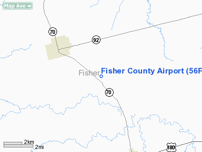
Location & QuickFacts
| FAA Information Effective: | 2008-09-25 |
| Airport Identifier: | 56F |
| Airport Status: | Operational |
| Longitude/Latitude: | 100-24-55.3880W/32-49-32.3830N
-100.415386/32.825662 (Estimated) |
| Elevation: | 1941 ft / 591.62 m (Estimated) |
| Land: | 74 acres |
| From nearest city: | 3 nautical miles SE of Rotan/roby, TX |
| Location: | Fisher County, TX |
| Magnetic Variation: | 08E (1985) |
Owner & Manager
| Ownership: | Publicly owned |
| Owner: | Fisher County |
| Address: | Fisher County Courthouse
Roby, TX 79543 |
| Phone number: | 325-776-2151 |
| Manager: | Marshal Bennett
COUNTY JUDGE. |
| Address: | Fisher County Courthouse
Roby, TX 79543 |
| Phone number: | 325-776-2151 |
Airport Operations and Facilities
| Airport Use: | Open to public |
| Wind indicator: | Yes |
| Segmented Circle: | Yes |
| Control Tower: | No |
| Lighting Schedule: | DUSK-DAWN |
| Beacon Color: | Clear-Green (lighted land airport) |
| Landing fee charge: | No |
| Sectional chart: | Dallas-ft Worth |
| Region: | ASW - Southwest |
| Boundary ARTCC: | ZFW - Fort Worth |
| Tie-in FSS: | FTW - Fort Worth |
| FSS on Airport: | No |
| FSS Phone: | 817-541-3474 |
| FSS Toll Free: | 1-800-WX-BRIEF |
| NOTAMs Facility: | FTW (NOTAM-d service avaliable) |
Airport Communications
Airport Services
| Airframe Repair: | NONE |
| Power Plant Repair: | NONE |
| Bottled Oxygen: | NONE |
| Bulk Oxygen: | NONE |
Runway Information
Runway 07/25
| Dimension: | 2800 x 50 ft / 853.4 x 15.2 m |
| Surface: | GRVL, Good Condition |
| |
Runway 07 |
Runway 25 |
| Traffic Pattern: | Left | Left |
| Displaced threshold: | 200.00 ft
DSPLCD THLD MKD WITH 20 WHITE TIRES ON EACH SIDE. | 0.00 ft |
| Obstruction: | 4 ft fence, 25 ft right of centerline
APCH RATIO 47:1 FM DSPLCD THLD TO +4 FT FENCE AT 191 FT 25 FT R. | 15 ft tree, 278.0 ft from runway, 45 ft left of centerline, 18:1 slope to clear |
|
Runway 16/34
| Dimension: | 3300 x 60 ft / 1005.8 x 18.3 m |
| Surface: | ASPH, Fair Condition |
| Weight Limit: | Single wheel: 12500 lbs. |
| Edge Lights: | Medium |
| |
Runway 16 |
Runway 34 |
| Traffic Pattern: | Left | Left |
| Markings: | Basic, Good Condition | Basic, Good Condition |
| Obstruction: | 25 ft trees, 703.0 ft from runway, 120 ft left of centerline, 20:1 slope to clear | 15 ft road, 500.0 ft from runway, 20:1 slope to clear |
|
Radio Navigation Aids
| ID |
Type |
Name |
Ch |
Freq |
Var |
Dist |
| SWW | NDB | Sweetwater | | 275.00 | 08E | 22.0 nm |
| SDR | NDB | Snyder | | 359.00 | 08E | 27.8 nm |
| TMV | NDB | Stamford | | 290.00 | 08E | 34.5 nm |
| AKL | NDB | Haskell | | 407.00 | 08E | 41.4 nm |
| DYS | TACAN | Dyess | 063X | | 08E | 37.4 nm |
| TQA | VOR/DME | Tuscola | 053X | 111.60 | 10E | 46.7 nm |
| ABI | VORTAC | Abilene | 084X | 113.70 | 10E | 34.8 nm |
Remarks
- INTENSIVE SEASONAL LOW LEVEL AGRICULTURAL ACFT ACTIVITY INVOF ARPT.
Images and information placed above are from
http://www.airport-data.com/airport/56F/
We thank them for the data!
| General Info
|
| Country |
United States
|
| State |
TEXAS
|
| FAA ID |
56F
|
| Latitude |
32-49-32.383N
|
| Longitude |
100-24-55.388W
|
| Elevation |
1941 feet
|
| Near City |
ROTAN/ROBY
|
We don't guarantee the information is fresh and accurate. The data may
be wrong or outdated.
For more up-to-date information please refer to other sources.
|
|


