 |
|
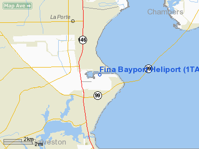
Location & QuickFacts
| FAA Information Effective: | 2008-09-25 |
| Airport Identifier: | 1TA0 |
| Airport Status: | Operational |
| Longitude/Latitude: | 095-00-37.7400W/29-36-39.8230N
-95.010483/29.611062 (Estimated) |
| Elevation: | 16 ft / 4.88 m (Estimated) |
| Land: | 0 acres |
| From nearest city: | 2 nautical miles N of Seabrook, TX |
| Location: | Harris County, TX |
| Magnetic Variation: | 06E (1985) |
Owner & Manager
| Ownership: | Privately owned |
| Owner: | Fina Oil & Chemical Company |
| Address: | 12212 Port Road
Pasadena, TX 77507 |
| Phone number: | 713-474-6000 |
| Manager: | D Bailey |
| Address: | Po Box 5010
La Porte, TX 77572-5010 |
| Phone number: | 713-474-6000 |
Airport Operations and Facilities
| Airport Use: | Private |
| Wind indicator: | Yes |
| Segmented Circle: | Yes |
| Control Tower: | No |
| Lighting Schedule: | PHONE REQ
FOR ROTG BCN & PERIMETER LGTS CALL 713-474-6000. |
| Beacon Color: | Clear-Yellow (lighted seaplan base) |
| Landing fee charge: | No |
| Sectional chart: | Houston |
| Region: | ASW - Southwest |
| Boundary ARTCC: | ZHU - Houston |
| Tie-in FSS: | CXO - Montgomery County |
| FSS on Airport: | No |
| FSS Toll Free: | 1-800-WX-BRIEF
FOR FP FILING CALL CXO FSS 1-800-833-5602. |
Runway Information
Helipad H1
| Dimension: | 70 x 70 ft / 21.3 x 21.3 m |
| Surface: | CONC, |
| |
Runway H1 |
Runway |
| Traffic Pattern: | Left | Left |
|
Radio Navigation Aids
| ID |
Type |
Name |
Ch |
Freq |
Var |
Dist |
| JPA | NDB | Sanjac | | 347.00 | 05E | 4.6 nm |
| CBC | NDB | Anahuac | | 413.00 | 05E | 20.6 nm |
| GLS | NDB | Galveston | | 206.00 | 08E | 21.3 nm |
| SYG | NDB | Sandy Point | | 402.00 | 05E | 24.8 nm |
| BVP | NDB | Nixin | | 326.00 | 05E | 25.3 nm |
| SGR | NDB | Hull | | 388.00 | 05E | 33.8 nm |
| LYD | NDB | Lakeside | | 249.00 | 05E | 37.0 nm |
| EYQ | NDB | Weiser | | 286.00 | 06E | 38.2 nm |
| DWH | NDB | David Hooks | | 521.00 | 05E | 42.4 nm |
| EFD | TACAN | Ellington | 031X | | 05E | 7.8 nm |
| HUB | VOR/DME | Hobby | 118X | 117.10 | 05E | 14.2 nm |
| MHF | VOR/DME | Trinity | 083X | 113.60 | 07E | 14.3 nm |
| VUH | VORTAC | Scholes | 077X | 113.00 | 06E | 21.9 nm |
| IAH | VORTAC | Humble | 113X | 116.60 | 05E | 27.2 nm |
| DAS | VORTAC | Daisetta | 116X | 116.90 | 05E | 39.7 nm |
| HOU | VOT | Houston Wm P Hobby | | 108.40 | | 14.2 nm |
Images and information placed above are from
http://www.airport-data.com/airport/1TA0/
We thank them for the data!
| General Info
|
| Country |
United States
|
| State |
TEXAS
|
| FAA ID |
1TA0
|
| Latitude |
29-36-39.823N
|
| Longitude |
095-00-37.740W
|
| Elevation |
16 feet
|
| Near City |
SEABROOK
|
We don't guarantee the information is fresh and accurate. The data may
be wrong or outdated.
For more up-to-date information please refer to other sources.
|
|


